 |
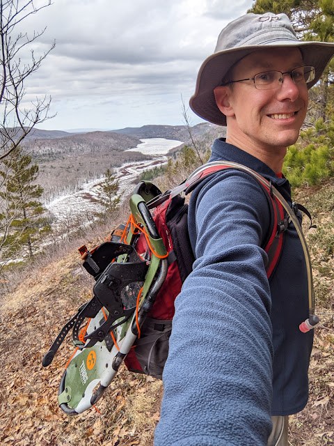
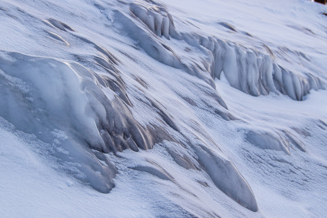
| My old friend, the Cliffs |
List of all of my backpacking and adventure posts
But January 2022 was different for me. I was starting my first ever sabbatical: A semester with no teaching responsibilities. After seven years as a professor, (and ten years as a student before that) I'd earned the right to temporarily exchange teaching for a major project, in my case, writing a book.
Sarah, sadly, still had to teach. But she encouraged me to use my sabbatical to do things I wouldn't have otherwise done. One thing I never get to do during the school year is travel up north. All of my backpacking and hiking in da UP is done between May and August, which to be fair is a pretty good time to be there. But as a student at Michigan Tech for ten years, I'd learned to love the Keweenaw Peninsula's spectacular (and intense) winters. I became an avid snowshoer, something that is rarely even possible where I live downstate.
So I reserved a small cottage at the North Shore Cottages, a set of vacation units on the Lake Superior shore north of Calumet. I reserved it for 10 days in late February, including two full weekends, on the assumption that a blizzard would undoubtedly delay my arrival or hasten my departure.
With friends and family I called my plans a "writing retreat", but the real goal was half writing, half snowshoeing. I made a list of favorite Keweenaw snowshoeing destinations to visit and sought out guided events as well. I rented a car for the whole trip, so that Sarah could have our car to use at home. I paid a bit extra to make the rental an SUV, so that I would have all-wheel drive for the snowy UP roads.
A couple of weeks before my trip, I came down with a nasty cough. Like, keep-me-up-at-night bad. Covid tests and a doctor's visit shed no light. Nobody could tell what it was, or do anything about it. Tea and cough drops soothed it a bit. Luckily, with two weeks before my trip, it would certainly settle itself by then, right?
Interlude: I mostly write these blog posts for myself. They help me reflect on my experiences shortly after each trip, and they provide me with pleasant reminiscences when I read them years later. Reviewing past trips can be a lovely way to spend a dark winter evening.
All of which is to say, if you're reading this -- welcome! I hope you enjoy my stories. But please know that this post, even more than my others, is written for myself, as a sort of after-the-fact diary of a memorable trip. I hadn't intended to blog about it, but I've found myself remembering it fondly. I've also found the details slipping out of my memory, which encouraged me to write it down while I still remember enough of it.
Now, on with the story!
 |
| Blue ice on Lake Superior |
Thursday, February 17, 2022: I packed up my rented RAV 4, kissed Sarah goodbye, and headed north. It was cold and windy, but not snowy. It had been a strange winter in the lower peninsula, and I barely saw fresh snow -- and no snowbanks at all -- until I was well past the Mackinaw Bridge.
That's why all of the snowmobilers were heading the same way as me. When I pulled into my hotel in Newberry, it was already packed with snowmobilers. (I'd decided to stay in a hotel to avoid driving my in-laws nuts -- and possibly infecting them with whatever I had!) The parking lot was piled high with snow banks, and the air was crisp and clear with a whiff of snowmobile exhaust. Ahh, the smell of a northern winter.
Friday, February 18: I woke up to an equally crisp, clear, and frigid morning, with temperatures forecast to peak around 10 degrees. The forecast also called for snow to build later in the day, with the potential for a nasty storm over the Keweenaw -- my destination and home for the next 10 days.
I hopped into my trusty rental SUV and raced west, hoping to beat the snow. Things started out well enough, but by Marquette huge flakes of lake-effect snow started to cover the windshield. I stopped to text my "landlord" and arranged to arrive a bit earlier than planned, so that I didn't have to delay my arrival and risk being stuck in a worsening storm.
The snow got much worse as I turned up the Keweenaw. By the time I'd reached Houghton, I was starting to second-guess whether I should try to find a hotel for the night. I pulled in to Roy's, my favorite bakery in all of the UP, for a quick break. Of course, I also picked up 15 of their best frozen pasties, plus a hot one to eat for dinner. And a jelly-filled donut, just for good measure.
I decided that I was close enough to risk it. I drove some white-knuckle miles along US-41 up Quincy Hill, following in the tracks of the car ahead of me. In Calumet, I zig-zagged to Tamarack Waterworks road and then made my way cautiously downhill and directly into the storm. After a few guesses at some high-snowbanked corners, I reached the lakeshore and found a sign pointing down the driveway for my cottage.
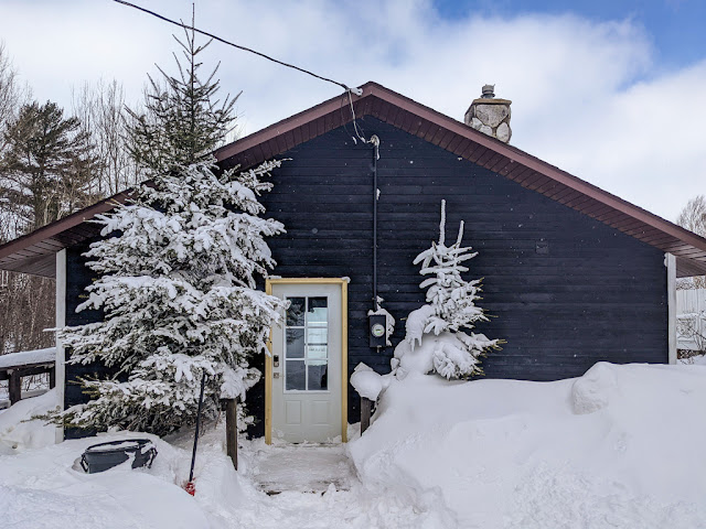 |
| The cottage on a less snowy day. Lake Superior is on the other side of the building. |
The driveway was freshly cleared, and the cottage was blazing with light and warmth. It was like finding a cozy cabin waiting just for me in the middle of a blizzard. Exactly like that.
The "Port Side Cottage" was set next to Brewery Creek, a picturesque stream bordered by evergreens and extremely deep snow. Just a few dozen yards in front of the cottage was the Lake Superior shore. The cottage had walls of windows facing both the lake and the stream, giving (I assumed) spectacular views, but what daylight the storm let through was quickly disappearing. Lake Superior was out there somewhere.
The cottage itself was tiny and cozy. There was one main room, with a kitchenette, small dining table, and a large sectional couch that I could easily stretch out on while I stared out the windows wrote. Next door was a bedroom that was tightly packed with two beds, and beyond that, a small bathroom. That was it! There was a front door leading to a small porch, but I wasn't about to go out there.
Being extremely Covid-cautious and knowing that cleaning people had probably been inside the cottage very recently, I made a key mistake: I opened the windows and turned on ceiling fans, to try to air the place out. The wind cleared out the room, all right, and dropped it down into the 50's. I caught a chill that I couldn't get over, and that made my cough even worse.
To fight the chill, I found a small space heater and turned it on high. Then I reheated my pasty with a super hot oven and enjoyed it with a liberal dose of ketchup. Afterwards I curled up under my camping quilt (a very wise thing to bring) and phoned with Sarah for a while. I slowly warmed up, but the cough didn't go away.
After trying to read for a while, I gave in, took some Nyquil (I brought two full bottles) and went to bed with the storm raging around the cabin.
 |
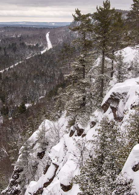
| The breakwater and remnants of the waterworks |
Saturday February 19: I slept late and woke up to a cold, windy, but clearing winter wonderland outside my windows.
I spent the morning tidying up email and doing a bit of writing. Just enough to justify the name "writing retreat".
I also woke up to an email canceling my afternoon plan, a guided hike to the Point Mills nature preserve. The cancelation was due to a combination of weather and lack of interest (apparently I was the only person who signed up to attend). On the upside, the cancellation email turned out to be from one of my former students -- the sort of serendipity that makes a teacher's day.
Instead, I headed out to check out the cabin's waterfront. The cabin, one of several rentals, was built at the former location of the Tamarack Mine's waterworks -- an industrial site that pumped water far uphill to Calumet, for use in the mine's boilers. A massive concrete breakwater bristling with ancient pipes fronted the lake. I walked along, examining the breakwater, without putting on snowshoes. I realized that this was a big mistake once I started to "posthole" into the deep snow.
That small amount of exploring whetted my appetite, and I wanted to get outside more -- perhaps on actual snowshoes. But where to? I had just a few hours of daylight left, no time for any of the big adventures I'd planned for later days. I decided to check out McLain State Park, which would at least be an interesting site. I packed up the RAV4 with a daypack and my snowshoes and headed uphill.
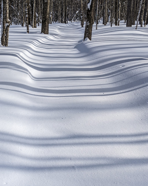
On my way there, I passed a sign for a remote trailhead of the Swedetown Trails. Swedetown was mostly for skiers -- at least as far as I knew -- and I'd never really been on those trails except to help out with the Great Bear Chase. I decided to stop anyhow and take a quick look, which turned out to be a momentous decision for the rest of my trip. To my surprise, the trailhead map showed an extensive set of snowshoe trails, and from the looks of the fresh powder, they were nearly untouched!
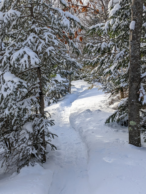 |
| Muggun Creek loop with fresh powder and pines |
I strapped on my snowshoes and headed down the Muggun Creek snowshoe loop. The day had cleared up considerably and the wind calmed down, although the temperature remained a crisp 10 degrees. There was a fresh foot of powder overtop of a deep and well-packed base, and in many places I was the first person to touch the trail since yesterday's storm. Sun shone through snow-covered pines, making gorgeous shadows on the fresh snow. The views lifted my heart, but they were also bittersweet as they brought back memories of beautiful days snowshoeing while I was a grad student.
The trail followed a high bluff above Muggun Creek, often criss-crossing well-groomed (but empty!) ski trails, before descending into a valley and following along the bubbling and picturesque creek itself. A high hillside across the creek was strangely melted and curiously artificial looking. I later learned that it was holding back Calumet's wastewater settling ponds.
I completed 3 beautiful miles of snowshoeing and was back in the car before I noticed that my cough was almost completely gone.
Back in my cozy cabin, I heated up a frozen Lasagna for dinner. I curled up on the couch under my quilt and enjoyed a quick call home and some reading before bed. My cough returned just in time to ensure I needed to take NyQuil.
Daily mileage: 3 miles.
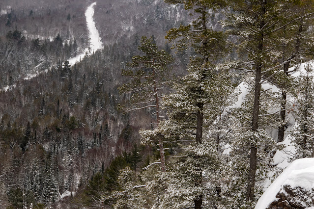
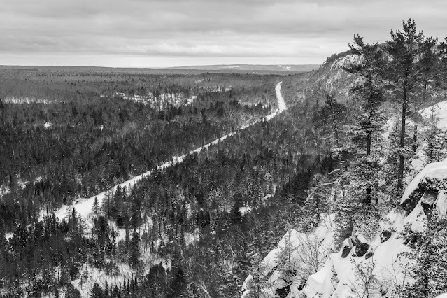 |
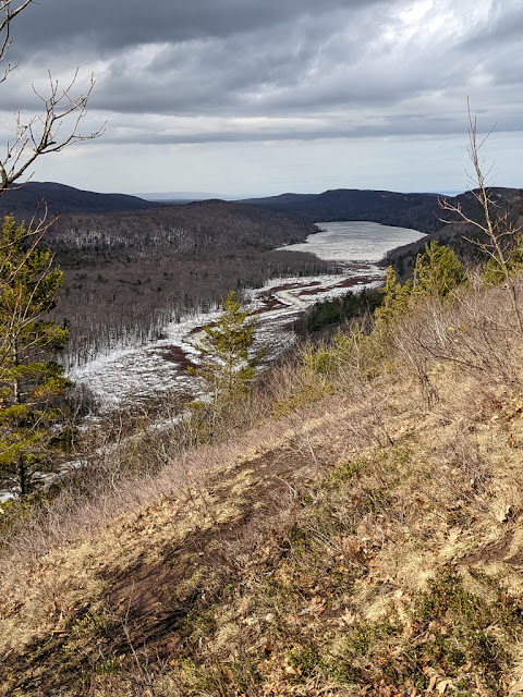
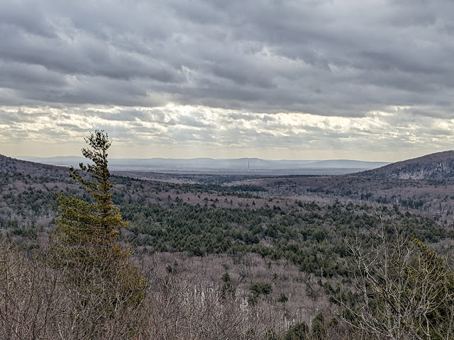
| Cliff drive, seen from high above the North American gap |
Sunday February 20: Today's plan was to visit one of my favorite old Copper Country Exploring locations, "The Cliffs". Another good reason to visit the Cliffs was another impending blizzard, with forecasters calling for two solid days of heavy snow starting Monday. Better to get outside and enjoy the Keweenaw now, and spend time writing during the blizzard.
The weather remained too cold for salt to work well on roads. Cliff drive, which is only ever kind-of plowed in the winter anyhow, hadn't been cleared recently. Luckily my all-wheel drive SUV handled it just fine... or at least well enough. I reached the end of the plowed section of road, which was right about where my trailhead was located, with a minimum of trouble.
I carefully did a 3-point turn between the high snowbanks (ok, it was more like a 12-point turn -- the snowbanks made the road quite narrow) and parked along the shoulder, facing back the way I'd need to exit. I double-checked that the SUV could get started moving after a full stop (always a potential problem when parking in snow, especially on an unplowed shoulder). Ah, UP winters -- it was all coming back to me.
I snowshoed up the North American Gap, a low point in the cliffs that held a two-track, currently a snowmobile trail. The trail passed the old North American mine, hidden beneath a dense cover of evergreens. My cough seemed especially bad today, and the cold air wasn't helping as much as it had yesterday. I probably made it worse by overdoing the uphill hike, huffing and panting the whole way, and by the time I stopped for a break I had build up a massive headache too. Certainly the fumes from passing snowmobiles didn't help, but the looks from the snowmobilers -- utterly confused by the lone snowshoer hupping his way up their trail -- were worth it.
After a few turns (and a few more pauses for breath), I reached my goal, a high overlook at the very edge of the Cliffs. The overlook was spectacular as always, with views out over Cliff Drive and the interior of the Keweenaw, but the gray sky didn't help me get any good photos. It looked like the clouds might clear out a bit, but the wind was too sharp to sit and wait at the overlook. I hiked back downhill into a protected hollow and whiled away some time before checking the lookout again -- no luck, but I didn't mind re-enjoying the view. I repeated the whole process a few more times before the headache and cough convinced me that I needed to get out of the wind and back into warmth.
Downhill was considerably easier, and I felt good enough to spend a few minutes tramping through the old North American mine ruins on the way past.
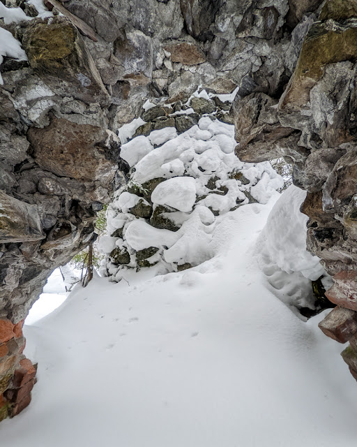
 |
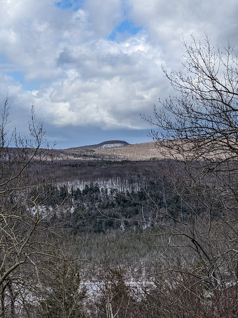
| Trees on the cliffs |
Back out on the road, I paused to let a rusty truck packed with college-aged guys zip past. I put everything back in the SUV, turned it on, slowly pressed the gas, and... spun my wheels helplessly. I tried "rocking" and putting it into low gear... nothing worked. I was completely stuck.
Just as I was getting out to see if I could shovel a path for the wheels, I saw four Michigan Tech students hurrying down the road. They had piled out of the truck as soon as they saw this hapless guy in his California-plated SUV spinning his tires. They had me moving in no time flat, and paused only to yell "Don't stop! Keep moving!" before I drove off. They probably talked all day about the poor lost dude from California who didn't even know how to drive in snow.
I made it as far as Calumet before I stopped at a gas station, where I poked and prodded every button on the dashboard and looked up everything I could think of in the owner's manual. I searched on my phone. I couldn't avoid the answer: It was no wonder I'd gotten stuck -- this stupid SUV only had 2 wheel drive!
In a foul mood, and unwilling to do anything more dangerous than drive down a paved road, I went back to the cottage. Overall, it was a disappointing day: Gray weather, a tough hike, a nasty cough and headache, getting stuck and discovering that my rental didn't even have the one feature I'd chosen it for.
Some warm lasagna, a quick call home, and some quiet reading while looking out the windows at the Greatest Lake did make the evening a bit better. My cough hadn't let up, and I suspected that the dry radiator-heated air of the cottage didn't help, so I started simmering some pots of water in hopes of humidifying the air. I quickly steamed the entire place up and still went to bed coughing. I woke up in the middle of the night and had to take a second dose of NyQuil.
Daily mileage: 2.2 miles.
 |
| Looking through a boiler ruin at the North American mine |
Monday February 21: I woke up feeling better. I looked outside, expecting a blizzard, but the forecast had pushed it off until the afternoon. It was going to be a multi-day snow event, so I decided to use the morning to get outside while I still could.
I started with a quick walk around "town" -- the rental properties at the Tamarack Waterworks -- examining some of the old brick waterworks buildings and a barrel sauna for guests to use (I never did get around to using it, sadly). This only whetted my appetite, so I packed up the SUV and carefully navigated uphill towards the alluringly close-by Swedetown Trails.
Knowing now that the car only had two-wheel drive actually made it easier to drive "correctly" -- I'd survived up here for 10 years in a tiny 2WD car. You just have to have a healthy respect for physics.
At Swedetown I enjoyed their main snowshoe trails, the big and small Bear Paw loops. These started at the main ski chalet in Swedetown, a "suburb" of Calumet, and wound through beautiful and dense pine stands while mostly avoiding the busy groomed ski trails. There were a surprising number of people on the trails for a Monday morning. They all seemed exceedingly cheerful, and I had more than one conversation about how great it was to get out "once more before we're socked in!"
By this point I'd realized I would be visiting the convenient and exceedingly well maintained Swedetown trails a lot on this trip, so I purchased a season snowshoe trail pass. Only in the Keweenaw is it a reasonable investment to buy a season pass in late February.
By lunch time, the snow had started -- lightly, for now -- so after 3.3 beautiful miles of snowshoeing I headed back downhill to the cottage. I spent the afternoon writing and occasionally stopping to appreciate the astonishing beauty of the view out my side window: Huge lake effect snowflakes falling in front of a dark cedar woods, with a bubbling snowbound creek in between them.
At night I coughed, took NyQuil, and tried to sleep. The wind howled and gusted and the snow battered the windows.
Daily mileage: 4.3 (1 mile around "town" and 3.3 at Swedetown)
 |
| View from the cottage. That's Lake Superior... somewhere. |
Tuesday February 22: This blizzard was the real deal. It continued all night, all day, and all night again. I could rarely even see the lake out my front window. When the snow occasionally lightened for a moment, I caught sight of massive waves crashing against the pack ice.
I stayed cozy in the cottage for most of the day, focusing on writing. With exactly zero cell service this far away from civilization, I had to rely on the cottage's wifi, which in turn relied on a line-of-sight dish connection to a tower up the hill in Calumet. With the dense snow and gusty winds, my connection occasionally failed. I felt wonderfully isolated.
I only ventured outside for a very brief walk in the afternoon and quickly retreated in the face of frigid wind and stinging snow.
Daily mileage: 0.5
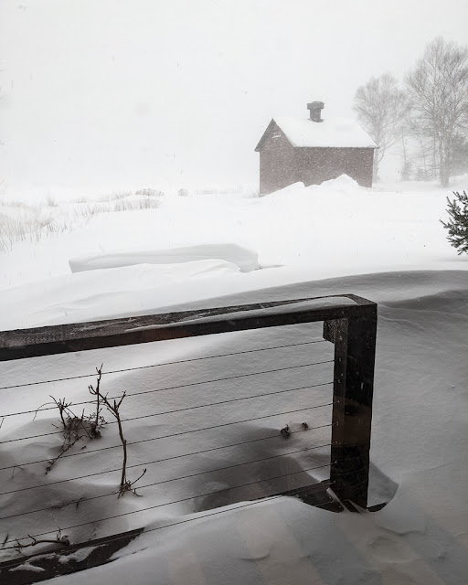
Wednesday February 23: After a night of NyQuil-and-howling-wind-induced nightmares, I woke late to find sunlight shining into the cottage. The storm had cleared after two days; it left behind a gorgeous winter wonderland and two feet of fresh, fluffy powder. (Keweenaw County's official records show 31 inches from February 21st through the 23rd.)
I suited up fully -- big coat, thick hat, snow pants, big gloves -- and opened the door to find this:
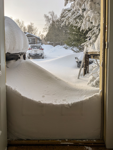 |
| That's... a bit much. |
Just behind it was the landlord, plowing and snowblowing with enthusiasm. I thanked him and took a very brief walk along the road, which would have been significantly easier with snowshoes. Luckily, the Keweenaw County Road Commission was out in full force, showcasing their fearsome plow trucks, as well as their fearsome efficiency in using them. The snowbanks next to the road were up to my shoulders in places.
I decided it was best to let the plows have some time to clear the roads (they plow at 60+ miles per hour and don't slow down for anyone), so I went back into the cottage, made some unexpectedly strong coffee, and spent the morning writing my way through a caffeine buzz (thanks, Keweenaw Coffee Works!).
The day continued to be spectacular, bright and sunny, and after lunch I was confident that the roads would be driveable again. I quickly shoveled the plow chunks away from the end of the driveway (an inevitable consequence of the super-efficient road plows) and hopped in my 2-wheel-drive SUV for a trip up to Swedetown.
Yep, Swedetown again. The trails had one more designated snowshoe loop that I hadn't yet tried out, and I wanted to be there on this gorgeous day with several feet of fresh powder! I could see that I'd made quite a mistake by never going to Swedetown's trails in the 10 years I lived in the Copper Country.
The Woodland Trailhead for Swedetown was pretty far out of town on a well-plowed but narrow gravel road. The only other car at its parking pad drove out just as I arrived, so I had the whole place to myself.
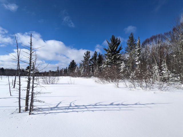
I snowshoed onto the long and narrow "Lotus Lookout" loop and discovered that I was the first person since the storm to venture onto it. The sky was clear and blue, the powder was deep and untouched, and the bare trees cast sharp-edged shadows in the brilliant sun. It was a snowshoer's dream. This was the kind of day that made the months of gray-cloud lake-effect-filled drudgery worth it.
 |
| Shadows on fresh snow |
Lotus Lookout itself was apparently an opening onto a scrubby field, where the fresh snow reflected the sun to almost painful levels. I stood for a while, soaking up the sun and enjoying the clear blue sky. After returning on the other side of the loop, I still had some energy left in my legs. I turned off onto "Bruce's Crossing", a short connector to the main ski loops that was also wholly untouched. As I reached the core ski loops, I looked behind me, only to find an older woman on racing skis slowly following in my footsteps. I hadn't heard her at all! She thanked me for breaking trail. Another skier stopped to chat with us as we all rested. The topic of conversation was the only possible thing: How glorious the day and fresh snow were.
Rested again, I decided I would rather turn around instead of trying to find my way along the busy ski trails. I returned in my own footprints. Swedetown's snowshoe trails were most excellent, and I was sad to have ignored them for so many years.
I wasn't quite ready to go home, though. With a few more hours of daylight -- and not a cloud in the sky -- I headed down to a completely different place, one that I'd been to hundreds of times before: the Quincy Mine. I pulled in to one of my favorite access points along Kowsit Lats road (named tongue-in-cheek after the housing development that replaced a pasture at the end of the road), which turned out to be incredibly narrow, with snowbanks easily above the top of my car.
I found a place to pull off, put on snowshoes, and headed out to the Quincy #7 rockpile. This pile of the mine's poor rock spills off of a tall hillside and gives a spectacular overlook of Houghton and Hancock, with the Portage in between them. It did not disappoint, although with the cool air (10 degrees), the sun getting low, and the wind staying high, I found it hard to stand still and enjoy the view.
 |
| Three corners of Quincy buildings |
I went back to the car, changed into thicker gloves, and then walked down Roundhouse road. The old Quincy roundhouse was still there, fully renovated, as was its old watering station out front. I scrambled my way up the roadside snowbanks, face-planting only once, and snowshoed along the old Quincy & Torch Lake Railroad. This trail too was completely untouched, with powder so deep that it nearly reached my waist!
I had a grand time circling up through the core of the Quincy Mine's surface plant, visiting beautiful brick hoist houses, poking my nose into preserved ruins, standing in awe of the iconic #2 Shaft-Rockhouse, and staring down a gated mine shaft that was venting its (relatively) warm air up into the sky. I also overdid it a bit in the cold air and deep, trackless snow, having apparently not learned my lesson from snowshoeing the Cliffs. "Heart-pumping" doesn't quite describe the level of aerobic activity involved. I got simultaneously drenched in sweat and nearly frozen in the arctic air. I eventually slouched my way back to the car, legs leaden, fingers frozen, and soul satisfied. I turned up the heat full blast.
What a day! I'd had some of the best snowshoeing I'd experienced in years, in spectacular (if cold) weather. Back home, I curled up with a quilt to phone Sarah as I watched the snow fall. As I watched, a few local deer crossed the creek in front of the cabin, struggling through the incredibly deep snow drifts.
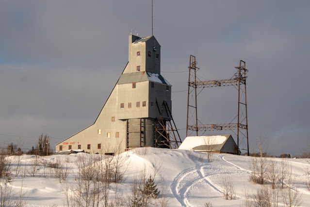 |
| Quincy Mine's #2 Shaft-Rockhouse, a Copper Country icon |
I slept well until a fit of coughing woke me up in the middle of the night. I checked my phone to see headlines blaring about Russia's invasion of Ukraine.
Daily mileage: 3.7 (0.5 at "home", 2.1 at Swedetown, 1.1 at Quincy)
Thursday February 24: The morning was again bright and sunny, with another 4 inches of snow overnight. I woke up with a bit of a headache and tiredness that told me I'd overdone it yesterday -- but oh how glorious it had been!
I spent the morning writing and doing laundry in one of the nearby buildings. In between, I had a pleasant chat with the property manager, Melissa, while I helped her shovel plow chunks out from the driveway.
Following the pattern I'd set for these beautiful days, I planned a big excursion for the afternoon. Today I wanted to recreate an old favorite outing: snowshoeing along Hunter's Point in Copper Harbor, where Lake Superior builds spectacular blue ice formations along its rocky shore. I'd done this hike many times when I lived up here, and I wanted to see it again.
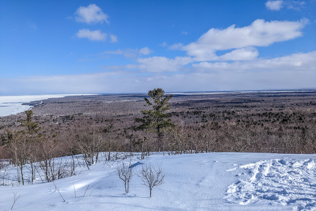
The roads remained icy and snow-packed, but the sky was sunny and beautiful. I drove past lovely sites like Great Sand Bay and stopped to enjoy a quick jaunt up onto the rock wall at Esrey Park, far up in the Keweenaw. Snowbanks everywhere were enormous, and it was clear that the Keweenaw was heading for a year of record snowfall (official total as of May: 325.6 inches, high but not quite a record).
I parked at the end of the plowed road nearest to Hunter's Point and found a surprising number of cars. I guess other folks could manage to take the beautiful day off, too! One couple in particular was putting on snowshoes while their dogs ran joyfully around.
The couple asked me some questions about the point that implied that it was new to them, so I suggested we walk together. The trail to Hunter's Point was well packed down from previous visitors, so my hiking was much easier than yesterday. We chatted and the dogs played hide-and-seek with me until we reached the beach, at which point we headed our separate ways.
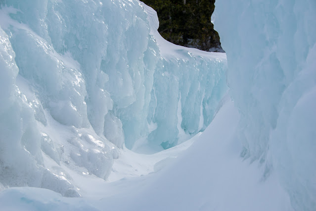 |
| Blue ice canyon |
I was not disappointed by the blue ice, although it was covered by more snow than usual (shouldn't have been a surprise, I guess). I found that I had to push myself to continue along the full shoreline, fighting fatigue, a headache, and a general desire to just go home and rest. I did walk all along the shore out to the end of the point, and then back on the Copper Harbor side.
Much like yesterday, I pushed myself too hard, and two days of going full-tilt added up. My cough only got worse, as did a nasty headache probably induced by overdoing it. The drive home was long and unpleasant, and I went to bed early.
Daily mileage: 2.5
Friday February 25: I slept well and woke feeling excited. I planned to take today entirely off from writing, for a most excellent reason: Visiting my favorite place in the UP, the Porcupine Mountains!
The Porkies offer guided snowshoe hikes throughout the winters: "advanced" on Fridays, "beginner" on Saturdays. Today was the very last advanced hike of the season, and being quite sure that I wasn't a beginner, I decided to check it out.
I left early, since it would take nearly two hours to get to the Porkies from my cottage at Tamarack Waterworks. On my way through Calumet, I stopped at Pat's Foods to acquire another Keweenaw favorite, Gitche Gumee hard cider.
The drive to the Porkies was thankfully uneventful. I realized halfway there that I would need to get a parking pass for the day -- an extra-expensive out of state parking pass -- as yet another consequence of having a half-useless California rental car.
A quick stop at headquarters took care of the pass, after which I headed to the Porkies ski hill (another place I had never been before). It was yet another gorgeous and sunny day, and the place was hopping with downhill skiers and snowboarders. The license plates in the parking lot showed that they were coming from across the midwest to enjoy one of the few places with actual snow.
I picked up my modern metal snowshoes and daypack, and after some bumbling around, I found the snowshoe barn. Ranger Katie arrived soon after and was astonished at the 17 of us who showed up for the season's last advanced snowshoe hike. Part of the reason for the crowd was that several local North Country Trail chapters had sent members. It had been such a long and cold winter, Ranger Katie explained, that she had never had more than one or two snowshoers come to previous hikes!
Ranger Katie recommended that anybody (like me) who had brought modern metal-frame snowshoes should trade them out for a loaner pair of traditional wooden snowshoes. The reason, she explained, was that we would be traveling through waist-deep fresh powder from the recent blizzard, and nothing floats better on powder than a 4-foot long set of traditional snowshoes. I obliged, thinking about my traditional pair that I'd left at home.
The huge group trudged across the base of the ski hill, where we took over the ski lift. This was part of the draw of the hike: A free ride up the ski lift, with its spectacular views out over Lake Superior. With 17 people, most of us totally unfamiliar with how to use a T-bar, we clogged up the ski lift for quite a while. The operator obligingly stopped the lift so that each of us, wearing our giant snowshoes, could easily get on and then, at the top, get back off again.
 |
| East Vista view (sadly, I took few photos during the epic backcountry snowshoe) |
The view from the chair was everything I could hope for. I spent the ride up chatting with a medic from Ironwood who was here with a group, as we both gawked backwards at the view over an icy Union Bay. At the top, we gathered in a nice big group, ooh-ing and aah-ing at the scenery, until Ranger Katie vigorously encouraged us to move away from the lift while the enormous backlog of skiers and snowboarders started to catch up with us.
Ranger Katie successfully wrangled us over to a less busy view of the lake, and from there we headed down into the backcountry. Sometimes walking on the sides of ski trails, sometimes going overland, we snowshoed our way down the back of the ski hill "mountain" and stopped for short talks about glacial erratic boulders, ski warming huts, hemlock trees, and animal tracks. We made it to East Vista, a lovely viewpoint showing off Union Bay, and then plunged back into the deep powder for some serious downhill bushwhacking -- although most of the bush was hidden under many feet of snow. We stopped for selfies, hauled each other up when we tipped over, laughed, chatted, and had a wonderful time.
After several hours of glorious snowshoe bushwhacking, we popped out onto a groomed ski trail that led us right back to the lodge (or, if you were me, you fell over the edge of a snowbank and face-planted onto the trail when you mis-judged your giant snowshoes). It had been a fantastic snowshoe hike and a wonderful capstone to my vacation.
I said goodbyes to the various people I'd met, returned my borrowed snowshoes, and got into the car. The drive back north was uneventful. I was practically glowing from the wonderful day.
In Calumet, I topped off the excellent day by picking up an imperative of Copper Country cuisine: A Gipp Burger, to go, from The Michigan House. I drove as quickly as I dared down the hill to my cottage, trying to keep the burger warm.
As I was about to turn in to the driveway, burger on my mind, I noticed movement out of the corner of my eye and slammed on the brakes. A tiny dog disappeared in front of the SUV. I opened my door, dreading what I might find, only to have the small, hyperactive dog jump straight up onto my lap and start licking my face. Luckily, I kept the burger safe. The owners, who had just arrived from Illinois and were unloading at the next cabin, gratefully retrieved their little yapper, and I finished parking.
I made it inside with the burger still mildly warm. I heated it briefly in the oven before deciding I couldn't wait any more -- both due to hunger and anticipation -- and so I scarfed it down. Even half-warmed and dried out from the oven, the burger was everything I'd hoped for.
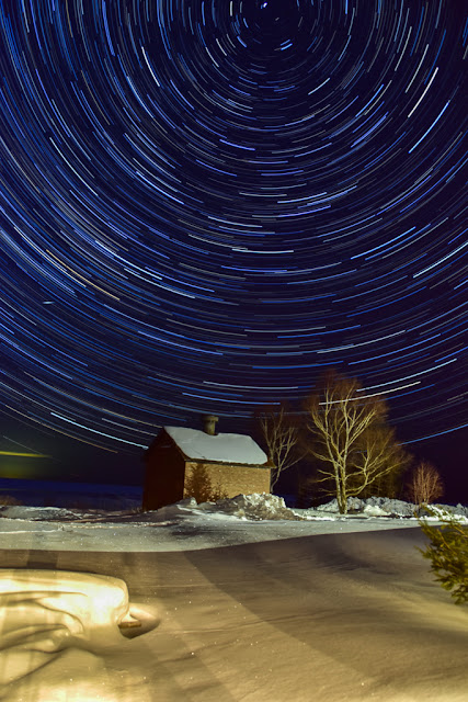 |
| Stars over Tamarack Waterworks |
The night was clear and cold, so I took the chance to do another favorite Copper Country activity: Taking photos of stars. I set up my fancy camera gear out on the cabin's front porch. With my fingertips nearly freezing off, I didn't take the time to compose the scene as much as I usually do. Nonetheless, I got a decent result.
NyQuil and coughing dogged me all night, as usual.
Daily mileage: 2.5-ish miles in the Porkies (I forgot to track the route)
 |
| Tamarack Waterworks lakeshore |
Saturday February 26: I hadn't made many plans for the weekend, because I hadn't really expected to still be here. I'd reserved my cottage across two weekends, assuming that weather would force me to arrive late or leave early. As it was, both weekends had excellent weather -- all the blizzards were on weekdays -- and so here I was without a Saturday plan.
After a morning of writing, I decided to visit my alma mater twice-over, Michigan Tech, where I could see the snow statues from Winter Carnival. It was an incredibly windy day (and, still, cold), so my walk was brisk. Winter Carnival had ended two weeks ago, which was long enough for the snow statues to start to degrade. In a few cases, they were also buried under giant piles of snow as campus's incredibly efficient snow removal heroes looked for anywhere they could find to put the massive amount of white stuff. Still, it was sunny and beautiful, and I enjoyed the walk.
 |
| Ice mound, soon to be an ice volcano |
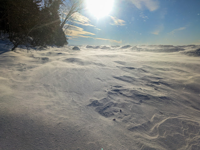
Back at the cottage, I felt an itch to get outside again. I put my snowshoes on and walked up and down the lakeshore in front of the Tamarack waterworks. The wind blasted my face and took my breath away. I enjoyed seeing and photographing the wind-sculpted shapes made by snow and ice, but I soon had to go back inside to warm up.
Daily mileage: 2.6 (1.7 on campus, 0.9 along the lake)
Sunday February 27: Today, for my last full day in the cottage, I had an excellent idea for what to do. My goal was Elmo's tower, which sits perched high atop the Cliffs near Phoenix. I'd snowshoed and hiked up to the tower and its scenic viewpoint many times over the years, and wanted to enjoy those spectacular views again. That, and a redemption of my less-than-stellar visit to the Cliffs at the start of the trip. But when I reached the start of the unplowed two-track that leads in to Elmo's Tower, to my dismay I found a gate that was clearly marked No Trespassing with very shiny and new signs. I drove around to another entrance and found the same postings.
I was disappointed but decided not to push it, and instead headed all the way back down to Quincy. It was another sunny and beautiful day, and I wanted to enjoy my last full day in the Keweenaw to the fullest.
 |
| View from a Quincy fill (not shown: skiers and snowboarders going mountain-goating) |
I again parked at the #7 rockpile and snowshoed up past the Quincy roundhouse, but this time I continued down the old railroad grade towards Mont Ripley. Somebody else had been there before me, leaving a nice set of snowshoe prints to follow along in. When I got close to Mont Ripley, I discovered that one of the railroad's "fills" -- a ravine filled in with mine rock, making an extremely steep-sided path for the rails to follow -- was now a backcountry ski and snowboard destination. I watched, open-mouthed, as several skiers and snowboarders made their way effortlessly down the incredibly steep slope and into the woods, showing all of the skills and fearlessness of mountain goats.
The sun felt so good in the cold air that I kept finding excuses to hang around in the sunlight. I took photos... I texted photos to people... I gawked at the skiers some more. I took a detour up into Quincy's industrial core, and then back down Roundhouse Road again.
At long last, I felt ready to head back to the cottage, where I spent the evening packing, cleaning, and coughing. It had been an excellent final day.
Daily mileage: 2.3
 |
| Lotus Lookout, at the Swedetown trails |
Monday February 28: I woke up early, ate a quick breakfast, and packed up my rental car. The weather had taken a turn, and snow was threatening throughout the entire UP. I left the cabin with a small pang of sadness -- it had been a wonderful place to stay -- but also excitement to get back home.
The roads were snowy and the wind was cold. The weather never exactly reached blizzard level, but it snowed heavily for most of my trip through the UP. The trip home was a series of minor failures: I tried to pick up Keweenaw Coffee Works coffee but could only find whole beans (I don't own a grinder); I couldn't find an open coffee shop anywhere in the UP; I barely managed to find an open lunch place and then only managed to actually eat lunch at 2 pm just before crossing the bridge.
Downstate, the snow was melted! What a difference from the Keweenaw. It was like I'd jumped a month into the future.
Summary: I hope you've enjoyed my reminiscences about a (mostly) lovely trip to the Keweenaw. The trip was a successful writing retreat (the book is done and submitted to the publisher!), while also being an excellent getaway to the snowy north. I enjoyed the best snowshoeing I've done in years, and got a renewed appreciation for just how hard the winters are up north. It's amazing how quickly my memories of northern winters lost their "edge", and this trip thoroughly refreshed and sharpened those memories.
I'm glad I did the trip, and I'm also glad to be home. My cough went away a few weeks after returning, and all it took was two doctor's visits, allergy medicine, decongestants, an antibiotic, an inhaler, a neti pot, and tons of rest.
I won't have another chance to take a sabbatical for at least seven years. Until then, I'll be going up north in the spring and summers only. Perhaps next time, I'll visit the Keweenaw in the fall!
Oh, and: If you rent an SUV, don't expect all-wheel drive.