Last time: The bare Greenstone - links to all of my trip logs
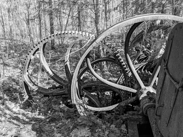 |
| Flywheels and gears at the old Island Mine site |
Thursday May 25, 2023: It might be darkest just before the dawn, but it's coldest just after you crawl out from under your nice cozy quilt.
I awoke to the spooky, rattling call of a lone Sandhill Crane flying overhead. I poked my head out from under the quilt and nearly froze my eyeballs. Eventually I couldn't put it off any longer. Attired in every warm item I brought, I crawled out into the freezing world. Hot tea and oatmeal helped, but nothing warmed us up better than packing up, strapping on our packs, and hauling them up and down a few dozen hills.
Island Mine was a perfectly nice place, but today we were headed toward one of the island's gems: Siskiwit Bay campground.
We took the Island Mine trail south to get there. The trail goes across the island's "grain", which means that it goes up and then down ridge after ridge after ridge.
Unlike the other trails we'd been on so far, trail crews hadn't reached the Island Mine trail yet. Worse, there was a lot of work for a trail crew to do: It looked like a windstorm had swept right along the trail, felling tree after tree directly across the tread.
They were always at the perfect height, too: Too high to climb over, too low to stoop under while wearing a pack. It seemed like every tree had managed to fall across the trail on a steep hillside, so there was no way to walk around them. So instead we removed our backpacks, shoved them under the tree, and then belly-crawled after them. Wash, rinse, repeat.
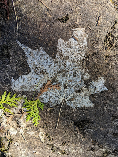 |
| The ghost of a leaf on a ridge |
There were payoffs, however. The bare trees on top of the ridges allowed glimpses of a distant blue Lake Superior. The sunny south-facing slopes were sprouting more wildflowers than I'd seen so far. And soon, I came to one of the day's biggest treats for me: the Island Mine itself.
The first clue was a puncheon bridge across a surprisingly straight and V-shaped stream -- actually a trench, a sure sign of somebody searching for copper. Shortly afterward I saw rock piles sitting next to the trail. Sarah and I were walking together today, but here we implemented Rule 1 again: Hike your own hike! I yelled, "I'm going to explore this, go on ahead!" as I plunged into the woods.
The Island Mine was not successful, but it wasn't for a lack of trying. It was unsuccessful, well, for a lack of actual copper. They dug a lot of trenches and several shafts, a few of which were still visible as water-filled holes in the ground. They spread piles of "poor rock" (copper-free rock encountered while digging towards actual copper) all across their site. The sheer quantity of poor rock suggested just how little copper there was to find.
Most exciting for me was the old boiler. Often referred to as a "steam engine", it was quite similar to what you'd find at the front of an old railroad locomotive. The mine had hauled the massive iron boiler across miles of Isle Royale ridges in order to power everything at the mine site. They hadn't bothered to haul it back down again. I found it where it had been left, now nearly buried in the forest.
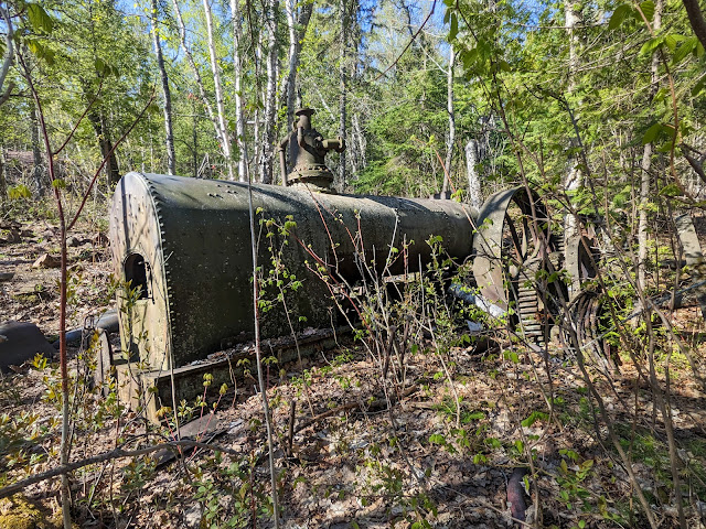 |
| The old boiler |
I spent a happy half-hour cavorting about the mine site, something I used to do quite often when I lived in the Copper Country. I probably could have spent several more hours there. I decided I would try to climb back up to explore more of the site later.
I passed an old rock-lined well that must have been used by the mine. Much farther down the trail, I met up with Sarah as she was enjoying a quick snack. The trail had turned onto the Island Mine's old road, leading straight down the ridges to the mine's dock at Siskiwit Bay. The road -- and hence the trail -- was remarkably straight and even. It even had ditching on both sides! The only time we had any trouble was when it crossed a roaring seasonal stream that had washed out its puncheon bridge.
My map showed the mine's cemetery nearby, but neither of us noticed any sign of it. We did meet the first other hikers of the day, a group coming up from Siskiwit. They sang its praises; we warned them of the downed trees to come. The road, er, trail next ran through a long swamp, but the excellent work of those road-building miners 150 years ago kept our feet dry.
 |
| Carnelian Beach, with Senter Point in the distance |
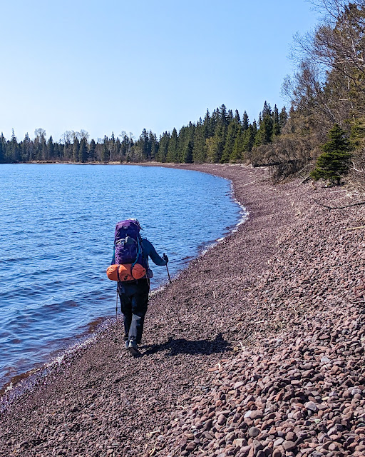
The trail came to Lake Superior at Siskiwit Bay. Here the trail turned out onto Carnelian Beach, a red cobble beach very similar to many we knew and loved in the Keweenaw. Actually, the trail sometimes ran just a few feed inland from the beach, but it was often washed out, and the park's official advice is just to walk on the beach itself. It wasn't easy to walk on the ever-shifting cobbles with backpacks, but our hiking poles kept us balanced. The beautiful lake kept us distracted, too, with its deep blue color reflecting the sky.
Near the end of the beach, the trail cut inland again to cross Senter Point, an odd protrusion into the middle of Siskiwit Bay. In the middle of the point, another deadfall blocked us. As we were bushwhacking our way around the tree, we met the second group of the day. This one included our fellow flyer from the seaplane, who had met up with his group and was now completing the Feldtmann loop in the opposite direction from us. This group also sang the praises of Siskiwit Bay campground. They also told us that one of the two shelters was open, and we could likely snag it if we hurried!
That re-energized our steps, and we thanked them and quickly headed off. The trail popped back out onto a beach -- this time a more sandy one where our pace speeded up, although we had to slow down to cross several small streams. Then the trail cut inland yet again, this time on a boardwalk through a swamp filled with Marsh Marigolds, and took us onto a spectacular bridge over the Big Siskiwit River. The bridge had clearly been a major piece of construction: It had metal supports and pilings set deep into the river bottom. But ice had pushed it off-kilter in the years since its building, leading to a slightly crooked crossing.
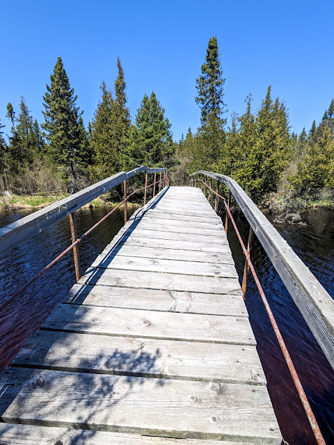 |
| The photo is straight; the bridge is not. |
The trail took us back out to the beach by way of one last inconveniently fallen tree (right in the middle of a swamp!), and then back inland yet again, past the turnoff for the Feldtmann Ridge trail. The trail became a narrow pink line winding through an open grassy clearing and finally into Siskiwit Bay campground. Sure enough, Shelter #5 was open! We gratefully sat down at its picnic table and ate a snack.
Siskiwit Bay campground is a lovely place, perched on a hillside above the south side of the bay. The rock underlying the bay and campground is red conglomerate, lending its color to everything we saw: The beaches, the shallows of the bay, and even the trails themselves.
Shelter #5 was partly hidden by a small screen of evergreens, but by craning our necks we could get a decent view of the bay. As I later learned, we'd managed to end up in the same shelter where Nina of Black Coffee at Sunrise fame had once encountered a wolf. We had no such adventures, but we did have a wonderful time.
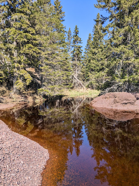 |
| One of many streams we crossed while walking the beaches |
Sarah decided to do laundry, defined as "going down to the dock, swishing clothes around in the water, and rubbing them a bit". I decided to stay on my feet and backtrack towards Senter Point, where I had heard rumors of the Island Mine's powderhouse hiding in its trees. A powderhouse is a stout stone structure with a flimsy roof where a mine would store its explosives. The idea was that if the explosives, well, exploded, then the force would be channeled upward and away from people rather than outward.
I packed a small daypack and backtracked across the Big Siskiwit river bridge, crawling under that dang fallen tree yet again. Once I was on the far side of Senter point, almost back to Carnelian beach, I headed off trail towards the body of the point itself. The walking was easier than I expected -- there were lots of small clearings, and evergreens generally kept brush under control. Sure enough, very soon the rocky walls of the old Island Mine powderhouse appeared through the trees.
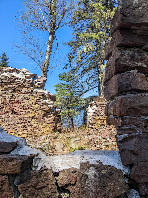 |
| Powderhouse walls |
The building was enormous by powderhouse standards, and perched right on the shore of the point. Most powderhouses from successful mainland mines were much smaller, but perhaps Island Mine had to stockpile more explosives for long winter months isolated from the rest of the world. Its roof had long since fallen in, and the walls had started to collapse in a picturesque manner. At some point in the past, somebody had done some stabilizing work on the tops of the walls. The powderhouse was located quite near the shore, meaning that the miners probably took a boat across the bay to pick up explosives.
The building was beautiful but also felt like a melancholy reminder of how hard and unforgiving life was on Isle Royale. Island Mine put a lot of time, energy, and money into a wholly unsuccessful venture.
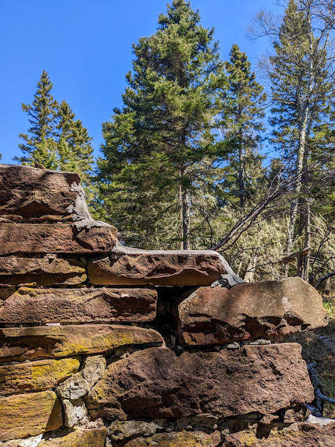 |
| One more powderhouse view |
I had intended to continue uphill, either to seek out the mine's old dock on the north side of the bay (and also off-trail), or to return to the mine site itself. Instead, I realized that I was completely bushed! I returned the way I'd come, pleased with a touch of exploration but also ready to rest. After my final crossing of the crooked bridge, I decided to try to climb over the inconveniently fallen tree, and instead managed to cover my pants and hands in sap.
Back at the campground, I found Sarah down on the dock, sitting at a picnic table in a stiff breeze, holding on to her slowly drying clothes. The wind was cold but the sun was warm, so I put on a coat and joined her. As we sat and squinted into the sun and wind, two paddlers came in from a trip around the bay and moved their packrafters up to Shelter #4. I was impressed at their ability to handle the lake on this windy, choppy day. They seemed uninterested in conversation as they began deflating their packrafts and packing up for whatever their next move would be.
We eventually decided that Sarah's clothes were as dry as they were going to get, and moved back up to the shelter. We ate a favorite freeze-dried meal for dinner -- Pad Thai -- and were just barely able to handle its spice. As we sat fanning our mouths, an early season hummingbird buzzed around us, undoubtedly looking for food that was not yet available.
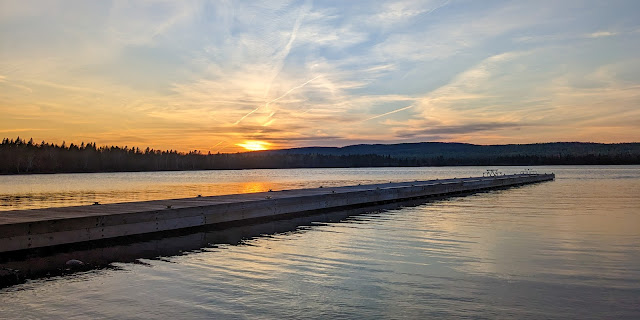 |
| The sun gets low over the Siskiwit Bay dock |
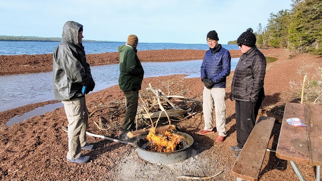
After dinner, we took advantage of another feature of Siskiwit Bay campground: The community fire ring! Individual sites at Siskiwit don't have fire rings, unlike Island Mine campground, but Siskiwit does have one central fire ring down near the beach. We started by making a fussy pile of kindling, trying to put together just the right combination of dry items and collect twigs. Soon three fellows from one of the tent sites joined us. They took charge of starting the fire and got it roaring fast. I'd never seen such efficient fire-starting.
The rest of the long, wonderful northern evening was spent standing around the roaring fire, chatting with these three hikers. They turned out to be Brian, Ken, and Dane, all experienced backpackers. We told stories, laughed, and had a grand time. Brian and I in particular shared a great interest in exploring the UP and traded detailed stories about our experiences.
The three backpackers were traveling the Feldtmann Loop counterclockwise, the opposite direction from us. They had just come from Feldtmann Lake and reported that they hadn't seen a single moose yet. We commiserated -- we hadn't seen so much as a hint of a moose yet -- it was that much stranger because spring is often a great time to see moose and calves.
They also sang the praises of Rainbow Cove, a short dayhike away from Feldtmann Lake. Ken in particular couldn't say enough about its beauty, its smooth lake-rounded rocks, and the way that you could lay out on the cove's sun-warmed rocks to heat up after a cold day.
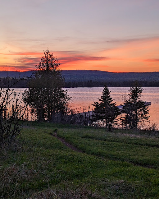 |
| Sunset from Shelter #5 |
At one point, the inevitable topic came up: food. Whenever two or more backpackers gather, there shall be a discussion of what everyone wants to eat as soon as they're off the island. Ken and Brian shared a half-remembered story of eating burgers on a deck somewhere in downtown Houghton after a long-past Isle Royale trip. I realized that they were talking about the Downtowner, a classic Houghton hangout, and I immediately felt a great hankering for a greasy burger with onion rings. Sarah daydreamed of a cherry Coke. We vowed to go get exactly those things as soon as we were back on the mainland.
Dane had a satellite communicator (similar to our Garmin) with the ability to get a weather forecast. As the sun set lower, he showed us tonight's forecast: 35 degrees! The strong wind and the clearing sky promised that it would feel even colder.
 |
| A pleasant evening at the fire pit -- photo courtesy of Brian |
After several wonderful hours, we finally put out the fire, said goodnight, and headed off to our separate sites. It had been a great way to end the day: meeting new friends, swapping stories, telling tales, and enjoying the cameraderie of hikers around a fire.
Bedtime was every bit as cold as the forecast had promised. Stars came out and shone sharply in the clear, cold sky.
Next time: A long hike to a lot of moose - links to all of my trip logs
Miles hiked: 4.4 (Island Mine trail) + 2.6 (Senter Point dayhike) = 7.0
Total miles: 25.3
 |
| Today's route in green, past days in pink |
No comments:
Post a Comment