Last time: Food fantasies? -- Links to all of my adventures.
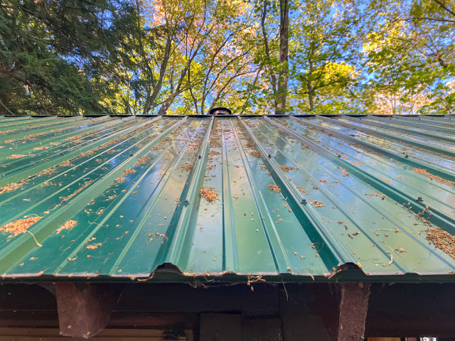 |
Metal cabin roof
|
Thursday May 29, 2025: I slept poorly. I barely (and blearily) got upright in the morning. The weather was warmer, but only a few bugs bothered me as I stepped outside to use the outhouse.
Breakfast was our usual: oatmeal and raspberries. We spent some time reading and discussing our plans for the day, which involved a relatively short hike. So, we took it slow. We packed up and left just before noon, finding that the day had warmed more than any previous days -- but it still wasn't hot.
I was glad that we had revisited the Section 17 cabin. It's cozy and private but still within 1 mile of a trailhead. Having stayed at the nearby and right-on-the-trail Greenstone Falls cabin a few years ago, I strongly prefer Section 17's solitude. We agreed that it would be a good place to start or end a trip, or even a place to stay several days in a row and just relax.
Today's plan was a change from our original itinerary, which had us hiking the Little Carp River trail for about 4 miles up to Lily Pond. That section of the Lily Pond trail is mostly a green tunnel that is nowhere near the river, and is much less picturesque than its lower section. Plus it has some muddy areas that we weren't excited to deal with. We decided instead to hike out to our car, drive to Summit Peak, and hike in to Lily Pond from there. That had a couple of advantages: We could throw away our trash, eat a snack (calories!), and I could also do a quick hike down a half-mile trail that I'd never touched before. The hike to Lily Pond itself would be shorter and on nicer trails than our original plan.
Our hike to the Little Carp River road trailhead was quick -- just about 1 mile -- and beautiful. This segment is one of the rougher bits of the Little Carp River trail, mainly due to roots, rocks, and constant small ups-and-downs, but it also runs close to many small and lovely waterfalls. We again noticed how different the trail felt hiking in this direction, compared to our first day's hike over the very same stretch of trail in the opposite direction.
Crossing the bridge at the trailhead, we passed two older fishermen sitting on a bench. They looked worn out. As I said "morning!" I wondered if they'd been caught off-guard by the ruggedness of the trail, something that often happens with dayhikers on this section. That led to me recall a story from many years ago: While dayhiking this part of the Little Carp River trail together, we encountered a group of high-school or college aged students, all with backpacks. Well, all of them except for one girl with no backpack, who looked a little ragged around the edges. She was followed by a boy, wearing his own backpack and also carrying a second backpack over his head. True love.
 |
| Trailside trillium |
The last quarter mile of trail was a gravel path, formerly a road, and it was straight uphill. This section always gets me, because it feels so easy on the way downhill -- you barely even notice the slope. On the way uphill, and near the end of a trip, it's rough. Today, with bright sun and warmer air, we were sweating by the time we reached the top.
Nonetheless, we made it to the car. The first thing I did was throw out our trash bag, dropping nearly half of a pound from my pack. Woohoo.
Another group of older hikers was just starting out from their cars. One of them gestured at me and asked, "are those necessary?" I didn't know if he meant our head nets or hiking poles, but I figured that either way the answer was "yes". It turned out he was asking about hiking poles. He was the only one in his group who had brought them.
In the car, we blasted air conditioning and opened a bag of Fritos as we drove to Summit Peak. The chips were delicious calories. We still didn't have any real food fantasies though. We parked at the upper parking lot, where our plan was to spend a bit of time here before heading out to our final cabin.
First we walked up to the lookout tower, which is somehow always longer and steeper than I remember. We both wore head nets and I brought my hiking poles for my trip along the Summit Peak side trail, which started at the tower. We passed multiple people along the way who were envious of our bug nets. For some reason, Summit Peak is always buggy. I don't think I've ever been there on a day when I didn't need a head net. Once again, somebody pointed at me and said "those are necessary!" I'm guessing they meant the bug nets this time, but who knows?
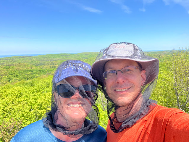 |
| Summit Peak selfie. The bug nets were necessary. |
Although we'd both climbed the tower many times, we did it again out of a sense of obligation (and to grab a bar of cell service to check if a favorite burger joint would be open tomorrow -- it was!). We climbed back down, sat on some benches, and ate rice cakes for lunch. They had dried out over the course of our trip and were now horribly crumbly, much to the future joy of the ridiculous number of chipmunks that live on Summit Peak.
At this point we parted ways. Sarah went back down to our car while I hiked the Summit Peak side trail. This is a short trail that connects the top of Summit Peak with the South Mirror Lake trail. Those trails, plus the Little Carp and Beaver Creek trails, can be put together to create a 5-ish mile dayhike up to Mirror Lake and back. But that requires starting at the top of the peak, something that I've never needed to do as a backpacker -- and so this one small segment of trail had gone un-done.
 |
| The Summit Peak loop, with the side trail in blue. |
While the side trail is short, its main purpose is to drop you from the top of Summit Peak nearly to its base, a drop of about 250 feet over half of a mile. As it turns out, most of that drop happens over a much shorter stretch, with both the start, and especially the South Mirror Lake end of the trail, having long relatively flat segments. Other than a few rocky bits, all well-tended (one part even had steps!), the trail was generally unremarkable. I reached the end of the trail, looked around at the boring intersection in the middle of the woods, and turned back around to climb right back up again. I'd checked off one of the last few trail segments I hadn't hiked in the Porkies (the only trail remaining, other than the legendary flagged route that may not even exist any more, is about one mile between Union Spring and the Government Peak trail).
I met Sarah at the car, where she'd set up a camp chair and was reading her Kindle. While she packed up, a truck pulled up, featuring the two tired-looking fishermen from the Little Carp River trailhead this morning. One told me that they were trying to get to Mirror Lake to fish and asked how I would get there. They had apparently tried the Little Carp River trail but found it too muddy, and South Mirror Lake was too hilly (it does have a brutal uphill right after the gate). I encouraged them to try Beaver Creek trail as a starting point. They thanked me and said they'd be back another day to try again.
 |
| Steps -- yes, steps! -- on the Summit Peak side trail |
We slung on our packs and headed down exactly that trail, Beaver Creek. It had a little mud and some bugs, but was generally in good shape. The trail crosses the Little Carp River on a bridge across a marshy area, then follows a long boardwalk across more of that marsh.
Last year when I'd visited here, this boardwalk was filled with fallen trees and broken boards. It was much better this time.
We turned off of Beaver Creek and onto the Little Carp River trail, then completed another mile or so of perfectly nice trail before we arrived at Lily Pond. This is a wide beaver pond on the Little Carp River, and it has a long and impressive bridge built across the river's mouth on the downstream end.
As soon as we'd opened the cabin to air out, we headed back down to sit on the bridge's wonderful bench, built right into the middle of the span. (The cabin is right next to the river, pond,
and trail.) We talked, for the umpteenth time over the years, about just how bad Porkies trail signs are. The sign at the start of today's trail listed the distance to Lily Pond as 1.5 miles, when the truth was over 2 miles. That might not sound like much (just half of a mile, who cares?), but like I mentioned back on
Day 1, most Porkies signs are wrong by a similar percentage -- and not consistently. Some are too long. Some are too short. Often subsequent signs on the same trails, pointing to the same destinations, give inconsistent and even impossible results.
Here are two signs I photographed during my
2022 April snowshoe trip along the Escarpment. The left one is at the trailhead, the right one is at the Escarpment trail intersection, 0.1 miles later. Notice how Trap Falls has gotten... farther away?! (Not to mention "Mirror Like".)
 |
| Don't trust Porkies maps or trail signs |
OK, getting off of that soapbox, climbing onto another one. I sat next to Sarah, sharing updates from the social media feed that is the cabin's log book. The book had been in the cabin for quite a few years, and I was able to find my two previous entries -- one from 2021, another from 2024. Recent entries didn't say much about mice or other troubles, which is always pleasant to read.
In the log book's long history, it had been filled with people obsessed with finding a certain spring on the far side of Lily Pond. Multiple maps, detailed instructions, and blow-by-blow accounts of mud-filled adventures to find the spring filled the book. The spring almost certainly exists (enough people claimed to have found it), but I've always thought it was way too much work for the limited payoff of... slightly cleaner water that I would still need to filter. Others took a canoe all the way out into the middle of the lake to get "clean" water from the middle of the pond. Again, too much work. River water works perfectly well, and tannins just add pleasant flavor!
The bridge was sunny and lovely, and we spent quite a long time enjoying it. Eventually we decided that the cabin had aired out enough, so we headed back up to unpack. With that chore done, we spent some more time reading, this time in our bunks.
Dinner was, again, Pad Thai, but this time a newer bag that hadn't gone rancid. It was OK, but not as good as we'd hoped.
 |
| Looking towards the Little Carp River, where the eagle was perched |
Shortly after dinner, Sarah headed outside to "enjoy" the outhouse. I wasn't paying much attention, but as soon as she left the door, I heard her hiss "Dave! Come look!". I jumped up, startled, and rushed out, but I was too late. A bald eagle had been perched on the beaver dam, right outside our door, but had flown away once Sarah came outside.
In hopes of seeing the eagle return, I walked down to the bridge and tried to read. Unfortunately the bugs had really ramped up, and even with my headnet I was chased back inside quickly. I did get to hear, and then see, a lone Trumpeter Swan. It paddled around the lake, took off, and did a lap, honking like a car horn the entire time.
We read a bit more, tried the bridge again (still buggy), and finally decided we were in for the night. We went to bed early, knowing that we would want to get up early to head home tomorrow.
Miles hiked: 4.0 (1 mile to trailhead, 1 mile Summit Peak side trail, 2 miles to Lily Pond)
Total miles: 21.0
 |
| Day 5: Routes in orange |
No comments:
Post a Comment