Last time: A campfire with friends
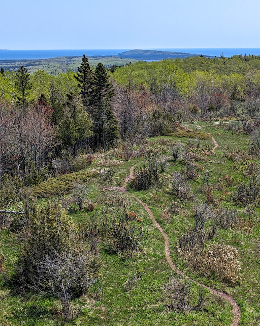
 |
| The Feldtmann Ridge, looking east |
Friday May 26, 2023: Morning was sunny, bright, and -- you guessed it -- cold! We took our breakfast down to a waterfront picnic table, where we basked in the sun while covered in all of our puffiest layers.
The bay and air were filled with wildlife. A pair of trumpeter swans flew overhead, making their curiously brassy honks. Sandhill cranes circled with their spooky, echoing call. Mergansers paddled and dove. And, of course, seagulls screeched.
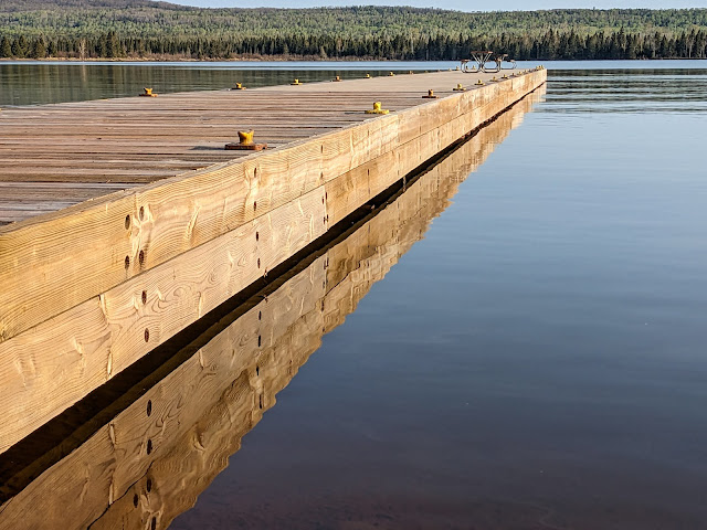 |
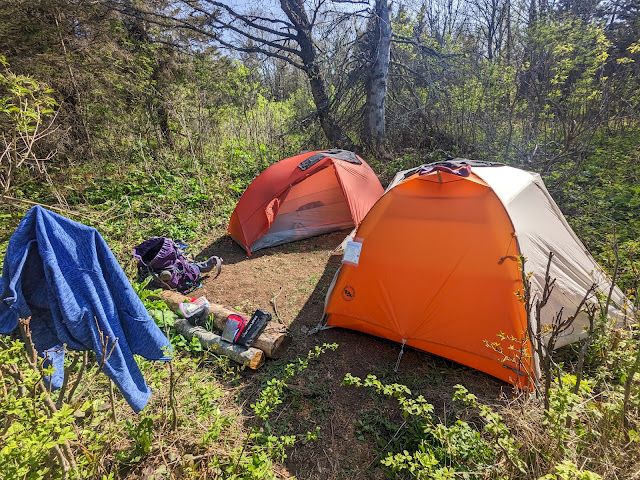
| Beautiful morning at the Siskiwit Bay dock |
Our original plan called for us to spend a rest day at Siskiwit Bay. It was a beautiful place, and I could have easily stayed put and enjoyed the scenery all day. But after talking it over, we decided to continue on to Feldtmann Lake campground and spend our extra day there. We were both feeling just fine currently, and moving along today would let us recover from our longest hike for an extra day. And among other things, Ken's description of Rainbow cove had enchanted both of us. Nonetheless, I decided that some trip soon, I would return and spend an extra day at Siskiwit Bay.
So we packed up quickly and set out on the trail. It was a big day: 10.3 miles along the Feldtmann ridge!
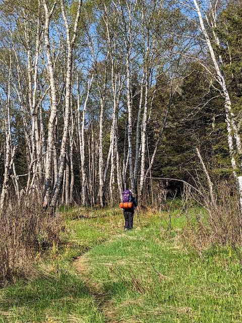 |
| The old logging road |
The start of the trail was extremely flat. It was yet another old road, this time a logging road, and the trail passed through flat woods that had been logged out (and burned!) a hundred years before. On the bright side, the trail was warmer and sunnier than the ridges above us, which meant that spring wildflowers were truly in bloom -- marsh marigolds, hepatica, and fields of spring beauties.
Nonetheless, the trail was so flat, straight, and without any views, that we lost track of time. I eventually checked my clock (aka phone) and discovered that we'd been marching for an hour with no apparent change in scenery.
We decided to stop and rest once per hour, to help pace ourselves on this long day. In our case, this meant picking a random point along the road where a fallen tree made a good bench.Soon afterwards, the trail started to climb up the Feldtmann Ridge itself. It was a long, slow slog of a climb. Luckily, the trail crews had made it through here and cleaned up many fallen trees. Was Island Mine the only trail they hadn't touched?
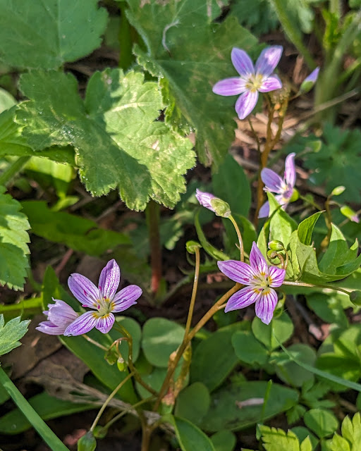 |
| Spring beauties |
We were doing the Feldtmann loop "backwards" (clockwise), and so we had expected to meet many other people heading in the more traditional counterclockwise direction. But part way up the ridge, we met the only other people we would see on the trail all day. They were a young couple with fantastic Yooper accents. They warned us that Feldtmann campground was pretty full, with several large groups (Moosewatch?) staying for a long time. Oh, and there were indeed moose to watch: "They're all over the place! They walk right through the campground!" We wished them luck and let them know about the wonderfully flat trail ahead of them.
We made our second hourly stop at the top of the long uphill in a classic Copper Country bedrock glade. A ridge of gray volcanic rock formed the base of the clearing, with grasses popping out of the cracks. The rock was topped with puffy lichens, and the whole opening was surrounded with dense forest on every side.
We gratefully took off our packs and pulled out a snack of peanut-butter rice cakes. We gently laid down on the soft lichen. Sarah almost fell asleep.
It turned out that an even better stop was just ahead of us. Back on the trail, one more uphill brought us to the real top of the ridge, which was bare and windy. Right in the middle were the footings of an old fire tower. The tower itself, built of wood, had collapsed off to the side of the trail.
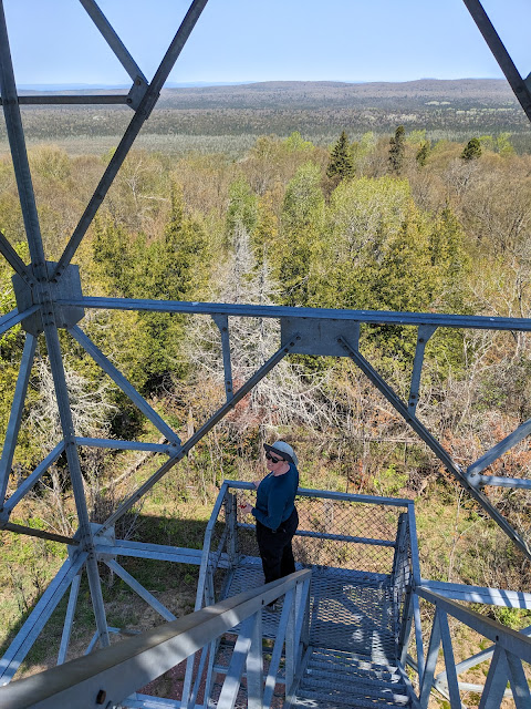 |
| Sarah at the Feldtmann Ridge fire tower |
The next bump along the ridge brought us to the "new" Feldtmann fire tower, a massive steel construction in the middle of a huge bare stretch of ridge. This was our halfway point, so we decided to make an unscheduled stop. We dropped our packs again, climbed as high as we could go on the tower (it's closed at the very top, much like the Mt. Ojibway fire tower), and took so many photos.
The tower has a spectacular view in every direction: Back east, the direction we had come from, we could see Siskiwit Bay sparkling in the sun. Lake Halloran, which had been completely invisible from the trail, was visible from this height. To the south, the expanse of Lake Superior spread out all the way toward the horizon, where the Keweenaw was a barely visible outline. North, we could see ridges and swamps alternating in bands between bare deciduous trees and dark evergreens, heading upward to the huge rounded bulk of the Greenstone Ridge.Finally, to the west, we could see the Feldtmann ridge stretching far into the distance. Feldtmann Lake itself was just a tiny slice of blue. We had a lot of walking left to do.
 |
| Looking back towards Siskiwit Bay |
After even more photos, a snack of meat sticks, and another good long rest, we pulled our packs back up and continued west.
The ridge was topped with hundreds of stunted serviceberry bushes, currently blooming with their showy white flowers. The trail soon dropped down into the woods, where the wildflowers were out in profusion. We saw fields of spring beauties, a few hepatica, and even one very early devil's paintbrush!
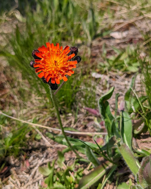 |
| An adventurous devil's paintbrush |
One hour later, almost on the dot, the trail wound around a small outcrop of rock and we suddenly found ourselves facing a lovely waterfall. This small waterfall -- perhaps eight feet tall -- tumbled down a rocky wall and cut through a collection of mossy boulders. What a perfect place to stop and rest!
We climbed up on a boulder and enjoyed another snack. As we ate, I thought I could see a volunteer trail heading up the cliff face, so I got up to investigate. I'd never heard anyone mention this waterfall -- it probably was barely a trickle in the summer -- so who knew what other magic might be hiding down this side trail?
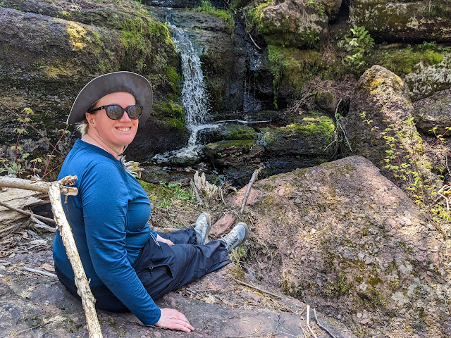 |
| Sarah with the bonus waterfall |
The side trail climbed on surprisingly well-maintained rock steps and turned to follow along a picturesque beaver pond. It went on for quite a while. I kept following, entranced by the bucolic scene, when I suddenly came to a section of boardwalk. They don't build those on volunteer trails! That's when I realized that I was actually on the main trail. Sure enough, back at the waterfall, the real trail made a short jog to cross the stream and then turned right up the rock "steps" I'd climbed.
Refreshed by this beautiful stop, we packed up and continued up the steps. The beaver pond was just as lovely on my second visit. Next we came to another stretch of open ridge. As with all Isle Royale ridges, it sloped gently to the south. This ridge was quite open, giving us lovely views over more ridges and down to Lake Superior. It dropped off steeply on the north side, where a single line of white pines stood at its crest. Their soft needles covered the path and gave off a gentle, pleasant scent as we passed.
By this point, we were both getting tired. Carrying 30 pound packs was wearing us out, and hauling them along the exposed ridges under the clear sunny skies was starting to make us sweat, despite the cool air.
All that was forgotten when we reached the end of the ridge, where several spectacular overlooks awaited us. Each overlook showed us a different view of Feldtmann Lake and its swampy lowlands, stretching out several hundred feet below us. Lake Superior sparkled in the distance, and we could even see a tiny white speck in the distance where the Rock of Ages lighthouse stood. We stood in awe. Then we took selfies.
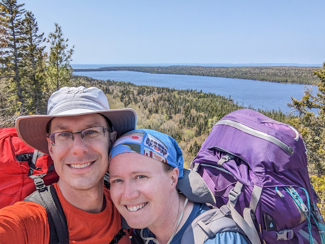 |
| Selfie high above Feldtmann Lake |
The trail soon entered a flat deciduous forest, and eventually started following some sort of (apparently) man-made berm whose origins I never figured out. We parted ways again (rule 1!) with me going ahead to hopefully get a good campsite.
The bridge over the stream at Feldtman Lake's outlet was badly in need of repair. Shortly afterwards, I found the small sign that welcomes visitors to Feldtmann Lake campground. I made a quick pass through the campground, which has only tent sites, and found exactly one site open: Site #3.
 |
| This is the entirety of Site #3 at Feldtmann Lake |
It was no mystery why site #3 was the only campsite left open. It was tiny, barely large enough for two small tents. It was totally exposed to the sun, with few shade trees anywhere near it. It was across the path from the lake, so there wasn't much of a view. And the kicker: It was right next to the outhouse. Other sites had many tents in them, including at least five at one, and four at another -- perhaps these were the Moosewatch groups that we'd heard about.
Sarah arrived shortly afterward and found me ornery and hot. We didn't have any choice except to set up here, so we did. We had to play Tetris with out tents in order to get both of them to fit.
On the upside, the site did have a short access path to the water. We went down and found Feldtmann Lake to be remarkably placid. The tiny sandy beach was damp, but we sat on our rain coats and cooled down a bit as our water filtered itself. The view was lovely: The perfectly flat surface of Feldtmann reflected the blue sky and the greening forest that crowded close in on every side.
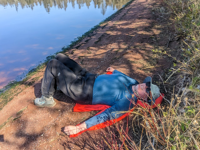 |
| Sarah resting along the shoreline |
Feldtmann Lake is also home to even more waterfowl than Siskiwit Bay. Mergansers paddled around everywhere, diving and preening. A slightly different duck kept making such a strange sound that we started calling it "The duck that goes 'meep'". We later learned it was a Goldeneye, and the sound -- which for all the world sounds like it's coming straight out of the Muppet Show -- is part of its mating call.
The shady beach cooled us down, and the rest did our muscles good. The sun sank lower in the sky, reducing the heat and glare in our tiny campsite. We ate a dinner of bland freeze-dried beef stew, on the theory that after that many miles, we really couldn't care less what our food tasted like. It was acceptable. It was calories.
As we sat eating at the beach, I heard some distant splashing. Sure enough, two young bulls were walking out of the trees far down the shoreline -- our first moose of the trip! They waded far out into the lake, dunking their heads to eat water plants. We took turns watching through our field binoculars, and we noticed several groups of people in other campsites doing likewise. We also noticed that many of the waterfowl hurried over to hang around near the moose. Perhaps they were hoping to get a good meal from whatever the moose stirred up?
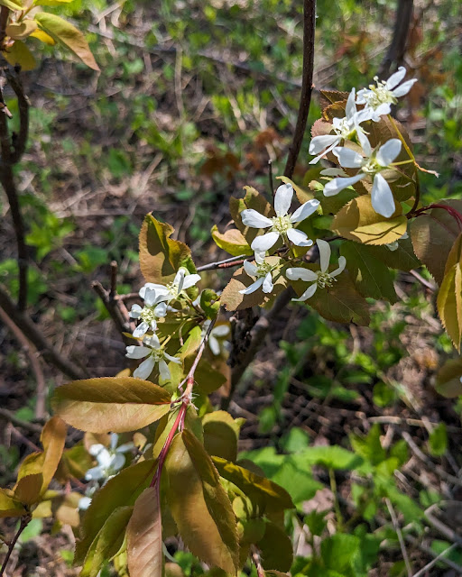 |
| Serviceberry flowers (because I didn't photograph the moose -- wait until tomorrow!) |
When the moose watching finally got a bit boring, we started to head for bed. That's when I remembered Dane's handy weather forecast from the previous day. I poked around in the app that connects to our Garmin, and discovered that ours would do the same thing -- at the cost of one "free" message. We decided it was worthwhile to spend one of those messages, and discovered that the night would be clear but much warmer, at a balmy 40 degrees!
We crawled in to bed, exhausted from the day. As I was laying down under my quilt, I heard the unmistakable sound of a moose splashing through water. It sounded like it was right in front of our campsite. Sure enough, when I stuck my head out of my tent, I could see one of the young bulls right in front of our site! It was followed shortly by the other one. I ran out to watch it wander down the beach, along with half of the rest of the campground.
After that, it was a bit hard to get to sleep. But it turns out that hiking well over 10 miles with a loaded pack beats the adrenaline of a double moose sighting, and we managed to get to sleep in the pleasantly non-frigid evening.
Next time: The magic of Rainbow Cove
Miles hiked: 10.3
Total miles: 35.6
 |
| Today's route in green, past days in pink |
No comments:
Post a Comment