Tuesday, May 31, 2022

Porcupine Mountains Solo April 2022, Days 3 and 4: Escarpment snowshoe and home

 Last time: Too many waterfalls, too much driving - All backpacking posts

You can find links to all of my hiking and backpacking trips in the adventure index.

Frozen Lake of the Clouds, a sight rarely seen by hikers

Sunday April 24, 2022: I woke up refreshed from a great night of sleep. The night was cool, not cold, but the wind howled and Lake Superior's waves crashed. Rainstorms blew through during the night, leaving the air fresh and clean. It was wonderful.

I had been contemplating two options for today's hike. Both involved hiking down the (still closed) M-107 to the Government Peak trailhead. But what would I do from there? Option one was to follow Government Peak trail south to Trap falls, a scenic waterfall that should be roaring. Option B was to instead head up onto the Escarpment and enjoy one of the premiere hikes in all of Michigan.

I'm sure you can tell what I chose: Escarpment! My actual decision-making process went more like this: I've seen a lot of waterfalls. And I've even seen Trap Falls in spring before. Plus the Escarpment... well, it's the Escarpment. And so the choice was made.

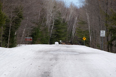
I hiked out to my car and drove all of a half a mile down M-107 to the Whitetail Cabin parking area (the entrance to Union Bay campground, where I was parked, is also on M-107). I pulled in to the small parking lot, got out my daypack and snowshoes, and headed around the barricade.

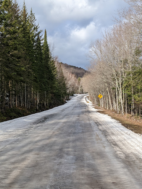
Icy M-107, looking towards the Escarpment.
Also notice the different trees on each side.

Like all Porkies roads, M-107 is a snowmobile trail in the winter. That means it's not plowed, and the snow machines pack it down into a feet-thick crust of snow and ice. This packed crust takes quite a while to melt -- much longer than a regular snow-covered road -- and so the park roads are usually closed until the middle of May.

Snowmobiles (and snowmobilers) are also notorious for dropping bits and pieces of equipment all over the road. On this hike, I found bits of tread, broken pieces of head- and taillights, a spark plug cable (!), headphones, a cell phone charger cable, and so many pointy tire studs.

The road started out partly clear, with piles of snow along the edges. That filled in quickly, and by a mile into the hike, I finally had to put on my snowshoes (learning my lesson from the mistake I'd made on Friday). 

The day was gray and warm. I had packed for essentially any weather -- rain gear, coat, fluffy layer, t-shirt. The exertion of snowshoeing uphill caused me to shed layers. As the sun started to peek out from the dense layer of gray clouds, I wondered if I should have brought sunblock!

Not today!

It was an eerie feeling to walk -- on snowshoes! -- down the center of a state highway, with nobody else in sight. No people, no cars, no man-made noise. This road is often so packed in fall that the backups last for miles. Today, I was completely alone.

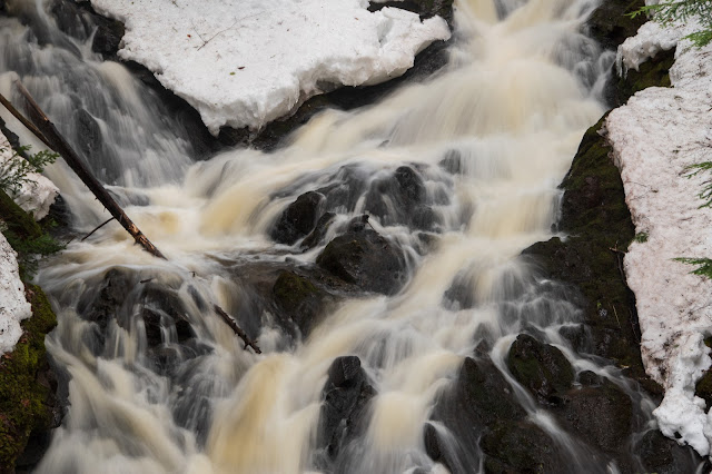
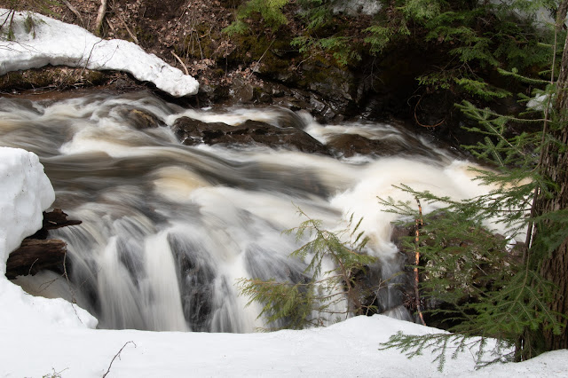
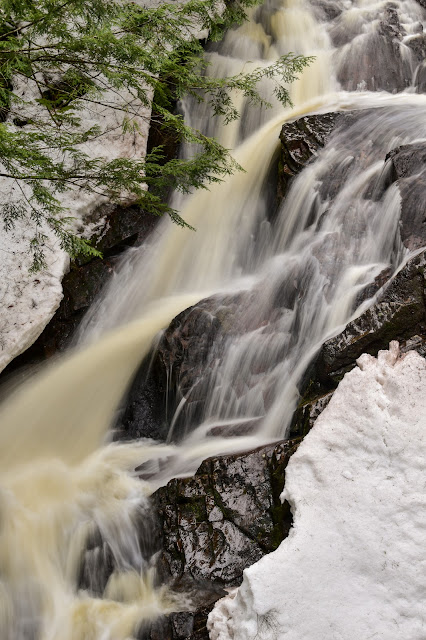
Even though I've driven M-107 dozens of times in my life, the view on foot was so different than the view from a car that it might as well have been a totally different road. I slowly walked past the scenery and got to see it more clearly. I could look deep into the woods, see the details, pause to inspect each seasonal stream-turned-waterfall. It was a unique experience.

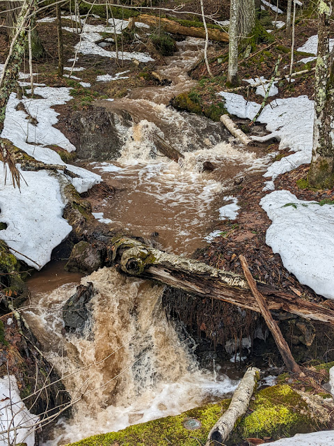
This stream barely exists any other time of the year

This pleasant amble eventually brought me to the Government Peak trailhead, where there was ample evidence that snowmobilers had enjoyed it throughout the winter. I paused for a quick snack, then picked up my gear and headed up the trail. 

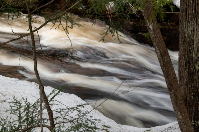
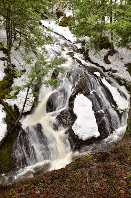
Government Peak trail itself, always steep and rocky as it climbs up ancient lakeshores, was an absolute river in the spring melt. The water ran over, under, and around the remaining snow. I kept my snowshoes on for traction as I trudged upwards, and I was glad to be wearing waterproof winter boots as well. I relied on my hiking poles constantly for support, balance, and a little extra push uphill.

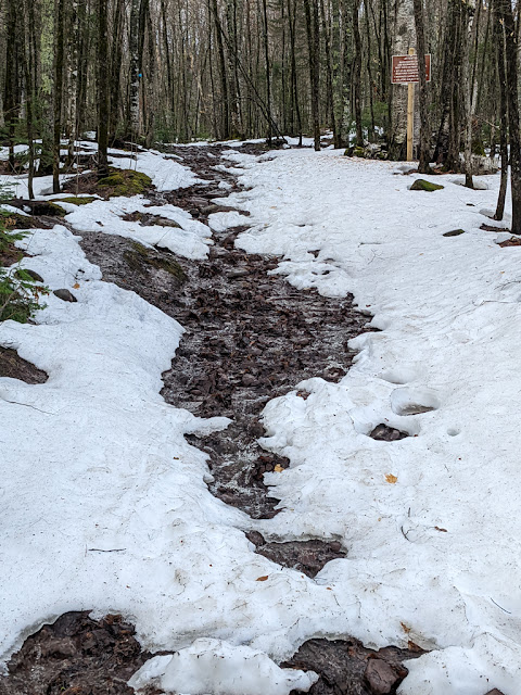
The first uphill on Government Peak trail.
Everything that isn't snow is covered with running water.

Oh yeah, the mileage signs. Porkies trail signs are notorious for being both inaccurate and inconsistent. Here's the first sign you see, right at the Government Peak trailhead. Notice that the Escarpment trail turnoff is just 0.1 miles away, and Trap falls is 2.25 miles:

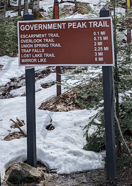
Escarpment trail: 0.1 mi, Trap falls: 2.25 mi

After hiking that 0.1 mile and reaching the Escarpment turnoff, there's another sign, below. Magically, Trap falls has gotten 0.15 miles farther away than it was 0.1 miles ago!

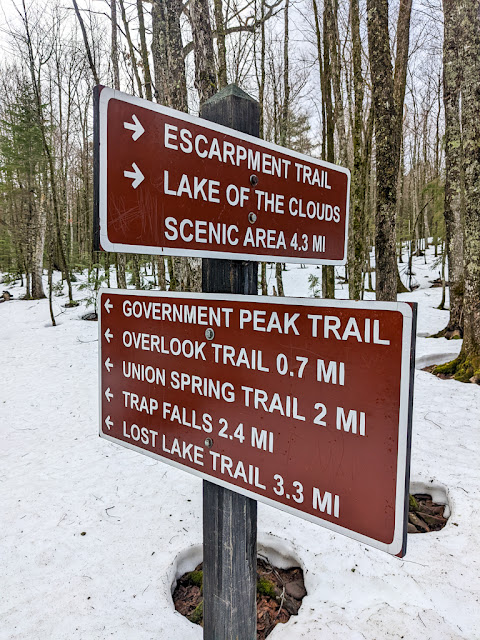
My advice: Use the signs as only the most general suggestion, and never trust them when it's critical.

The Escarpment trail was another steep, rocky river of meltwater. Here I had another unique experience: snowshoeing across a boardwalk.
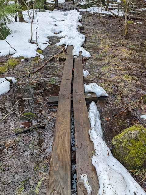
Snowshoes suggested

As I gained elevation, the trail started to clear up. I was suddenly snowshoeing on bare rocks! I took off the snowshoes and carried them as far as the next turn in the trail, where I was presented with a solid trail of snow and ice. I put the snowshoes right back on again.

I finally topped out at the edge of the Escarpment, a south-facing trail. That meant that it was snow-free (although the tread was ofter filled with meltwater). Confident that I wouldn't need the snowshoes, and not wanting to hand-carry them for the next several miles, I took a break and figured out how to tie them onto the back of my daypack.

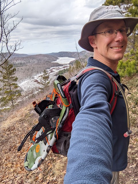
Selfie with snowshoes and Lake of the Clouds

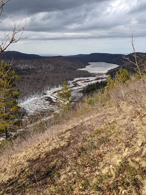
The Escarpment was as gorgeous as ever. I stopped often to enjoy views of the Big Carp River valley. With no leaves on the trees and all of the brush down, I could see much farther than in the summer. I was even able to catch some views out towards Lake Superior, and back east towards White Pine.

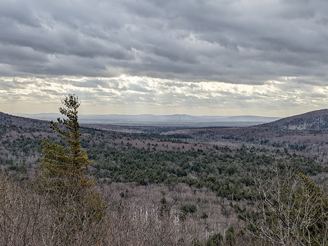
East towards White Pine (the old mine stack is just barely visible in the center)

I took my time and enjoyed every moment of the hike. I moseyed and dallied my way 2 miles to the halfway point, where the trail takes a steep plunge down into a valley between two "mountains." By this time the skies were well on their way to clearing, and the spring forest was bathed in warm sunshine. It was warm enough that I took off my fleece.

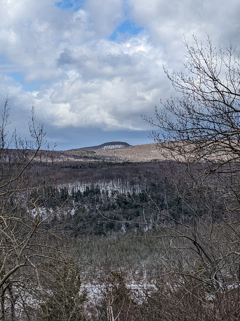
Government Peak in the distance

On the way down into the valley, I quickly started encountering snow again. In fact, the entire valley was filled with squishy snow.

The valley halfway along the Escarpment is absolutely filled with old mining remnants and I couldn't help but see them through the clear, brush-free woods. A collapsed shaft first caught my eye, then an old adit. I wandered off-trail, examining every mine and relic I could find while postholing the whole way in the squishy snow. I ran into a bubbling spring stream, which I followed partway down to the old Carp Lake Mine site. I'd been all the way down to the bottom of the Escarpment before, long ago, and seen the remains of the steam-powered stamp mill that still lives there.

Today I decided that my quickly tiring legs didn't need the extra trouble of hiking all the way to the bottom, and it would be too wet and mushy anyhow. So I turned around, headed back uphill (still postholing the whole way) and found the sign that marks the shortcut trail leading to M-107.

Here, quite belatedly, I undid my snowshoes from my daypack and put them on. Thus it was that I came to be snowshoeing in a t-shirt, surrounded by brilliant sun, blue sky, and snow as far as the eye could see.

Upper Big Carp river

I had a choice facing me: I could begin my trip home by heading downhill towards M-107. Or, I could continue along the Escarpment by heading uphill -- way uphill -- to the top of Cloud Peak. It had become such a beautiful day that I decided I couldn't possibly miss the views from one of the highest points along the Escarpment. So, uphill I climbed, slowly but surely.

I soon popped out into the large swath of open rock at the top of Cloud Peak, the long-ago site of the original Lake of the Clouds overlook. The sky had continued clearing, and I was presented with a clear blue sky and spectacular views of the distant Lake of the Clouds -- which was still frozen!

I found a ledge of rock with a particularly good view and sat down to enjoy lunch (peanut butter and rice cakes, with meat sticks and gorp). I rested and soaked up the sun and the incredible setting. The contrast between the blue sky, the warm sun, and the frozen lake were both jarring and wonderful.

Frozen Lake of the Clouds

I watched birds circling high above the Big Carp River -- but below me. Ravens, hawks, and (I think) a bald eagle all circled, looking for food or just riding the thermals. I'm not sure about the bald eagle because, well, how often have you seen one from above?! A sandhill crane flew past, parallel to the cliff and at eye level to me, croaking its spooky rattling call the whole way.

Before, during, and after lunch, I took so many photos. With such an iconic view staring me in the face, how could I resist? As I took photos, the wind gusted more and more, until it was almost blowing me over (thankfully, it was blowing away from the edge of the cliff).

After a glorious half hour in the most beautiful place in the world, the wind gusts finally convinced me it was time to turn around and head home. I packed up, strapped on my snowshoes, and headed back down to the valley, and then down the half-way trail.

The half-way trail turned out to be a river. I suppose I shouldn't have been surprised; it's the lowest point along the Escarpment. In addition to all the water coming down from the halfway-valley, the trail also collects water from every spring rivulet along the hill. At some points, I was literally wading through water along the trail. Thank goodness for waterproof snow boots!

At the very bottom of the trail, this small set of wooden steps had become a waterfall:

Water pouring down from the Escarpment into the ditch that these boards cross.


I came out on M-107, which was solid ice at this point. I made a short detour out on to the red rock piles of the Meade Mine to enjoy the Lake Superior view (the mine is now a gated bat cave). After that, I started the long snowshoe slog home along M-107. It was still sunny and beautiful, but boy were my legs tired. Even so, it was still a fantastic walk along the strangely silent road. It truly was a perfect day, brought to me by the unexpected silence, the chance to pause and rest and enjoy every spring waterfall, and the beauty of the deep woods.

As I neared my car, I saw the first other humans of my day, a distant group of 5 people who were likely slogging their way along the Deeryard ski loop in boots. I never caught up with them.

Back at my car, I checked my GPS: 10.4 miles! I had hiked all of 2, maybe 2.5 miles on the Escarpment itself, and the rest was getting there and back. No wonder I felt so tired!

One last view of the Escarpment


Back at the yurt, I split more firewood to leave for the next campers. I also (finally) got up the courage to clean out the disgusting half-burned trash from the fire pit, which I put in a bag and threw away in a campground trash can. Was that so hard?

Dinner was a new freeze-dried meal: Alpine Aire Chicken Pot Pie, which was delicious! (As is any freeze-dried food after a 10+ mile day, so maybe don't take my review too seriously.) I paired it with an icy cold beer that I had stuck in a snowbank earlier in the day.

The heavy meal and heavy beer conspired to make my eyelids heavy too. Knowing it was supposed to be a cold night, I decided to start a fire in the wood stove before going to bed. I was successful -- and adding heat to full stomach and beer made me even more sleepy.

I fell asleep quickly, but kept waking up when the fire burned down and the cold crept in. I would stir the embers, add another log, and go back to sleep again. It was hard to keep the temperature comfortable.

Moody Lake Superior


Monday April 25, 2022: After a long night of tossing, turning, and tending the fire, I was ready to head out and find coffee! I left a few notes in the log book as I ate a quick breakfast. I was packed and out of the yurt by 8 am. 

I walked through the deserted campground one last time. The air was cool and breezy. I took the path closest to the lake, which was foggy and gray.

My first stop on the long trip home was at Camp Coffee, a tiny coffee-selling trailer parked in a wrecker's front lot in L'Anse. The trailer was quite popular, but I eventually got my coffee and enjoyed it on the drive across the UP. The rest of the drive was long but uneventful, and I was back in Grand Rapids in time to enjoy evening rush hour.

From Day 2 -- the Presque Isle River's "dry" mouth


Final thoughts: Every trip to the Porkies is different, and I haven't had a bad one yet. Bad days, yes, with hard slogs and exhaustion. Likewise, this trip had ups and downs, but the visit as a whole was excellent.

This was my first Porkies visit in early spring. I knew I was rolling the dice with weather and trail conditions. I was lucky to get generally good weather (excellent weather for my Escarpment hike), but the late and cold spring kept the roads closed and caused me to be snowshoeing rather than hiking.

As it turned out, early spring was the perfect time for solitude. Compared to my busy visit last August, the difference was astonishing. The park was nearly deserted this April because early spring is a tough time in the Porkies. The roads are all closed, but the snow is too melty for snow sports. It's hard to get anywhere, and when you get there, the trails are made of mush, mud, and meltwater.

So if you're up for adventure (and wetness) and know what you're getting into, early spring is great. It's not for the faint of heart, though.

My 10+ mile Escarpment hike is one of my favorite Porkies hikes I've ever done. The solitude, beauty, perfect weather, and amazing experience of snowshoeing in a t-shirt all made the hike unforgettable. It was also an excellent chance to slowly walk along a state highway, alone, and enjoy scenery I might usually see only as a blur through a car window. My hike to the Union River waterfalls was another good long-distance hike, filled with interesting scenery and hard work. Even the middle day -- filled with too many waterfalls and too much driving -- was still better than not being in the Porkies.

Union Bay East Yurt was a new "cabin" for me, although I'd stayed in its next-door twin (Union Bay West yurt) before. It was especially lovely at this time of year, because Union Bay campground was closed. In the regular season, the yurt would be too close to the business and noise of the campground.

Another warning: Union Bay East, like all of the park's yurts, claims to fit 4 people. It's certainly possible -- it does have 4 bunks after all -- but it would be more than a little tight, especially if bad weather drives everyone indoors. Unlike cabins, the yurts don't have any meaningful storage space, or really space at all. I'm not sure where four people could even stash their packs!

To sum it up: This was a unique trip, one I won't likely have the chance to do again for many years, if ever. I'm glad I did it, and I highly recommend something similar for the adventurous Porkies hiker.

Miles hiked: 11.2 (10.4 on the Escarpment and M-107!)

Total miles: 24.1

Wednesday, May 11, 2022

Porcupine Mountains Solo April 2022, Day 2: Presque Isle and Black River Waterfalls

Last time:  Union Mine waterfallsAll backpacking posts

You can find links to all of my hiking and backpacking trips in the adventure index.

One of the Presque Isle waterfalls, although heaven knows which one

Saturday April 23, 2022: I slept well, snuggled into my incredibly cozy camping quilt. The night was colder than predicted, and my brain kept waking me up to tend the wood stove fire. Occasional rainstorms sped through, pitter-pattering on my yurt's roof. Lake Superior absolutely roared all night long, with white caps crashing against the shore. As one log book entry put it, "some people pay hundreds of dollars for a white noise generator as good as Lake Superior."

I finally awoke to this view -- not one that most campers would be excited about. I have no idea why these curtains are in the yurt:

Aaaaaah, a bear! (Actually an ad for "Yukon Thunder" soap in curtain form.)

The woodstove was cold and the morning was chilly. I restarted the fire from embers (zero matches!) and got the yurt warmed up in no time. On-and-off rain continued as the wind gusted and Lake Superior attacked the shore. I took my time enjoying breakfast (mush, I mean, oatmeal), reading, and generally having a lazy morning.

When things looked dry enough, I headed out on the day's adventure: more waterfalls! This time my target was the many waterfalls on the Presque Isle River, at the opposite end of the park. Because the park's roads were still locked in with ice and snow, I took the long way around (compare to the usual South Boundary Road route in red):

The long way to the west side of the park

As I drove, the sun unexpectedly came out. Wisps of fog and mist streamed across the road as the rain and sun encountered frozen ground and snow.

An hour later, I arrived at the gated and locked entrance to the Presque Isle campground. I was far from the only person to have the idea to visit the Presque Isle waterfalls today -- I parked behind a line of 4 or 5 other cars. The road to the campground itself was still covered in several inches of ice and snow.

I wore rain pants and a rain coat along with my day pack. The most recent weather forecast called for a gray but warm day with occasional rain, clearing up in the afternoon. It was already getting sunny, but I decided not to chance it.

Presque Isle River Rapids

I've seen the Presque Isle waterfalls before, but the West River trail is always a pleasant walk. The river was roaring with spring melt, as thousands upon thousands of gallons of water roared over every rapid and waterfall. I spent lots of time taking photos, but like yesterday, the unexpectedly sunny sky gave me trouble. It also warmed me up, until I eventually had to take off all of my rain gear.

Part of yet another waterfall on the Presque Isle river

I eventually reached the suspension bridge to the "almost" island that gives Presque Isle its name. Here I did something new: I walked the island down toward the river mouth, which was surprisingly quiet and calm. Not a soul was around, and I could scarcely believe that the lazy river that emptied into the lake was the same as the roaring torrent just a few hundred yards upstream.

The "dry" side of the river

I sat down on a convenient patch of grass and ate my usual camping lunch -- rice cakes with peanut butter -- while I watched the river flow past. It was immensely enjoyable: quiet, solitary, and beautiful. In retrospect, it was the best part of the day.

The "island" in the middle of the Presque Isle river's mouth divides the river in two. Most times of the year, the east branch of the river is totally dry, and you can walk across the riverbed in peace. Today, this "dry" side of the river was running high, a sure sign of just how much melt water was pouring down from the highlands. I eventually got up from my quiet patch of grass and hiked upstream, until I came to a waterfall I had never seen before. In most times of the year, this is bare and dry rock:

Not dry this time!

I climbed carefully down to a ledge near the waterfall and tried to take photos of the rushing water. Today, the waterfall was running so hard that I couldn't keep the camera lens dry -- which is why you get the blurry photo! As I sat down here, a family I'd been playing leapfrog with all day appeared, featuring a 2-ish year old who proceeded to throw a stick directly at me. The parents, staring at the waterfall, didn't seem to notice nor care.

Normally, hikers cross over to the east side of the river by walking across the dry riverbed. That wasn't possible this time, so I backtracked along the west bank, enjoying the waterfalls a second time.

View from the Presque Isle suspension bridge


By the time I got back to the car, there were still many hours of daylight left -- so many that it felt silly to drive back and sit in my yurt. So, I decided to check out one of my "stretch" goals for the trip: the waterfalls along the Black River, which I had never before seen. The Black River runs roughly parallel to the Presque Isle river, just a few miles west of the park.

A few miles as the crow flies, that is. No drivable roads head directly west to the Black River and the Black River Scenic Byway that runs along it (although the North Country Trail makes a nice beeline that way). Once again I ended up taking the loooooong way around:

Crow-flying distance from start to finish: About 5 miles.

The whole route took nearly an hour on the road, but the trip took much longer than that in total. That's because waterfall after waterfall pours down the Black River, and I stopped at (almost) every one. The National Forest Service has done a nice job of building up each of the waterfall areas with a parking area, a quarter-mile of trail, and an enormous flight of steps down to the river.

I ooh'd and aah'd at almost every waterfalls (I accidentally blasted right past Great Conglomerate falls). However, each waterfall's parking area was closed for the winter, so cars had to find their own ways to park wherever was clear. Sometimes I had to walk an extra mile, other times I just had to try not to fall down an icy flight of stairs.

Sandstone Falls on the Black River

I was perfectly nice. Well, mostly. Certainly the scenery was beautiful, the woods deep, the rocks dramatic, the rivers roaring. Nothing to complain about, right?

The problem was... well, there were two problems. First, much like everything else in the western UP, the Black River was absolutely filled with the meltwater from a long, hard, and snowy winter. This sounds like a good thing: Water is what makes waterfalls waterfalls, right? More falling water = more waterfall. That's true, but often the best part of waterfalls is not about the amount of water, but what the water looks like.

There was so much water running down the waterfalls that they had almost no definition or shape. The rocks that give the waterfalls form, the eddies and rapids that give them interest--they were all hidden under thousands upon thousands of gallons of rushing whitewater, spray, and foam. The sheer volume was impressive (and loud!), of course, but there's really only so many ways for a few zillion gallons of water to rush over a ledge.

Rainbow Falls on the Black River


When I got home several days later, I looked up photos of the waterfalls in other times of years, and they were much more interesting than what I saw. More than once I said "oh, that's what the waterfall is supposed to look like!" Fall would be a perfect season to view the Black River waterfalls; early spring is not.

The second problem was more about the format of the trip. In the end, the day's waterfall visits got more than a little repetitive: Drive a couple of miles, find the next access road, figure out how to park without getting stuck in the snow, hike in to the real parking lot, hike down 100 steep steps to a viewing platform, spend a few minutes seeing yet another roaring waterfall, and then reverse all of the steps.

I was getting tired at this point, but I also just didn't enjoy the repetition. Unlike yesterday's wonderful hike to the Union River, today's hike was broken up into many short segments, punctuated by short drives. I should have realized this long ago, but I really prefer one long hike to many small ones. Spend some time on my feet, get to really see a place from the ground, get into "nature" mode. It's just not fun to stop and start constantly, switching my mind between the details of driving and the joy of hiking. That's what the Black River waterfalls had me doing, and it did not do the trick for me.

There's quite a large drop-off between foreground and distance


I finally made it all the way to the end of the road -- Black River Harbor, once the site of a struggling fishing village, now the site of a nicely maintained park. A wedding party clung to each other in the increasing windy day. I briefly walked around the park, checked out a suspension bridge across the river (to me it looked just like the one at Presque Isle), and then I got back in the car to undo the entire trip.

I did do one very un-camping thing: I stopped at the Burger King in Ironwood for a good old fashioned greasy dinner. After just one day of camping, it was still amazing.

As I started the long drive home (of course, it was the looooooong way), the sprinkles and wind turned into downpours and blasts. Thunder, lightening, wind gusts, and even more fog and mist! The weather only added to my discontented mood. I drove slowly along M-28 until I finally outran the nasty weather.

Waterfall detail


I stopped by Headquarters to top up my water supply, which is when the torrential rain caught up with me again. At least I had a rain coat with me. It must have been a narrow line of storms, because shortly after the torrential rain caught up with me -- in fact, just after I'd finally filled up my water pack -- the storm blew past and left just a light mist.

I parked back at Union Bay and walked across the campground, pondering how I enjoyed Friday's waterfall hike so much more than today's. As I did, I noticed two things:

First, most of the shelf ice and icebergs that were present yesterday were gone. Blown out to sea or melted away (or both)? Either way, the spring melt continued unabated.

Second, a group of birds feeding on the ground flew up in front of me, leaving this strange birdie to forage on its own:

Mystery bird

Any clue what it is? It was almost like a white version of a Goldfinch, but larger. My best bet is some sort of albino or mutant.

The evening continued windy with occasional rain showers blowing through. I had expected today to be gray but dry, so once again the forecast was... imprecise. I spent most of the evening indoors, except for a brief burst of hauling and splitting more firewood between showers.

The night was warm enough that I didn't light a fire. I fell asleep to the howling wind and roaring waves crashing against the shore. Even a less-than-stellar day that ended in a cozy yurt next to Lake Superior was still pretty good by any standards.

View through the yurt's roof window

Next time: Snowshoes and sunburn - All backpacking posts

Miles hiked: 6 (3.1 at Presque Isle, 2.1 along Black River, and 0.8 back and forth to the car)

Total miles: 12.9

Tuesday, May 3, 2022

Porcupine Mountains Solo April 2022, Day 1: Intro and Union Mine Waterfalls

This is the first of 3 posts about my solo visit to the Porcupine Mountains in April 2022.

Find a link to the next one at the bottom, or check out my full list of adventures.

An unnamed Porcupine Mountains waterfall on the Little Union River

In "real life," I'm a math professor. I teach for a living. But in Winter semester of 2022, I got an opportunity that only comes around once every 7 or 8 years: A semester without teaching. As part of this "sabbatical," my entire job was to sit down and write a book about teaching. This meant that I could truly set my own schedule. The Lovely Sarah (who sadly did not have a sabbatical) encouraged me to make the most of this flexible semester, especially by taking trips that I might not otherwise be able to do.

The first trip was a "writing retreat" to the Keweenaw in late February. I spent half of my time writing, and the other half snowshoeing (and the third half coughing). More on that later, perhaps. (Edit: I wrote it up! Enjoy: A snowshoeing and writing retreat in the Keweenaw.)

My second trip -- the one I'm writing about here -- happened near the end of Winter semester, late April 2022. Right around final exam week, I decided I'd rather be anywhere else. So I reserved the Union Bay East yurt at the Porcupine Mountains Wilderness State Park -- my favorite bit of wilderness anywhere -- and headed north for a Spring adventure.

An early Spring adventure, that is. Previously I'd visited the Porkies in mid-Spring: Once with Kyle, and once with Sarah (and a late spring visit just last year). We'd gotten lucky on each of those trips, which turned out sunny and dry. I knew that I was rolling the dice with an April trip to the UP. The winter of 2021-22 turned out to be one of the snowiest in recent years -- over 300 inches in the western UP! -- and spring was long and cold. During the winter, the roads around the Porkies are snowmobile trails, and they get so packed down that it takes months for them to melt and open to vehicles again. Some years the weather warms quickly and the roads open early, but not this year. By the time I left for the UP, not even a single mile of the 25-mile South Boundary Road was clear enough to drive on. The forecast continued to call for cold, rain, and possibly even snow.

An unnamed rapid on the Union River

Thursday April 21, 2022: So it was that I headed north with the full expectation that I'd be stuck indoors most of the time. Oh well, a weekend stuck next to beautiful Lake Superior wouldn't be so bad, especially since my yurt had a wood stove.

I stayed the night with my parents-in-law in Newberry. Everything there had melted except their snow piles, but what piles they were! My parents-in-law expressed a bit of concern: Did I really know what I was getting into?

Friday April 22, 2022: On Earth Day 2022, I woke up early, enjoyed a lovely breakfast with my parents-in-law, and headed west towards the Porkies. The drive was easy and I made great time, stopping only to grab another coffee and a donut at the Huron Mountain Bakery in Marquette.

I arrived at the park by early afternoon and checked in at Headquarters. The Visitor Center is only open May 15 - October 14, so campers have to stop by the much less grand HQ building to check in during the long, long winter.

My yurt was located right next door to the Union Bay campground, but the campground was also closed for the season. I parked at the muddy Folk School parking lot, right outside the locked gates to the campground. I hefted on my backpack (yes, I packed for backpacking) and walked across the campground, which was also soggy with melt water. 

Union Bay East yurt. The green box is the "chuckwagon" (a bear-proof storage box).

The yurt was just as expected: a big round tent-like thing perched on a bluff just above the Greatest Lake. It was my first time at the Union Bay East yurt, and I was welcomed with a gray sky and a cool breeze.

Yurt interior with skylight (it's a plastic bubble)

I quickly set up the basics and was back outside as quickly as possible. I still had daylight left, and it wasn't raining too much -- why waste it?

I parked just outside of Headquarters, in front of the barricades and signs warning that South Boundary Road was closed to vehicles. A couple was just heading up the road on mountain bikes, one of them with a trailer attached.

I put my own gear together: A daypack (yes, I brought a daypack in addition to my backpack!) filled with a camera, lenses, and everything I would need in case I had to spend a night in the woods. I wore a light raincoat, rain pants, and of course snowshoes! I was wearing winter boots and decided carry the snowshoes for now, since the road looked walkable at the start. I also brought along a sub that I'd bought in L'Anse but never eaten, chewing it quickly as I headed south along the icy snowmobile trail that is South Boundary Road.

 
Starting out clear... ... 1 mile later, getting icy...

The Porcupine Mountains climb higher and higher as you move south from the lake towards the interior highlands. As a result, the farther you get from Lake Superior, the more snow there is. Sound Boundary road follows exactly this path. Near Lake Superior it was remarkably clear, with only snowy shoulders. But as I walked away from the lake (always south, always uphill), it became more and more snowy and icy.

... 3+ inches of ice with snow on top (and a bonus deer).

Around the first bend, I found a ski trail crossing and quickly checked it out. The trail was snowy, slushy, and muddy where water flowed underneath the snow. I kept postholing -- my feet breaking through the snow and into the mud -- so I stomped back out to the road and continued walking.

At this point, I made a strange decision that (in retrospect) I can't explain at all. I set my snowshoes by the side of the road and left them, to be picked up later. Somehow thinking that I wouldn't need them -- even after the ski trail experience!

A little farther up the road, I caught up with the mountain bikers, who had stopped and were unpacking gear from their mini bike trailer. We chatted pleasantly for a while, while they switched from riding bikes to hauling sleds, complete with snowshoes strapped on top. They were heading in to a nearby cabin. "We're glampers" one told me, contrary to all evidence. I wished them luck and continued on to my goal, the Union Mine trail.

I soon found where the trail crossed the road, and popped down to check out the Union River. This is where I finally realized my snowshoe mistake. The snow was still a foot or two deep, mushy and wet. Snowshoes would work wonders -- but I was at least a mile away from my snowshoes, and I didn't want to walk two miles (back and forth) to get them. Oh well -- I forged onward, slipping, sliding, and sometimes sinking up to my knees.

The Union Mine's "waterwheel" waterfall

The Union River was as beautiful as ever, shaded by tall hemlocks and gushing over an endless series of rapids and slides. I had indeed hit things at just about the peak of the melt. Out came my Serious Camera, and I started getting back into photography mode.

This is where I first noticed the huge temperature difference between the road (warm!) and anywhere down near the river (cold!). It made sense -- could air sinks -- but I've rarely felt such a pronounced difference.

I crossed to the other side of the road and continued following the Union Mine interpretive trail, postholing the whole way. The trail follows the Union River for a while, and that river is basically made of waterfalls through here. They were roaring.

The Union Mine trail turns away from the river eventually and then rejoins the Little Union River near an old mine shaft. One of the largest waterfalls in the Porkies runs through a deep gorge here, although in most seasons it is just a trickle. It wasn't a trickle today, and I spent quite a while enjoying (and photographing) it.

A waterfall that barely exists for most of the year

In every blog post I write about Porkies waterfalls, I'm obligated to quote Jim Dufresne's excellent Porkies guidebook:

"Downstate [Porkies waterfalls] would be the centerpiece of a state park, but here they are so commonplace they are unnamed and left off the park maps."

None of the waterfalls I saw today had names, and especially not this beautiful and quite large seasonal waterfall.

Here I turned off-trail, following the Little Union River downstream to Dan's Cabin. This is the luxurious backwoods accommodation for Porkies Artists-in-Residence, named in honor of the late Porkies photographer (and founder of the Friends of the Porkies) Dan Urbanski. The cabin sits just next to the "hall of waterfalls" on the Little Union River that thoroughly enchanted me when I visited with Kyle, and captured me again on this much snowier visit.

Dan's Cabin

At this point, an oddly bad thing happened: The sun came out! While that was lovely and pleasant and all, it was actually a problem for photographing waterfalls: Too much sunlight makes it hard to take a long exposure, which gives that wonderful milky blur to the water. I wandered around a while and finally gave up. I left by following a ski trail out to the road.

I returned the way I'd come, heading downhill back towards Lake Superior. I crossed a different branch of the Union Mine trail and popped in quickly to check out yet another of the Porkies' biggest waterfalls, which was also roaring (and is also little more than a trickle in the summer).

Another huge waterfall that is usually just a trickle

Back on the road, I trudged along, quite tired from all of the snow slogging. A deer watched me warily, and I noticed some tracks that were either from a very large dog--or a wolf!

I eventually made it back to my much-missed snowshoes, which I picked up and trudged back to my car. My final mileage to, from, and along the 1-mile Union Mine interpretive trail was 5.7 miles. Nonetheless, the hike satisfied me in a very specific way: A long, tough hike to get to a beautiful place that is inaccessible by any other means, and plenty of time enjoying that place. This was an excellent beginning to my Porkies visit, and I'd barely been here for half of a day!

I drove back to Headquarters and took advantage of a wonderful feature: Free potable water! I filled up my water filter's "clean" bag from the always-available faucet just outside the main entrance. Four free liters, no filtering required.

Back at Union Bay campground, I parked and walked in again. I met a father and son trudging out, heavily laden with gear and food. They had been staying at the Union Bay West yurt -- my neighbors -- but were leaving early. They offered me their well-dried firewood, knowing that cool weather was coming. I thanked them for the offer and continued on. Nobody else would be in the West yurt all weekend.

Detail of yet another waterfall

With plenty of daylight left, and with nicely warm temperatures for the moment, I settled in at the yurt's picnic table and read the cabin's log books. There was a brand new log book, just a few days old. The most recent visitors to the yurt were three students from Michigan Tech who had visited the Porkies as part of an Ecology class. That's a class I'd have liked to take! There was also an older log book, fully filled, that stretched all the way back to 2018. I ate dinner as I read (freeze-dried lasagna -- adequate, if not amazing) and enjoyed stories of camping trips long past. Perhaps because the yurt is so close to a modern campground and parking lot, the logs lacked many of the tales of struggle and poor planning that feature in so many many backcountry cabin logbooks.

After dinner, I hauled in some fresh firewood. The park provides wood for heating the cabins that are open in the winter. The wood was fairly wet, despite the large tarp covering the pile. The logs were split, but still much too large to be useful in the wood stove. I spent some re-splitting the wood with the yurt's axe, and then hauled in a large pile that would need several days to dry.

The yurt's fire pit, on the other hand, was disgusting. Someone had left an enormous amount of unburned napkins or paper, which had gotten wet and soggy. There was also a partly burned plastic bag and styrofoam meat tray (they never burn! stop trying!) and some mysterious food remnants. Maybe a lobster shell?

What not to do with a fire pit. Click to enlarge, if you dare.

I vowed to clean out the fire pit before I left. For now, I left it: When you don't have regular running water and soap, you think really hard before getting your hands that messy.

At one point, just for the heck of it, I turned on my cell phone. Magically, I had one tiny bar of service! (I've never had cell service anywhere in the Porkies, except for a few occasional high points like Government Peak.) Apparently this stretch of Lake Superior shoreline catches some distant tower's signal. I checked in with Sarah, who was preparing for the next day's final exams, and then went right back into airplane mode. Why waste Porkies time on doomscrolling?

Evening slowly slid in. It was hard to tell, with the uniformly gray sky. There was no sunset to speak of. The wind slowly increased and the waves roared against the rocky shore.

The temperature remained moderate, but I knew it would be cool tonight. I moved inside and got a small fire started in the wood stove -- one match! (The detailed instructions in the Last Porcupine Mountains Companion have served me quite well over the years.) I fed it logs slowly all evening while I sat and read on my Kindle.

Inside the yurt: Two bunks, a wood stove, and a table.

Eventually I snuggled in to my bed: A highly insulated air mattress (the yurt's mattresses were as rock-hard as ever) and a 0-degree camping quilt. Together with the small bit of heat from the wood stove, I was as snug as a backpacker could hope to be.

Next time: Day 2 - Too many waterfalls!

Miles hiked: 6.9 (including 1.2 miles just back and forth to the car)

Total miles: 6.9