Friday, July 28, 2023

Isle Royale 2023, Day 5: Rest day at Feldtmann Lake

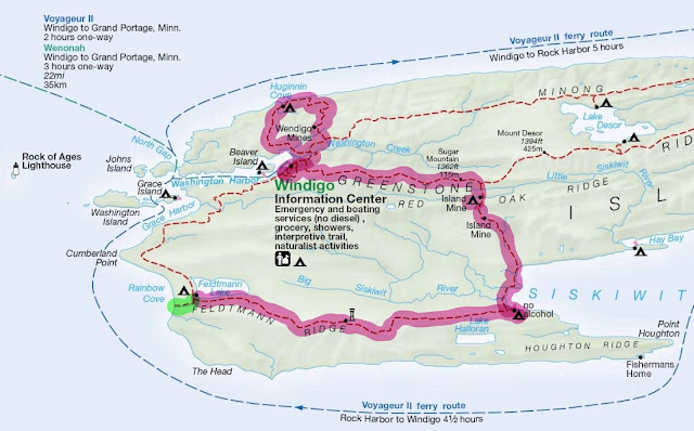
Last time: A magic waterfall on the way to Feldtmann Lake - Links to all of my trip logs

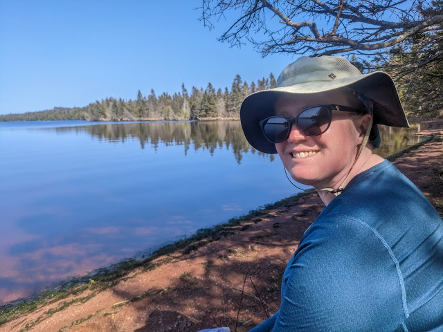
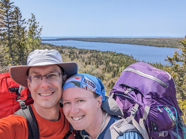
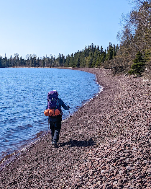
Enjoying the beach at Feldtmann Lake

Saturday May 27, 2023: The night was as warm as promised -- 40 degrees! -- and for the first time all trip I didn't wear a hat and puffy coat to bed. I still wore a thermal base layer and fleece, true, but who's counting?

When I woke up in the morning, I heard the same thing that I'd heard while going to sleep the night before: The distinctive thump-splish-splash of moose walking through shallow water. I crawled out of my tent and, sure enough, there were the same two young bulls, clomping back and forth along the beach. I walked along the campground trail (parallel to the beach) to watch them, when suddenly they came up into the campground and walked straight through site #2, whose occupant seemed to be completely asleep and unaware in his tent.

I excitedly told Sarah about this once she woke up. First we spared a thought for the three poor guys we'd met at Siskiwit Bay, who had complained that there were no moose at Feldtmann. They missed an entire moose parade by just one day!

But ever practical, Sarah's main question was: Has anybody packed up and left their site empty? Today was our self-imposed rest day, and any way to avoid spending it in the tiny, exposed site #3 would be good, even if it meant living in a moose highway. We took a look and found that the inhabitants of both sites #1 and #2 were now gone.
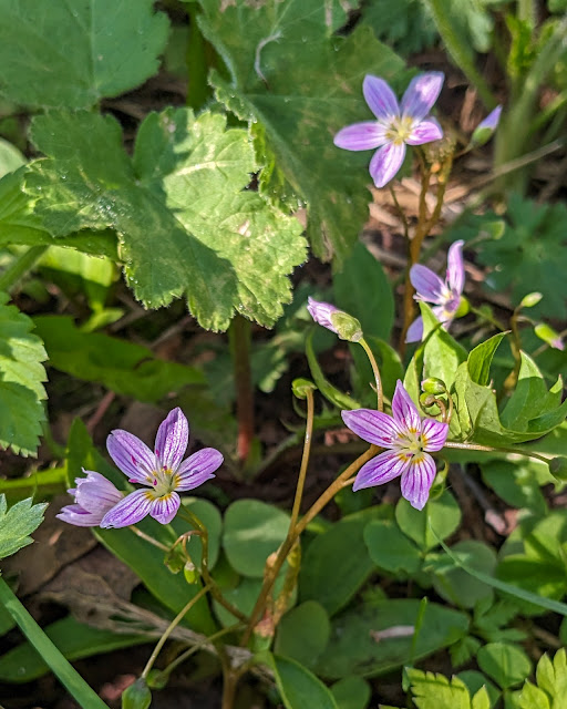
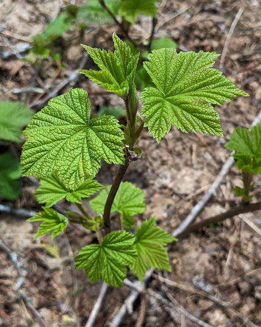
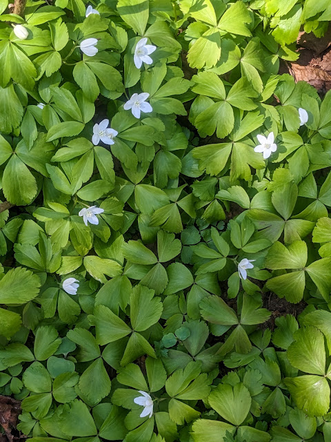
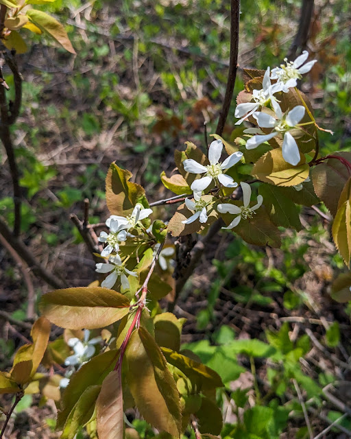
Wood Anemone

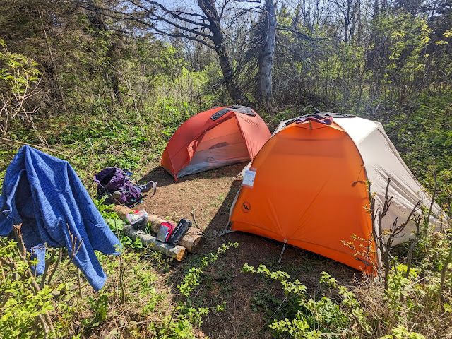
We decided to move in to site #2, which seemed all around nicer. So it was that our tents levitated down the path, one of us at each end. Ah, the advantages of a modern lightweight tent! The new site was shady, spacious, and right next to the lake -- everything that site #3 was not.

After all of that, we finally enjoyed breakfast while sitting on a driftwood bench near the beach. The lake was again lovely and calm in the morning light. There were now three moose feeding down by the lake's outlet.

The rest of our morning was uneventful: We hung some stinky hiking clothes to air out on a clothesline, lounged around doing some reading, and had a lunch of rice cakes and peanut butter.

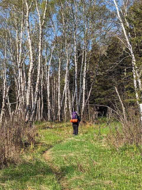
After lunch, we packed a daypack and headed down the trail to Rainbow Cove. We were promised that this short (0.8 mile) trail would lead us to the most amazing beach on Isle Royale -- a beautiful place of warm cobbles and amazing sunsets. We were just behind a large group who seemed to have some sort of very specific task that involved wandering off into the brush and measuring things.

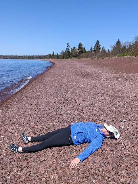
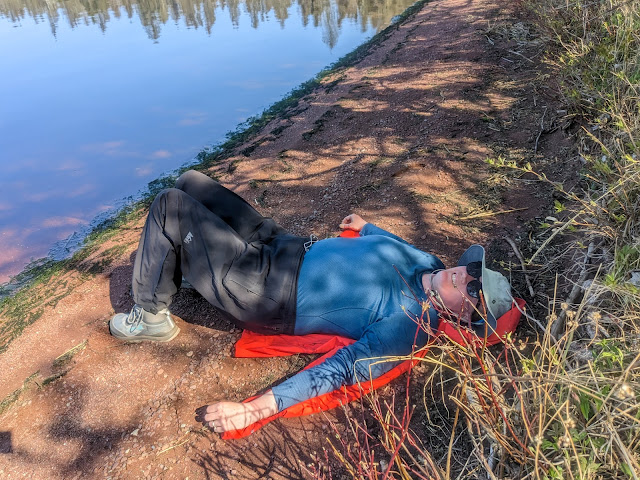
Rainbow Cove's beach, featuring a napping Sarah

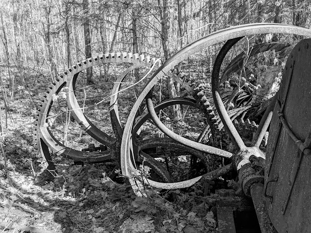
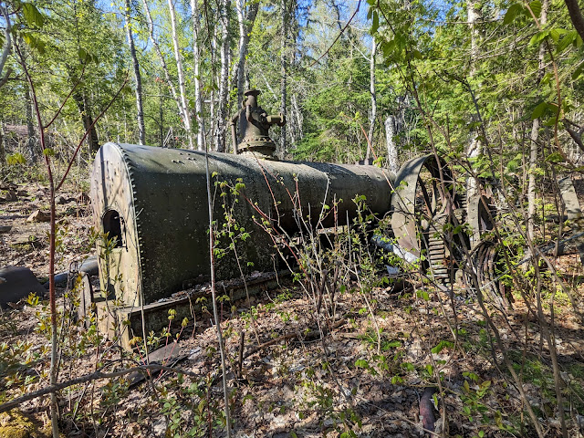
The trail headed gradually downhill, generally following Feldtmann Lake's outlet stream (which, as far as I know, has no name). Along the way, we passed through many odd openings in the trees. They reminded me a bit of old homestead clearings, and sure enough, at one point I saw an old cookstove hiding in the trees. It probably wasn't from farmers -- the west exposure would have been horrible in the winter -- but perhaps fishermen once lived here? I don't know for sure.

Soon we came out to Rainbow Cove itself. It was... familiar. Other hikers had set our expectations high, and indeed, it was a lovely place. But if you've ever been to Calumet Waterworks or Agate Beach or Great Sand Bay (in one of its rockier seasons) on the Keweenaw, then you have also seen Rainbow Cove. Even Carnelian Beach, which we'd hiked just two days earlier along Siskiwit Bay, was pretty much the same. It's a beautiful red cobble beach made from the conglomerate that is absolutely ubiquitous in the Copper Country.

So we were perhaps a bit underwhelmed. But the beach was gorgeous, the sky was perfectly clear and blue, and there was the greatest lake in the world -- Superior! -- lapping right at our feet. So who were we to complain?

Our first task was to filter some cold Lake Superior water for future use. This involved both of us wading into the lake as far as we could go, which was about ankle-deep. The water was probably 38 degrees at most, and even in the hot sun, it hurt. While the filter ran, we put on sun block -- a lot of it -- and sat on a piece of driftwood. Then we kept sitting there, basking in the sun and reading. As we did, another Moosewatch group (or the same one? I have no clue) came down the trail, walked down to the stream's outlet, crossed it, and then disappeared into the brush along the lakeshore.

After a while, I got up and walked down the beach myself. The stream's outlet was cold and fast-running, and I waded across to see what I could see. The answer: More beach. I waded back and found that Sarah had burrowed into the rocks down near the water.  The golf-ball-sized pebbles did a great job of conforming to her body. I tried it, and with a little wiggling and shuffling, the pleasantly warm rocks made a shallow form-fitting nest. I quickly had a small backrest set up and settled in to read. It was ideal: Warm sun and rocks, cool water just below our feet, beautiful views, and good books.

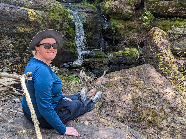
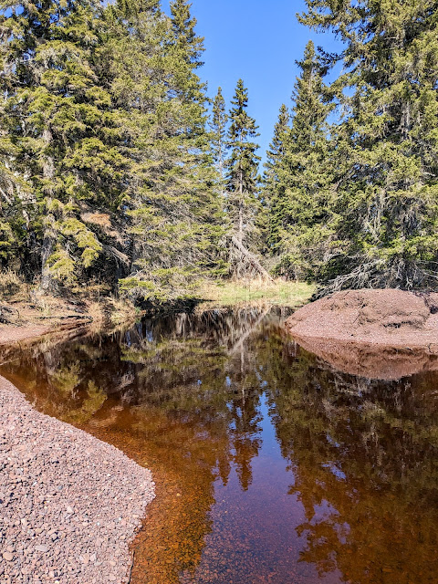
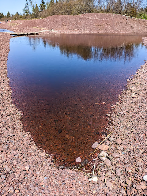
Feldtmann Lake's outlet stream at Rainbow Cove

The Rock of Ages lighthouse -- which we'd first seen from the Feldtmann Ridge lookout -- was visible in the far distance. A variety of boats came and went across the shallow cove, never stopping, always on their way to somewhere else. The seaplane crossed the sky in front of us, and we waved. Less than 15 minutes later, the plane returned heading the other way. We waved again.

We spent three or four hours on the beach, finally calling it quits when it started to feel like dinnertime. While we'd started out a bit skeptical, Rainbow Cove had proved to be just as fantastic as promised. But make sure you visit Calumet Waterworks too, just to give yourself a comparison.

Back at camp, we took advantage of a luxury. We had left our "pocket shower" sitting out -- basically a large black water bag that does a nice job of absorbing heat from the sun. It had worked well on this sunny day. We hung it up around a tree and used it to give our hands and faces a scrub.

That was all well and good, but from there things went downhill. For in our absence, the bros had arrived.

"The bros" was our name for a collection of guys -- it's always guys -- who had arrived and set up in several open sites. They may or may not have been hiking together or even knew each other prior to arriving at camp, but somehow (pheromones? secret signs?) they had found each other and were now inseparable. Their key characteristic was to have a loud and expert-level opinion of every possible topic. They were loud enough to be heard across the campground, but that wasn't necessary, because they had packed fishing rods and were walking up and down the beach (and through our campsite) sharing their thoughts along the way. Their opinions were vast and varied. Gear and pack weight were favorite topics, as were lure choices, GPS and navigation apps, the proper kind of water bottle... anything and everything. Each statement used profanity like it was punctuation. "It f-ing slaps!" was used as an exclamation point.

On the upside, at least they weren't fellow Michiganders. I know this because they loudly wondered where they could buy marijuana now that they had arrived in Michigan (where it is legal). The short answer: Not in a national park.

We distracted ourselves by enjoying a dinner of freeze-dried something. My notes say lasagna, but my brain has no record of this. It was calories, not much more.

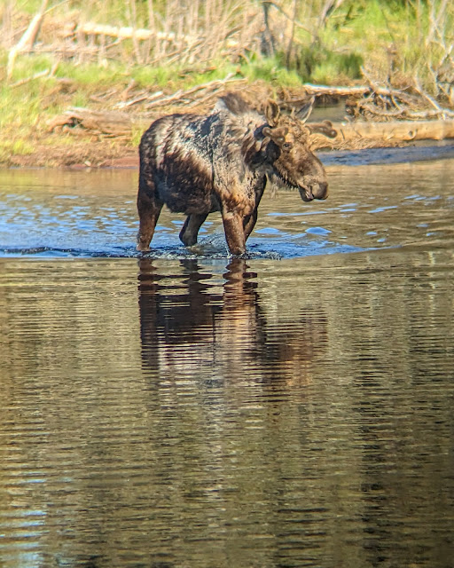
No, this is not fake. Yes, that is a real moose. Yes, that's the bench we were sitting at.

We enjoyed the not-so-quiet evening by reading while sitting on a driftwood bench between our site and the beach. This also gave the passive-aggressive message to please not walk through our campsite again. But soon both we and the bros had to move, because moose were coming. The two young bulls had decided they wanted to be on the other side of the lake, and got there by walking along the entire beach in front of the campground just as they had done this morning. This brought out the whole campground, cameras and all.

Sarah and I stood in our campsite and watched the young bulls walking not 10 feet away from us. Then they turned around and walked back... and forth... and back again, dunking their heads to find tasty morsels at the bottom of the lake.

I have been close to moose before, and they never fail to impress and terrify at the same time. They're just plain big, and it is much too easy to imagine what would happen if they suddenly decided that you were a problem to be dealt with.

The moose walked past so often that eventually it got a bit boring. Later, when they'd settled into one particular corner of the lake, I learned how to take a photo through a pair of binoculars:

Moose through binoculars

While much less exciting than moose, we also enjoyed a great deal of waterfowl drama that evening. Mergansers dove, the birds that went "meep" went "meep", and then a pair of geese started chasing away some uninvited guests, which involved an enormous amount of flapping and honking that echoed across the entire width of the lake.

Soon enough, our long, hard day of relaxing caught up with us. It was bedtime! We crawled into our tents, but alas, the bros had other ideas. They had set up on the beach in front of the next campsite, fishing and loudly discussing wilderness first aid or Netflix or something. Their penetrating voices and profane punctuation put any thought of sleep out of my mind. I gritted it out until 10 pm, when I finally crawled back out of my tent and walked down the beach. I did my best to kindly but firmly ask them to quiet down because people are trying to sleep and everyone can hear you! and they were so surprised that they actually did it.

Although it was now past 10 pm, the sun was merely low in the sky. As much as I would have loved to see the Milky Way in the perfectly clear night sky, I would have had to stay up until well past midnight. I didn't have it in me. I was out light a lightbulb once I got back into the tent.

Next time: Return of the Windigo - Links to all of my trip logs

Miles hiked: 1.6 (Rainbow Cove and back)

Total miles: 37.2


Saturday, July 22, 2023

Isle Royale 2023, Day 4: Siskiwit Bay to Feldtmann Lake

Last time: A campfire with friends


The Feldtmann Ridge, looking east

Friday May 26, 2023: Morning was sunny, bright, and -- you guessed it -- cold! We took our breakfast down to a waterfront picnic table, where we basked in the sun while covered in all of our puffiest layers.

The bay and air were filled with wildlife. A pair of trumpeter swans flew overhead, making their curiously brassy honks. Sandhill cranes circled with their spooky, echoing call. Mergansers paddled and dove. And, of course, seagulls screeched.

Beautiful morning at the Siskiwit Bay dock

Our original plan called for us to spend a rest day at Siskiwit Bay. It was a beautiful place, and I could have easily stayed put and enjoyed the scenery all day. But after talking it over, we decided to continue on to Feldtmann Lake campground and spend our extra day there. We were both feeling just fine currently, and moving along today would let us recover from our longest hike for an extra day. And among other things, Ken's description of Rainbow cove had enchanted both of us. Nonetheless, I decided that some trip soon, I would return and spend an extra day at Siskiwit Bay.

So we packed up quickly and set out on the trail. It was a big day: 10.3 miles along the Feldtmann ridge!

The old logging road

The start of the trail was extremely flat. It was yet another old road, this time a logging road, and the trail passed through flat woods that had been logged out (and burned!) a hundred years before. On the bright side, the trail was warmer and sunnier than the ridges above us, which meant that spring wildflowers were truly in bloom -- marsh marigolds, hepatica, and fields of spring beauties.

Nonetheless, the trail was so flat, straight, and without any views, that we lost track of time. I eventually checked my clock (aka phone) and discovered that we'd been marching for an hour with no apparent change in scenery.

We decided to stop and rest once per hour, to help pace ourselves on this long day. In our case, this meant picking a random point along the road where a fallen tree made a good bench.

Soon afterwards, the trail started to climb up the Feldtmann Ridge itself. It was a long, slow slog of a climb. Luckily, the trail crews had made it through here and cleaned up many fallen trees. Was Island Mine the only trail they hadn't touched?


Spring beauties

We were doing the Feldtmann loop "backwards" (clockwise), and so we had expected to meet many other people heading in the more traditional counterclockwise direction. But part way up the ridge, we met the only other people we would see on the trail all day. They were a young couple with fantastic Yooper accents. They warned us that Feldtmann campground was pretty full, with several large groups (Moosewatch?) staying for a long time. Oh, and there were indeed moose to watch: "They're all over the place! They walk right through the campground!" We wished them luck and let them know about the wonderfully flat trail ahead of them.

We made our second hourly stop at the top of the long uphill in a classic Copper Country bedrock glade. A ridge of gray volcanic rock formed the base of the clearing, with grasses popping out of the cracks. The rock was topped with puffy lichens, and the whole opening was surrounded with dense forest on every side.

We gratefully took off our packs and pulled out a snack of peanut-butter rice cakes. We gently laid down on the soft lichen. Sarah almost fell asleep.

It turned out that an even better stop was just ahead of us. Back on the trail, one more uphill brought us to  the real top of the ridge, which was bare and windy. Right in the middle were the footings of an old fire tower. The tower itself, built of wood, had collapsed off to the side of the trail.

Sarah at the Feldtmann Ridge fire tower

The next bump along the ridge brought us to the "new" Feldtmann fire tower, a massive steel construction in the middle of a huge bare stretch of ridge. This was our halfway point, so we decided to make an unscheduled stop. We dropped our packs again, climbed as high as we could go on the tower (it's closed at the very top, much like the Mt. Ojibway fire tower), and took so many photos.

The tower has a spectacular view in every direction: Back east, the direction we had come from, we could see Siskiwit Bay sparkling in the sun. Lake Halloran, which had been completely invisible from the trail, was visible from this height. To the south, the expanse of Lake Superior spread out all the way toward the horizon, where the Keweenaw was a barely visible outline. North, we could see ridges and swamps alternating in bands between bare deciduous trees and dark evergreens, heading upward to the huge rounded bulk of the Greenstone Ridge.

Finally, to the west, we could see the Feldtmann ridge stretching far into the distance. Feldtmann Lake itself was just a tiny slice of blue. We had a lot of walking left to do.

Looking back towards Siskiwit Bay

After even more photos, a snack of meat sticks, and another good long rest, we pulled our packs back up and continued west.

The ridge was topped with hundreds of stunted serviceberry bushes, currently blooming with their showy white flowers. The trail soon dropped down into the woods, where the wildflowers were out in profusion. We saw fields of spring beauties, a few hepatica, and even one very early devil's paintbrush!

An adventurous devil's paintbrush

One hour later, almost on the dot, the trail wound around a small outcrop of rock and we suddenly found ourselves facing a lovely waterfall. This small waterfall -- perhaps eight feet tall -- tumbled down a rocky wall and cut through a collection of mossy boulders. What a perfect place to stop and rest!

We climbed up on a boulder and enjoyed another snack. As we ate, I thought I could see a volunteer trail heading up the cliff face, so I got up to investigate. I'd never heard anyone mention this waterfall -- it probably was barely a trickle in the summer -- so who knew what other magic might be hiding down this side trail?

Sarah with the bonus waterfall

The side trail climbed on surprisingly well-maintained rock steps and turned to follow along a picturesque beaver pond. It went on for quite a while. I kept following, entranced by the bucolic scene, when I suddenly came to a section of boardwalk. They don't build those on volunteer trails! That's when I realized that I was actually on the main trail. Sure enough, back at the waterfall, the real trail made a short jog to cross the stream and then turned right up the rock "steps" I'd climbed.

Refreshed by this beautiful stop, we packed up and continued up the steps. The beaver pond was just as lovely on my second visit. Next we came to another stretch of open ridge. As with all Isle Royale ridges, it sloped gently to the south. This ridge was quite open, giving us lovely views over more ridges and down to Lake Superior. It dropped off steeply on the north side, where a single line of white pines stood at its crest. Their soft needles covered the path and gave off a gentle, pleasant scent as we passed.

By this point, we were both getting tired. Carrying 30 pound packs was wearing us out, and hauling them along the exposed ridges under the clear sunny skies was starting to make us sweat, despite the cool air.

All that was forgotten when we reached the end of the ridge, where several spectacular overlooks awaited us. Each overlook showed us a different view of Feldtmann Lake and its swampy lowlands, stretching out several hundred feet below us. Lake Superior sparkled in the distance, and we could even see a tiny white speck in the distance where the Rock of Ages lighthouse stood. We stood in awe. Then we took selfies.

Selfie high above Feldtmann Lake

Then, of course, we had to hike down off of the ridge. As any hiker knows, it's harder to go down a steep slope than up it. This one was especially nasty due to patches of bare gravel on some of the steeper bits. Our hiking poles continued to be our best friends.

The trail soon entered a flat deciduous forest, and eventually started following some sort of (apparently) man-made berm whose origins I never figured out. We parted ways again (rule 1!) with me going ahead to hopefully get a good campsite.

The bridge over the stream at Feldtman Lake's outlet was badly in need of repair. Shortly afterwards, I found the small sign that welcomes visitors to Feldtmann Lake campground. I made a quick pass through the campground, which has only tent sites, and found exactly one site open: Site #3.

This is the entirety of Site #3 at Feldtmann Lake

It was no mystery why site #3 was the only campsite left open. It was tiny, barely large enough for two small tents. It was totally exposed to the sun, with few shade trees anywhere near it. It was across the path from the lake, so there wasn't much of a view. And the kicker: It was right next to the outhouse. Other sites had many tents in them, including at least five at one, and four at another -- perhaps these were the Moosewatch groups that we'd heard about.

Sarah arrived shortly afterward and found me ornery and hot. We didn't have any choice except to set up here, so we did. We had to play Tetris with out tents in order to get both of them to fit.

On the upside, the site did have a short access path to the water. We went down and found Feldtmann Lake to be remarkably placid. The tiny sandy beach was damp, but we sat on our rain coats and cooled down a bit as our water filtered itself. The view was lovely: The perfectly flat surface of Feldtmann reflected the blue sky and the greening forest that crowded close in on every side.

Sarah resting along the shoreline

Feldtmann Lake is also home to even more waterfowl than Siskiwit Bay. Mergansers paddled around everywhere, diving and preening. A slightly different duck kept making such a strange sound that we started calling it "The duck that goes 'meep'". We later learned it was a Goldeneye, and the sound -- which for all the world sounds like it's coming straight out of the Muppet Show -- is part of its mating call.

The shady beach cooled us down, and the rest did our muscles good. The sun sank lower in the sky, reducing the heat and glare in our tiny campsite. We ate a dinner of bland freeze-dried beef stew, on the theory that after that many miles, we really couldn't care less what our food tasted like. It was acceptable. It was calories.

As we sat eating at the beach, I heard some distant splashing. Sure enough, two young bulls were walking out of the trees far down the shoreline -- our first moose of the trip! They waded far out into the lake, dunking their heads to eat water plants. We took turns watching through our field binoculars, and we noticed several groups of people in other campsites doing likewise. We also noticed that many of the waterfowl hurried over to hang around near the moose. Perhaps they were hoping to get a good meal from whatever the moose stirred up?


Serviceberry flowers (because I didn't photograph the moose -- wait until tomorrow!)

When the moose watching finally got a bit boring, we started to head for bed. That's when I remembered Dane's handy weather forecast from the previous day. I poked around in the app that connects to our Garmin, and discovered that ours would do the same thing -- at the cost of one "free" message. We decided it was worthwhile to spend one of those messages, and discovered that the night would be clear but much warmer, at a balmy 40 degrees!

We crawled in to bed, exhausted from the day. As I was laying down under my quilt, I heard the unmistakable sound of a moose splashing through water. It sounded like it was right in front of our campsite. Sure enough, when I stuck my head out of my tent, I could see one of the young bulls right in front of our site! It was followed shortly by the other one. I ran out to watch it wander down the beach, along with half of the rest of the campground.

After that, it was a bit hard to get to sleep. But it turns out that hiking well over 10 miles with a loaded pack beats the adrenaline of a double moose sighting, and we managed to get to sleep in the pleasantly non-frigid evening.

Next time: The magic of Rainbow Cove

Miles hiked: 10.3

Total miles: 35.6


Today's route in green, past days in pink


Wednesday, July 19, 2023

Isle Royale 2023, Day 3: Island Mine to Siskiwit Bay

Last time: The bare Greenstonelinks to all of my trip logs

Flywheels and gears at the old Island Mine site

Thursday May 25, 2023: It might be darkest just before the dawn, but it's coldest just after you crawl out from under your nice cozy quilt.

I awoke to the spooky, rattling call of a lone Sandhill Crane flying overhead. I poked my head out from under the quilt and nearly froze my eyeballsEventually I couldn't put it off any longer. Attired in every warm item I brought, I crawled out into the freezing world. Hot tea and oatmeal helped, but nothing warmed us up better than packing up, strapping on our packs, and hauling them up and down a few dozen hills.

Island Mine was a perfectly nice place, but today we were headed toward one of the island's gems: Siskiwit Bay campground.

We took the Island Mine trail south to get there. The trail goes across the island's "grain", which means that it goes up and then down ridge after ridge after ridge.

Unlike the other trails we'd been on so far, trail crews hadn't reached the Island Mine trail yet. Worse, there was a lot of work for a trail crew to do: It looked like a windstorm had swept right along the trail, felling tree after tree directly across the tread.

They were always at the perfect height, too: Too high to climb over, too low to stoop under while wearing a pack. It seemed like every tree had managed to fall across the trail on a steep hillside, so there was no way to walk around them. So instead we removed our backpacks, shoved them under the tree, and then belly-crawled after them. Wash, rinse, repeat.

The ghost of a leaf on a ridge

There were payoffs, however. The bare trees on top of the ridges allowed glimpses of a distant blue Lake Superior. The sunny south-facing slopes were sprouting more wildflowers than I'd seen so far. And soon, I came to one of the day's biggest treats for me: the Island Mine itself.

The first clue was a puncheon bridge across a surprisingly straight and V-shaped stream -- actually a trench, a sure sign of somebody searching for copper. Shortly afterward I saw rock piles sitting next to the trail. Sarah and I were walking together today, but here we implemented Rule 1 again: Hike your own hike! I yelled, "I'm going to explore this, go on ahead!" as I plunged into the woods.

The Island Mine was not successful, but it wasn't for a lack of trying. It was unsuccessful, well, for a lack of actual copper. They dug a lot of trenches and several shafts, a few of which were still visible as water-filled holes in the ground. They spread piles of "poor rock" (copper-free rock encountered while digging towards actual copper) all across their site. The sheer quantity of poor rock suggested just how little copper there was to find.

Most exciting for me was the old boiler. Often referred to as a "steam engine", it was quite similar to what you'd find at the front of an old railroad locomotive. The mine had hauled the massive iron boiler across miles of Isle Royale ridges in order to power everything at the mine site. They hadn't bothered to haul it back down again. I found it where it had been left, now nearly buried in the forest.

The old boiler

I spent a happy half-hour cavorting about the mine site, something I used to do quite often when I lived in the Copper Country. I probably could have spent several more hours there. I decided I would try to climb back up to explore more of the site later.

I passed an old rock-lined well that must have been used by the mine. Much farther down the trail, I met up with Sarah as she was enjoying a quick snack. The trail had turned onto the Island Mine's old road, leading straight down the ridges to the mine's dock at Siskiwit Bay. The road -- and hence the trail -- was remarkably straight and even. It even had ditching on both sides! The only time we had any trouble was when it crossed a roaring seasonal stream that had washed out its puncheon bridge.

My map showed the mine's cemetery nearby, but neither of us noticed any sign of it. We did meet the first other hikers of the day, a group coming up from Siskiwit. They sang its praises; we warned them of the downed trees to come. The road, er, trail next ran through a long swamp, but the excellent work of those road-building miners 150 years ago kept our feet dry.

Carnelian Beach, with Senter Point in the distance

The trail came to Lake Superior at Siskiwit Bay. Here the trail turned out onto Carnelian Beach, a red cobble beach very similar to many we knew and loved in the Keweenaw. Actually, the trail sometimes ran just a few feed inland from the beach, but it was often washed out, and the park's official advice is just to walk on the beach itself. It wasn't easy to walk on the ever-shifting cobbles with backpacks, but our hiking poles kept us balanced. The beautiful lake kept us distracted, too, with its deep blue color reflecting the sky.

Near the end of the beach, the trail cut inland again to cross Senter Point, an odd protrusion into the middle of Siskiwit Bay. In the middle of the point, another deadfall blocked us. As we were bushwhacking our way around the tree, we met the second group of the day. This one included our fellow flyer from the seaplane, who had met up with his group and was now completing the Feldtmann loop in the opposite direction from us. This group also sang the praises of Siskiwit Bay campground. They also told us that one of the two shelters was open, and we could likely snag it if we hurried!

That re-energized our steps, and we thanked them and quickly headed off. The trail popped back out onto a beach -- this time a more sandy one where our pace speeded up, although we had to slow down to cross several small streams. Then the trail cut inland yet again, this time on a boardwalk through a swamp filled with Marsh Marigolds, and took us onto a spectacular bridge over the Big Siskiwit River. The bridge had clearly been a major piece of construction: It had metal supports and pilings set deep into the river bottom. But ice had pushed it off-kilter in the years since its building, leading to a slightly crooked crossing.

The photo is straight; the bridge is not.

The trail took us back out to the beach by way of one last inconveniently fallen tree (right in the middle of a swamp!), and then back inland yet again, past the turnoff for the Feldtmann Ridge trail. The trail became a narrow pink line winding through an open grassy clearing and finally into Siskiwit Bay campground. Sure enough, Shelter #5 was open! We gratefully sat down at its picnic table and ate a snack.

Siskiwit Bay campground is a lovely place, perched on a hillside above the south side of the bay. The rock underlying the bay and campground is red conglomerate, lending its color to everything we saw: The beaches, the shallows of the bay, and even the trails themselves.

Shelter #5 was partly hidden by a small screen of evergreens, but by craning our necks we could get a decent view of the bay. As I later learned, we'd managed to end up in the same shelter where Nina of Black Coffee at Sunrise fame had once encountered a wolf. We had no such adventures, but we did have a wonderful time.

One of many streams we crossed while walking the beaches

Sarah decided to do laundry, defined as "going down to the dock, swishing clothes around in the water, and rubbing them a bit". I decided to stay on my feet and backtrack towards Senter Point, where I had heard rumors of the Island Mine's powderhouse hiding in its trees. A powderhouse is a stout stone structure with a flimsy roof where a mine would store its explosives. The idea was that if the explosives, well, exploded, then the force would be channeled upward and away from people rather than outward.

I packed a small daypack and backtracked across the Big Siskiwit river bridge, crawling under that dang fallen tree yet again. Once I was on the far side of Senter point, almost back to Carnelian beach, I headed off trail towards the body of the point itself. The walking was easier than I expected -- there were lots of small clearings, and evergreens generally kept brush under control. Sure enough, very soon the rocky walls of the old Island Mine powderhouse appeared through the trees.

Powderhouse walls

The building was enormous by powderhouse standards, and perched right on the shore of the point. Most powderhouses from successful mainland mines were much smaller, but perhaps Island Mine had to stockpile more explosives for long winter months isolated from the rest of the world. Its roof had long since fallen in, and the walls had started to collapse in a picturesque manner. At some point in the past, somebody had done some stabilizing work on the tops of the walls. The powderhouse was located quite near the shore, meaning that the miners probably took a boat across the bay to pick up explosives.

The building was beautiful but also felt like a melancholy reminder of how hard and unforgiving life was on Isle Royale. Island Mine put a lot of time, energy, and money into a wholly unsuccessful venture.

One more powderhouse view

I had intended to continue uphill, either to seek out the mine's old dock on the north side of the bay (and also off-trail), or to return to the mine site itself. Instead, I realized that I was completely bushed! I returned the way I'd come, pleased with a touch of exploration but also ready to rest. After my final crossing of the crooked bridge, I decided to try to climb over the inconveniently fallen tree, and instead managed to cover my pants and hands in sap.

Back at the campground, I found Sarah down on the dock, sitting at a picnic table in a stiff breeze, holding on to her slowly drying clothes. The wind was cold but the sun was warm, so I put on a coat and joined her. As we sat and squinted into the sun and wind, two paddlers came in from a trip around the bay and moved their packrafters up to Shelter #4. I was impressed at their ability to handle the lake on this windy, choppy day. They seemed uninterested in conversation as they began deflating their packrafts and packing up for whatever their next move would be.

We eventually decided that Sarah's clothes were as dry as they were going to get, and moved back up to the shelter. We ate a favorite freeze-dried meal for dinner -- Pad Thai -- and were just barely able to handle its spice. As we sat fanning our mouths, an early season hummingbird buzzed around us, undoubtedly looking for food that was not yet available.


The sun gets low over the Siskiwit Bay dock

After dinner, we took advantage of another feature of Siskiwit Bay campground: The community fire ring! Individual sites at Siskiwit don't have fire rings, unlike Island Mine campground, but Siskiwit does have one central fire ring down near the beach. We started by making a fussy pile of kindling, trying to put together just the right combination of dry items and collect twigs. Soon three fellows from one of the tent sites joined us. They took charge of starting the fire and got it roaring fast. I'd never seen such efficient fire-starting.

The rest of the long, wonderful northern evening was spent standing around the roaring fire, chatting with these three hikers. They turned out to be Brian, Ken, and Dane, all experienced backpackers. We told stories, laughed, and had a grand time. Brian and I in particular shared a great interest in exploring the UP and traded detailed stories about our experiences.

The three backpackers were traveling the Feldtmann Loop counterclockwise, the opposite direction from us. They had just come from Feldtmann Lake and reported that they hadn't seen a single moose yet. We commiserated -- we hadn't seen so much as a hint of a moose yet -- it was that much stranger because spring is often a great time to see moose and calves.

They also sang the praises of Rainbow Cove, a short dayhike away from Feldtmann Lake. Ken in particular couldn't say enough about its beauty, its smooth lake-rounded rocks, and the way that you could lay out on the cove's sun-warmed rocks to heat up after a cold day.

Sunset from Shelter #5

At one point, the inevitable topic came up: food. Whenever two or more backpackers gather, there shall be a discussion of what everyone wants to eat as soon as they're off the island. Ken and Brian shared a half-remembered story of eating burgers on a deck somewhere in downtown Houghton after a long-past Isle Royale trip. I realized that they were talking about the Downtowner, a classic Houghton hangout, and I immediately felt a great hankering for a greasy burger with onion rings. Sarah daydreamed of a cherry Coke. We vowed to go get exactly those things as soon as we were back on the mainland.

Dane had a satellite communicator (similar to our Garmin) with the ability to get a weather forecast. As the sun set lower, he showed us tonight's forecast: 35 degrees! The strong wind and the clearing sky promised that it would feel even colder.

A pleasant evening at the fire pit -- photo courtesy of Brian

After several wonderful hours, we finally put out the fire, said goodnight, and headed off to our separate sites. It had been a great way to end the day: meeting new friends, swapping stories, telling tales, and enjoying the cameraderie of hikers around a fire.

Bedtime was every bit as cold as the forecast had promised. Stars came out and shone sharply in the clear, cold sky.

Next time: A long hike to a lot of mooselinks to all of my trip logs

Miles hiked: 4.4 (Island Mine trail) + 2.6 (Senter Point dayhike) = 7.0

Total miles: 25.3

Today's route in green, past days in pink


Wednesday, July 12, 2023

Isle Royale 2023, Day 2: Windigo to Island Mine

Last time: A very long dayhike around the Huginnin Loop

Washington Harbor from the Windigo dock

Wednesday May 24, 2023: I awoke early in the morning in our shelter at Washington Harbor. I had a nasty headache -- too much hiking yesterday? A cold night? Not enough water? Why not all of the above?

I was fairly snug under my 0 degree quilt, but if I so much as poked my nose out, it started to hurt from the cold. I pulled back under and tried to go back to sleep. But I'd gone to bed when it started to get dark around 9 pm and slept for 10+ hours. Between that, the cold air, and the headache, more sleep wasn't in the books.

We got up, keeping all of our many layers on, and briefly sat at our heavily shaded picnic table. We quickly decided to walk to "downtown" Windigo where the sun was shining brightly on one of the docks. We sat at a picnic table and warmed in the sun, watching mergansers dive and an otter swim along the shore. Then we used the flush toilets, a grand benefit that we would give up for the next several days.

After warming up sufficiently, we went back to the shelter and made hot tea and breakfast (oatmeal), which mostly cleared up the headache. We packed up slowly and finally headed out around 10:30 am.

Today, our goal was the Island Mine campground. We'd get there via the legendary Greenstone Ridge trail.

White violets along the Greenstone Ridge trail

We started by heading in the same direction as yesterday's dayhike to Huginnin Cove, but instead turned onto the Greenstone, and quickly started climbing. We were clearly ascending a ridge, but not the kind of ridge you'll find on the east end of the island. The west end of Isle Royale saw more glaciation than the east end, and as a result the glaciers dropped more "till" here. The end result was that the ancient lava flows that form the many ridges of Isle Royale were covered with a deep layer of dirt and gravel, and then covered with trees. They're more like big forested hills.

The steep climb continued for a mile or so, and then leveled out into a remarkably wide and flat path. We paused, puffing from the uphill with full packs, and looked around. We could see for a long distance through the woods, and we were clearly on a high point, but there was no view to be had: We were surrounded by trees on top of a hill.

At this point, Sarah and I implemented Rule 1: Hike your own hike. We hiked at our own speeds, knowing that we would meet up again at Island Mine campground. The trails were remarkably clear. Very few trees were down, and were easy to walk around. There was no mud to speak of. It was easy, straightforward hiking along the top of a big rounded hill.

Greenstone "ridge" trail: Flat with a slight green haze

The trees covering the ridge were almost entirely deciduous, still mostly bare from winter. May is early spring on the island, and the trees here were just barely into the "green haze" that happens when the first tiny leaves start to appear.

While this end of the Greenstone Ridge Trail lacked the sweeping views of the east end, there was plenty to see if you looked closely. It was easy to see the pleasant shape of the land, including small rocky outcrops that would soon be hidden by underbrush. Tiny violets -- purple, yellow, and white -- were blooming along the sunny edges of the trail. Thimbleberries were putting out their first leaves. Curious fungus grew on logs and in the leaf litter.

And of course, there was the hardiest wildflower of the north: The Dandelion!

Seriously, these guys were blooming like mad

I eventually stopped to eat lunch -- a rice cake and meat stick -- while sitting on a nondescript log next to the trail. There was nowhere more interesting to stop. Sarah arrived just as I finished, and we chatted briefly before I continued on.

A curious fungus along the trail

I met several hikers along the way. The first few were solo hikers, all headed into Windigo, and who must have gotten an early start. One didn't even respond when I greeted him -- hiking with earbuds, I think. Soon a father and son pair overtook me, and also said little. After winding through the only bit of mud I'd seen all day and cresting Sugar Mountain (a mildly high spot on the trail), I met several more groups all standing together and chatting near the intersection with Island Mine trail. Most were heading farther east towards South Desor, while one older couple was heading back to Windigo from that very site. 

I talked with the older couple briefly and mentioned that I was heading toward Island Mine. They were heading back to Windigo, so I asked them to say hi to Sarah when they saw her. We parted ways and I turned south onto the Island Mine trail.

Later, at the campground, Sarah told me that she had met the older couple, and they had indeed greeted her and passed along my well-wishes. Then they had explained just how great it was that we were headed to South Desor, and how much we would enjoy it. She'd spent the rest of the hike wondering if she would even see me at Island Mine!

Very young thimbleberry leaves

The Island Mine trail was as different from the Greenstone as could be. It was basically a long, rocky, downhill stream, followed by a swampy area, and then a long, rocky, uphill through even more running water. I eventually gave up trying to avoid the water and just waded through it with my trail runners. 

I arrived at the Island Mine campground quickly. It's located on a low ridge in open woods, with a (different) small stream nearby for water. I've often heard complaints about Island Mine: It's the only campground not on a body of water, its water supply is unreliable, it's just a boring spot in the middle of the woods.

I can't disagree with any of those, but these things didn't bother me so much. This early in the season, there were reasonably good views of the nearby landscape of ridges and valleys. The sites were spacious. The stream was running well enough for me to easily fill up the 4 Liter dirty bag for our gravity filter. And there was one great advantage: Each site has a fire ring, something that almost no other foot-accessible island campgrounds have.

A trillium at our campsite, too early to blossom

Sarah soon arrived, relieved to clear up the misunderstanding about South Desor. We set up our tents, appreciating that the effort warmed us up a bit. It was a cool day, and the wind had become gusty and biting.

Our dinner was a proven winner: freeze-dried Fettucine Alfredo. Afterwards, we built a small fire in our fire pit and thoroughly enjoyed its heat. This early in the season, there was no shortage of extremely dry down wood, and we kept the fire going for quite a while as the sky darkened and the air grew even colder. We had more freeze-dried cookies and several rounds of hot tea to fight the chilly evening air. 

Sarah with the best fire ever

Several other groups came into the campground, and by nightfall, every site appeared to be full -- even the group sites.

The night was frigid -- again -- under a perfectly clear sky. I went to bed wearing a thermal baselayer, fleece, puffy jacket, long pants and a hat, and slept curled up under my 0 degree quilt.

Next time: Over, under, or around every tree

Miles hiked: 6.9

Total miles: 18.3

Today's route in green, past days in pink