Friday, May 31, 2024

Porkies Solo 2024, Day 1: Intro and Lake of the Clouds to Mirror Lake

This is the first of 5 posts about my solo backpacking trip to the Porcupine Mountains in May 2024. There's a link to the next one at the bottom of each post, or take a look at this list of all of my adventures.

Mackinac Bridge, floating in fog


You know how people tend to remember an event mainly by how it ends rather than how they feel throughout the event? In unrelated news, my May 2024 solo backpacking trip to the Porcupine Mountains was fantastic!

Last year, a friend of The Lovely Sarah went on sabbatical in Korea. Sarah's friend invited her to come visit, and Sarah embraced the opportunity with gusto. So it was that in late May, I dropped off Sarah at the airport and bade her goodbye for 10 days and the trip of a lifetime.

Sarah's trip covered our usual late-May spring backpacking trip time slot. What was I to do? I didn't think too hard: I planned a solo backpacking trip to my very favorite place in the world, the Porcupine Mountains.

This solo trip was a chance to hike the last major trail in the Porkies that I'd never before hiked: the Cross Trail. This trail is notorious for being barely maintained, not to mention that it goes straight through the middle of the Memenga Swamp. While I'm not a completionist, I was curious to see just how bad this trail was -- plus the ability to say that I've hiked the entire park did sound kind of nice.

As always, I would hike between rustic cabins, and I'd have a chance to try out some new cabins too (OK, maybe I am a bit of a completionist). The cabins are in high demand, so I wasn't able to reserve everything that I'd hoped for -- the Mirror Lake 8-bunk will have to wait for another day, which I guess is fair for a solo hiker -- but I was still able to put together a decent 5-day loop that would include the Cross Trail and one new cabin. I would also have a rest day at the mouth of the Big Carp river, one of my very favorite places in the park.

I didn't make any major changes to my tried and true packing list. I stuck with my now old-faithful lightweight trail running shoes, which do great in wet and muddy conditions. Likewise, I brought lots of rain gear and my zero degree quilt, expecting wet days and cold nights.

Speaking of wet and cold, the weather forecast for my trip settled into a nearly solid wall of rain:


Well, that's to be expected in the spring. Maybe I would get lucky and there'd be a few nice days... right?

Saturday May 18, 2024: A day after dropping Sarah off at the airport, I packed my own bags and headed north. I stopped at a scenic overlook just outside of St. Ignace to enjoy lunch in my car. From the overlook, the Mackinac Bridge seemed to be floating in fog.

While the air was cool at the Straits, the rest of the UP was in the middle of a heat wave. I turned on the AC as I headed west. But as I pulled up to the Super 8 in Houghton for the evening, a wall of thunderstorms rolled in just behind me, breaking the heat with a drenching downpour. Welcome to spring in the UP!

I managed to fit in a couple of short walks around town between downpours, enjoying the old familiar sights. I also grabbed a small pizza for dinner from the Studio, my favorite pizza place in the Keweenaw (which has now mysteriously merged with my favorite coffee place in the Keweenaw -- what a combo).

The Portage Lake Lift Bridge, between storms


Sunday May 19, 2024: The storms cleared out overnight, and I woke up to a sunny and cool morning. I grabbed adequate coffee from not-my-favorite coffee place, because it was open (while my favorite coffee place, again mysteriously, decided that opening at noon on Sunday was the right call).

I headed out of town on my way to another important food-related stop: the Bosio Biscuit Company, recently opened by an old college friend in Tapiola. If that location doesn't ring a bell, you can be excused -- it's a 4-corners in the middle of southern Houghton county, not on any of the main highways. It is, however, extremely worth the detour. I had a great but brief time catching up, and then took my biscuits and gravy to go. I ended up eating them at the Ontonagon Township Park, a lovely view of the lake with delicious food.

Maybe you can tell, but I was kind of stocking up on good food experiences in anticipation of a week of mushy oatmeal for breakfast, peanut butter and meat sticks for lunch, and freeze-dried dinners. I had packed one luxury -- a small can of beer -- to enjoy at some point.

That dread of camping food was also a symptom of a bigger cloud that hung over this trip. For some reason, I just wasn't excited about it. Oh, it had been fun to plan and prepare... but once I was actually on the road, I felt like dragging my feet. I just wasn't into it, and I wasn't sure why. Maybe the bad weather? The expectation of bugs and mud? The long, long drives, all alone without my favorite backpacking buddy? Regardless, I pushed on.

I arrived at the Porkies Visitor Center by about 11 am, checked in, and drove around to my starting trailhead at the Lake of the Clouds overlook. As soon as I set foot out of the car, bugs swarmed my face. None of them bit, but they wanted to be really, really close to my eyeballs. Gnats and non-biting flies seemed to be the main offenders. Luckily, I had packed my head net for exactly this reason, and I put it on posthaste.

View from the Big Carp River bridge looking towards Lake of the Clouds


With my 25 pound pack on my back, I first took a quick look over the overlook, then down the steep drop-off from the Escarpment towards North Mirror Lake. I met several groups on that steep descent and chatted with each of them, many of them expressing envy at my bug net. The biggest group, 6 high school or college-aged students, were resting at the very bottom of the trail before heading steeply up and out. We stopped to talk for a while, and their questions gave me a chance to put in a plug for Superior Wilderness Designs, who made my fantastic pack.

This was my first time hiking the North Mirror Lake trail north to south, although I'd done it many times in the other direction. After the steep 300 foot drop from the overlook, it regains nearly double that elevation as it heads up to the interior highlands. I took it slow and enjoyed familiar waypoints along this route, including the sunny and scenic bridge over the Big Carp river and the deep canyon carved by an entirely unnamed stream.

Canyon along the North Mirror Lake trail

As I slowly trudged upward, I met more hikers. I played leapfrog with two younger hikers who looked rather unprepared: Their shoes appeared to be brand new, they were wearing shorts and sweaters (?!) and had no bug nets at all. One time when I passed them, I stopped to chat and gauge whether they were OK. They were, so I headed onwards trusting that they could make their own decisions. Later, I met two bug-net-covered hikers taking a break next to the trail. One of them -- if I understood right -- was going all the way up to the overlook to "bring back" another group, which would be quite a serious round trip.

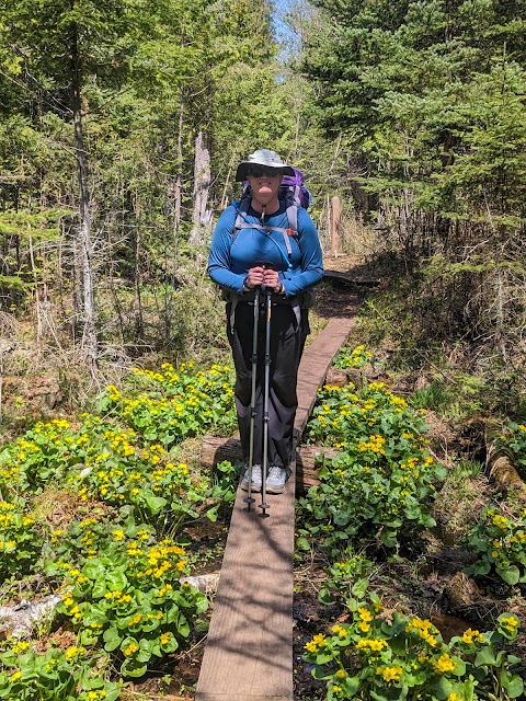
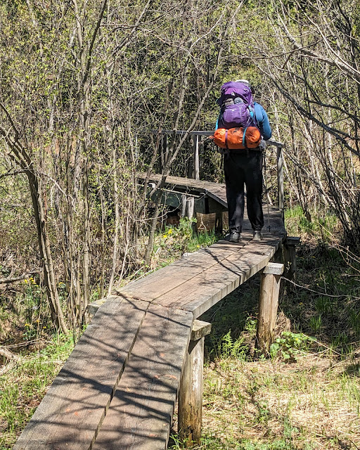
Once I had topped out, the trail got muddy, although it was far from bad. I trudged through the middle of it all in my lightweight trail runners, using hiking poles to keep my balance in the slippery puddles. It looked like I had missed out on the best of the spring wildflowers, but a few showed up in this wet section. Even better, just outside of Mirror Lake, the North Mirror Lake trail crosses a swamp on a long boardwalk. This swamp is beautiful and filled with wildflowers in every season, and this year didn't disappoint.

Spring Beauties


I made my way over Trail Creek, past the 8 and 4 bunk cabins, beyond the turnoff to the Correction Line trail, and down the spur to the Mirror Lake 2-bunk cabin. Sarah and I had stayed here twice before. It is a curious cabin -- originally a very small ranger cabin, later expanded by adding a second room that now holds the woodstove, table, and wood bin. It's quite a ways away from the lake in a quiet and isolated setting.

I appreciated that the cabin provided protection from the bugs, but I soon discovered that was mainly because all of the gnats and flies that had made it into the cabin were beating against one sunny window, trying to get out. At least they weren't bugging me -- and the cabin came supplied with a flyswatter!

Once I got in and unpacked, I did the essential first steps of camping: I filtered some water from Trail Creek, and hauled in some firewood. While the forecast for tonight was fairly warm (50 degrees), it's always smart to stock up.


Inside the Mirror Lake two-room, er, two-bunk


After that, I did a bit of wandering up and down the shoreline, checked out the bridge over the Little Carp River, and generally paced restlessly. I continued to feel strange, even a bit depressed. I wasn't eager to do anything interesting like taking a dayhike or exploring the lakeshore, but I felt like I would be missing out if I hid in my cabin. The cabin came with a canoe, but I felt uncomfortable taking it out on the lake alone. In the end, I decided that staying in the cabin was better than battling the bugs outside, so I went back inside, still feeling unhappy with my choices.

One joy of cabin camping in the Porkies is the log book found in each cabin. The Mirror Lake 2-bunk had two log books, which usually means one full older one and one newer one -- so, lots to read. I hopefully opened one up, only to discover that it has just a few entries from the end of 2023. The other one was brand new and completely empty. So much for good reading!

I laid down on a bunk and tried reading on my Kindle instead. I might even have had a short nap, always a sure sign that something's not quite right with me. When I woke up -- or came back from a reverie, or whatever -- I felt refreshed and actually eager to get out and see the lake. I guess sometimes taking a nap is just what the doctor ordered.

I convinced myself that I could handle taking the canoe out into the lake. Sarah and I had managed the canoe together a few years ago, so why not now? Plus, the wind was light and I was feeling good. I sorted through the huge number of PFDs in the cabin until I found one that fit me (it looked like it was about as old as I am), grabbed two paddles (in case I lost one -- I do have a realistic assessment of my canoe abilities), and headed down to the lakeshore. I turned the canoe over, shoved it out into the shallow water, and jumped aboard. I was on an adventure!

In the canoe, during a calm moment


The trip began slow and easy. The canoe only had bow and stern seats, nothing in the middle, so I could only sit in the back. I slowly made my way clockwise along the shore, in front of the other two cabins and several campsites. I poked around in some weedbeds and got to the Little Carp River's inlet, crossed it, and headed towards "the rock", a large shoreline outcropping that seemed to grow straight out of the lake directly across from the cabins. I saw a bald eagle and a pair of swans touring the lake.

I started to feel the breeze gust up a bit, which prompted me to turn around and return home rather than continuing along the (long, wiggly) shoreline. That's when I realized that the gentle, helpful wind had been at my back the entire time, and now it was getting stronger. The trip back into the wind was... not easy. I was basically paddling straight into the wind, and with only one paddler in the canoe I had to work double time just to make progress. Not to mention that the wind tended to push me to one side or the other, and I am very much an amateur at steering a canoe. I ended up nose-first in a weed bed, side-swiping the shore, nearly running into fallen trees, and even turning around backwards. I seriously considered dragging the canoe up on shore and bushwhacking my way back to the cabin. I eventually got into a rhythm -- a fast rhythm -- and made some progress directly into the wind. Once I got into the shelter of the far shore, I finally felt like I was actually going to make it. I rammed the canoe into the muddy launch area, staggered out, and nearly fell over. I hadn't realized how much I'd been using not just my arms, but also my legs and abs, just to give myself leverage with the paddle!

With that, my adventures for the day were done. I stumbled back to the cabin and flopped down on a bench, ready for dinner and sleep. Dinner was a new freeze dried meal that I'd packed as a test, single-serving Good-to-Go Thai Curry. That will also be the last time I ever eat that particular meal. My notes simply say "too many brassicas". It was packed with limp, brown broccoli and questionable cauliflower, and not much else. It did however contain a lot of calories, and that's what I needed at the moment.

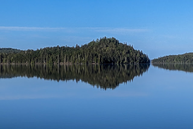
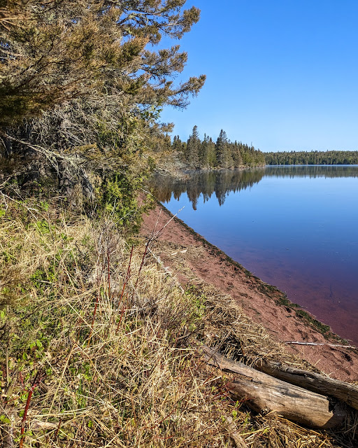
Mirror Lake, living up to its name


After processing those calories with a bit of rest, I took one last trip down to the lake -- still wearing my bug net -- and found that the wind had died down and let the lake truly live up to its name. As I stood enjoying the view, I heard a barred owl vigorously hooting from the woods. I was a bit sad that there were no loons yet -- I love their calls -- but it was probably too early for them to have returned.

I finally returned to the cabin for good, climbed under my quilt, and spent several hours reading in bed. As I did, occasional rain showers moved in and started making loud noise on the cabin's metal roof. I eventually slept but only fitfully, as I kept hearing many small critters going about their business outside the cabin.


Miles hiked: 5.0 (4 miles on the trail + 1 mile getting water and wandering)
Total miles: 

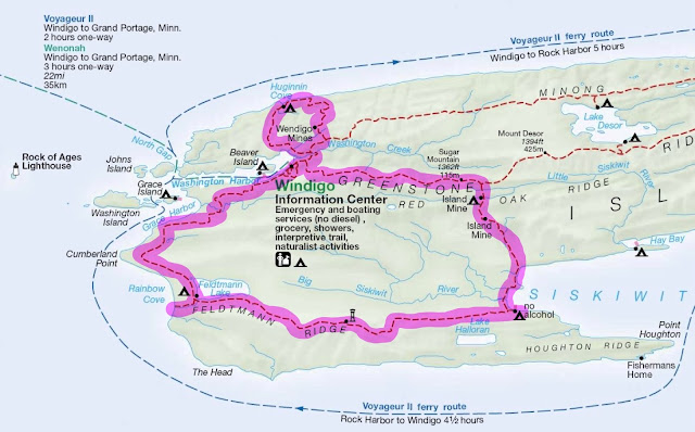
Today's route in pink. Don't trust the distances on the map, they're detached from reality.

Wednesday, September 6, 2023

Porcupine Mountains July 2023

Buckshot landing after sunset

The Porcupine Mountains are my first backpacking love. I keep going back, year after year, trip after trip, covering new trails, staying at new cabins, yet also finding new ways to appreciate old favorites.

In 2023, The Lovely Sarah and I started our summer with a grand May backpacking trip to Isle Royale. While we didn't have quite so much time at the end of summer, we did want to get away to the UP again. We decided on a short, easy cabin camping trip in the Porcupine Mountains.

This trip wouldn't be a hardcore backpacking adventure. It was very much meant to be "slackpacking" for 5 days and 4 nights. As usual, the rustic cabins we stayed in were part of the charm: no running water, no electricity, but a roof over our heads to keep us dry and away from the bugs. We were lucky enough to reserve one new cabin -- the recently added Cotten cabin -- and two old favorites, Lake of the Clouds and Buckshot cabins. I had visited the Lake of the Clouds cabin once back on a solo trip in 2021 and sang its praises. Sarah and I had stayed in Buckshot as our very first Porkies cabin in 2014 and loved it, but hadn't returned since.

Wildflowers on Lake Superior's shore

Summer was, as always, filled with other commitments. After making our camping reservations (in February, 6 months before our dates -- the earliest possible reservations!), the rest of our lives took over and our Porkies plans fell to the wayside. Our gear was fully tuned up from our Isle Royale trip, so we didn't need to think about much. Right?

Just a few days before our planned departure, we took a closer look at the calendar. Wait, were we really planning to drive all 9 hours from Grand Rapids up to the Porkies, get there early enough to check in at the Visitor Center, drive all the way around the park, and hike in to our first cabin, all in one day? That didn't seem good.

So I started to look for a hotel in Marquette, a good waypoint and one of our favorite UP cities, for the night before our arrival in the Porkies. As it turned out, finding a reasonably priced hotel room for a Saturday night at the peak of summer in the UP's largest city was, well, impossible. We eventually looked farther afield and found a decent room at the Super 8 in Houghton. We would need to drive farther, but at least we'd be closer to the Porkies for the next day (and spend time in another wonderful UP city).

Our packs were far from light. Being a "slackpacking" trip didn't mean leaving the packs behind, rather, it meant bringing all of our luxuries and doing very little hiking. In addition to bringing all of the usual essentials, plus my Serious Camera (3 extra pounds), we also packed hammocks (1 pound each) and tiny foldable camping chairs (another 1 pound each). One of our biggest backpacking complaints is that there's never anywhere to rest your back, and we wanted to give these chairs a good shakedown before using them on a serious camping trip. In the end, our packs were nearly as heavy as they were for our 7 day, cold-season Isle Royale trip. We just wouldn't be hiking nearly as far with them -- a grand planned total of about 9 miles.

There used to be a giant parking deck here

Saturday July 29, 2023: Thus it was with heavy packs but light hearts that we headed north. After a long drive -- made longer by a massive backup on the Mackinac Bridge -- we arrived in Houghton for the night. Nothing beats a beautiful evening in the north, so we ate dinner at a picnic table in Houghton's waterfront park. We each got food from favorite places: Sarah from Sky Sushi, which more than one person has sworn is the best sushi they've ever had (!?), me from Studio Pizza.

After the meal was done and we were simply lounging around, I suddenly realized something. Houghton's infamous and ugly waterfront parking deck was gone! I knew it had been demolished, but despite sitting next to its former site for half an hour, I simply hadn't noticed. The waterfront looked and felt... normal. Nice work, Houghton.

Sunday July 30, 2023: We woke up in our wholly adequate hotel room and walked to Cyberia, a long-established Houghton coffee shop that I hadn't been in for years. I was amazed to realize that they were charging the same prices for coffee as we'd pay in the middle of Grand Rapids! Nonetheless, we paid, because, well, it was coffee. We ate lunch at Gino's in Hancock, which was brand new to both of us -- we chose it for its nice patio on this lovely and sunny day. After a nice lunch, we headed south to the Porkies.

The Visitor Center's driveway and parking lot were under construction, so we detoured to the temporary Visitor Center -- the Porkies Ski Chalet -- and quickly and easily checked in. From there, we had to drive nearly the entire way around the border of the park -- about 25 miles -- to get to Speakers trailhead.

The many potholed gravel patches on South Boundary Road made the drive around the park on South Boundary Road more interesting than usual. It looked like many culverts had been repaired, but the road had not been repaved. We hit the first pothole hard, and then took much of the rest of the road at about 20 miles per hour.

We pulled in to Speakers trailhead and grabbed our heavy packs. We were off, down Speakers trail, but not to Speakers -- also a favorite cabin -- but rather to the newly purchased Cotten cabin, just a little way down the shoreline and along a very short and flat trail. Indeed, it turned out that this trail used to be a driveway -- for cars!

Cotten cabin from the shore. Garage on the left, sauna building between them.


Cotten 8-bunk cabin is truly deluxe. Staying at it risks becoming glamping. The cabin was built by the owners of a small parcel of private land within the Porkies, and in the last few years the park was able to acquire that land and the cabin on it. As a result, the cabin is vastly different from other Porkies cabins. For one thing, it has a bunch of buildings in addition to the cabin: A garage (locked), an outhouse, a wood shed, and a sauna (open!). The cabin itself seems to have been hand built, with great care. It has three rooms, something unheard of in most Porkies cabins: A large kitchen-living room combo with a "breakfast bar", futon, and Adirondack chairs around a wood stove; a bunk room with four small bunks, and a second bedroom with a single larger bed. A curious box next to the wood stove turned out to be a battery attached to a solar panel on the roof, with a USB charging port installed in the front. The log book claimed that it was broken, but it successfully charged my camera (aka phone) once I pushed a tiny, nearly invisible button to activate the charger. What luxury!

Chairs, wood stove, and an end table (!) in Cotten cabin.


There's also a front porch featuring a couple of benches, two picnic tables, and a lovely stretch of beach, where we quickly set up our camping chairs. The lake bluff was much lower than at the nearby Speakers cabin, making it easier to get down to the beach. Speakers was just across a tall ridge, but there was a lot of shoreline erosion that made it dodgy at best to walk in that direction.

The lake was stirred up and choppy. Sarah, like the fish she is, decided that the lake was more than calm enough to go swimming. She convinced me to give it a try too, and I waded in as far as my knees before deciding that I'd had enough. Lake Superior, even in late July, is not warm. We did find a large "sitting rock" that let us enjoy the sun for a while, but eventually we went back to our camp chairs.

We dried out while reading, and then had a freeze-dried dinner -- Chana Masala, a new and slightly too spicy option for us. Not long after that, we went to bed with the sound of the waves lulling us to sleep.

Today's distance: 1 mile

Camp chair on the beach of Cotten cabin

Monday July 31, 2023: I woke up at 9:30 am, after something like 10 hours of sleep. Sarah stayed asleep even longer than me. We must have needed this vacation!

I started my morning with tea down at a picnic table near the beach, next to the now-calm lake. When Sarah joined me, we enjoyed breakfast (our usual: instant oatmeal) and even more tea. Then Sarah went for her second swim of the trip, although I decided not to join her this time.

We took our time reading, enjoying the view, and slowly packing up. We finally left around 1 pm, walking 1 mile down the extremely flat and easy trail back to our car. Cotten was a spectacular cabin in a beautiful setting. It would also be a lot roomier for larger groups compared to Speakers cabin. We will definitely be back.

We drove all the way back around the park, watching out for gravel patches and potholes, and then turned left on M-107. Our goal was Lake of the Clouds, but along the way we passed the Porcupine Mountains Outpost, a touristy shop filled with snacks and t-shirts. Of course we immediately pulled in and purchased ice cream cones (a waffle cone for me!), and sat outside enjoying them. This was super-duper slackpacking. The day was warming up considerably, and the cool ice cream was a great treat.

Wild daisies near Cotten cabin


We continued to Lake of the Clouds, where we ended up in a small traffic jam at the entrance booth. The employee manning the booth must have loved to chat with tourists, because we could see him doing exactly that, at great length and with much gesturing. I suppose it's a good thing that the person who probably meets the most people in the park also happens to like talking with them.

We passed through quickly -- no questions, no need for a map, thanks! -- and drove up to the parking lot. The Lake of the Clouds overlook was busy with tourists, many of them seemingly annoyed at having to walk 100 yards on paved trails to enjoy the spectacular view. We enjoyed the view ourselves, then headed back to the car to prepare for our hike down to our next cabin, the well-named Lake of the Clouds cabin.

That's when Sarah noticed a missing wheel cover. It had undoubtedly gone flying off at one of those pothole-ridden gravel patches. It's an annoyingly expensive part, and it was still fairly early in the afternoon, so we decided to go drive to the worst of the potholes and look for the wheel cover. Back in the car, back down M-107, turn right, follow South Boundary Road... I jumped out of the car and waded through the grassy shoulder as Sarah slowly continued along. Nothing. We checked two more bad spots with equal luck.

After that, it was either driving another 20 miles checking out every single pothole, or give up. We gave up (and decided not to replace the wheel cover). Sarah eventually pulled in to the Nonesuch Mine parking lot to turn around. This mine site is unmarked from the road, but has all sorts of interesting history and geology down an easy trail. As long as we were there, we decided to look around. We hiked in through the mine's old townsite (now a grassy field), past ruins from the mine's many (always unsuccessful) incarnations, and stopped at the Little Iron River and its many small waterfalls. It was an enjoyable detour, all thanks to a missing wheel cover.

Ruin at Nonesuch mine


We drove back to Lake of the Clouds (and past the talkative park employee), parked, and hitched on our backpacks. This time we groaned as we hiked uphill on the nicely paved trails, because we then immediately had to hike down off the Escarpment, losing 300 feet in elevation extremely quickly until we bottomed out near Lake of the Clouds. As we hiked down, somewhere close by a tree crashed to the ground, echoing through the forest. That gave us pause, and made us even more grateful for the cabin we were about to be in.

At the start of the spur trail to the cabin, the normal sign explaining that there's a cabin ahead had been rigged up with an "Occupied" sign. It gave us pause for a moment, until we realized that it must have been left there by the previous renters -- we were tonight's renters!

Sarah with the "Occupied" sign


The Lake of the Clouds cabin is -- as it was at my last (solo) visit -- beautiful. It has a lot of fancy features, such as a ceiling (it helps the cabin warm up faster in shoulder seasons!), a set of steps for accessing the upper bunks, and a collection of topographic and fishing maps. Once our packs were off, Sarah quickly set up her hammock and laid back for an afternoon of reading. I sat in my camp chair, paging through the log book. Many entries complained about people "accidentally" coming down the access trail, clearly to peek at the cabin, or even just to access the lake. A recent pair of renters had made and attached the "Occupied" sign, and it was working wonders. We had no "accidental" visitors at all.

Out on the lake, a family of trumpeter swans toured around -- perhaps the same parents that I'd seen in 2021. There were enough bugs to warrant some bug spray, but not enough to chase us inside, and so we whiled away several hours reading and enjoying the serene setting.

Dinner was freeze-dried lasagna, always good. We sat back outside for a while, until the serenity was shattered by the shouts of a noisy group of campers carried across the lake. This drove us inside and in to bed, at which point Sarah's inflatable pillow popped and couldn't be repaired. She ended up laying her head on a rolled-up pile of clothes. It was an odd end to an odd, but generally good, day.

Today's distance: 3.5 miles (1 mile from Cotten, 1.5 miles at Nonesuch, 1 mile down to Lake of the Clouds)
Total distance: 4.5 miles

Sarah's hammock at Lake of the Clouds


Tuesday August 1, 2023: The morning was hazy and smelled slightly of smoke from Canadian wildfires, the story of the summer of 2023.

The Lake of the Clouds cabin comes with both a rowboat and a canoe. Actually, two canoes, as the logbook reported somebody hauling one out of the weeds near the end of the lake -- I wish I knew the story there. The oars and oarlocks on the rowboat were both completely borked. The rescued canoe was leaky. That left the other canoe, and the logbook promised that a snake lived in it. I turned over the canoe, and sure enough, zip! went a tiny snakey tail, hiding inside one of the enclosed ends of the canoe. Not surprisingly, no amount of shaking and banging on the sides made it come out. Sarah promised me that if that snake emerged while we were in the middle of the lake, we would not remain upright long enough to get back to shore. So, no boating for us.

Instead we laid back and read some more, Sarah in a hammock, me in a camp chair. We were doing a lot of sitting and reading on this trip, and it was wonderful.

Lake of the Clouds cabin with snaky canoe (front) and leaky canoe (back).


In the early afternoon, we packed up and headed back out to our next cabin. The climb up to the Escarpment was invigorating as always. Based on advice in the log book, we followed an unmarked (but very well established) "shortcut" trail that cut off the Lake of the Clouds lookout, avoiding a bunch of elevation gain and many annoying tourists.

We again stopped at the Outpost, where we again acquired ice cream cones ("We just got waffle cones back!" said the person serving me my second waffle cone from this very location in as many days). We discovered that the Outpost had wifi, so we sat at a picnic table and checked in with our phones, ruining the mellow disconnection of the past few days. Sure enough, multiple things were on fire in my professional world, and we ended up spending half an hour sitting there as I tried to straighten things out. At least there was ice cream.

When the smoke was finally clearing, we were more than ready to head back into the woods. Our next stop was Buckshot cabin, which was the very first Porkies cabin we stayed in (back in 2014) but had never revisited. To get there, we expected to have to park at Lake of the Clouds and hike half of a mile downhill to the Lake Superior Trailhead. So, we drove back to Lake of the Clouds, noticing some cars parked along the shoulder near the trailhead as we did so. At the booth, we asked the chatty employee about this and learned that it was completely OK to park along the shoulder of M-107 overnight at the Lake Superior Trailhead. We turned around and did exactly that.

Just a few of the rocks on the Lake Superior trail.


We also had not been back on this particular stretch of the Lake Superior Trail since 2014. I remembered the beginning -- a flat trail in a beautiful Hemlock forest -- and the long, slow downhill that followed it. But then suddenly the trail turned to pure rocks. Somehow I did not recall this unpleasant change at all. The trail was essentially following the back side of the Escarpment, exposing angled and jagged slabs of reddish sandstone that tended to shatter into pointy plates and large cobbles. It was hard to find, much less keep, our footing in many places.

Sarah, on the other hand, totally recalled the rocks but was surprised by the downhill. We relied heavily on our hiking poles this time -- something we hadn't had at all last time -- and made slow progress over the tilted bedrock, beach cobbles, and occasional washouts.

We started to encounter a few ripe thimbleberries along the trail, the first of the trip, and took every chance to stop and enjoy them. We also passed a campsite part way up the hillside -- LS-19 -- where a backpacker was packing up and heading out. We stopped to chat, and he made it clear that the site was unpleasant, buggy, had no view, and that he was getting out of Dodge rather than staying at it.

We finally made it to the bottom of the hill, much more tired than we should have been, and quickly found Buckshot cabin. My recollection here, at least, was accurate: Buckshot is a beautiful cabin. Its interior is nicely finished with lovely pine paneling, very similar to Lake of the Clouds cabin. Also like Lake of the Clouds, its big banks of windows provide a lot of light. And better yet, it is just steps from the Greatest Lake. But it's not quite as close to the lake as I remembered, nor does it have much of a view. When I was last here, in June 2014, the area between the cabin and lake shore was mostly low-growing ferns that allowed us a decent view. In the years since then, those ferns had been overtaken by shoulder-high thimbleberry bushes and other high brush that completely surrounded the cabin. This made it nicely private, but also eliminated any views of the lake.

Buckshot cabin, mostly surrounded by brush


We unpacked quickly and took our chairs down to the lake shore to continue our trend of high-quality sitting-and-reading time. We pushed through the thimbleberries on a narrow path to the shore. The shore in this area is made of huge slabs of angled bedrock, clearly related to the rock that made up the trail above it, so we had to wedge smaller rocks under the feet of our chairs to keep them level. As we sat, a bald eagle flew above us, then landed on an outcrop of bedrock farther down the shore and stood for a while, looking majestic and such.

Eventually, Sarah decided that it was time for her daily swim in Lake Superior. The lake was calm and I was still hot from the rough hike, so I joined her as well. Walking into the lake was a real trick: The sloping bedrock formed many underwater dips and divots, and its smooth surface was slick with algae. Nonetheless, the swim was wonderful. We splashed around in the water, friction-scrubbed our faces clean, and generally felt cleaner and cooler than we had in a few days.

Sarah stayed out in the lake to float and enjoy life, while I went back up to the "beach". I pulled out a can of hard cider that we'd backpacked in from the car, rigged it up to a cord attached to a small tree, and set it in Lake Superior to cool. Then I sat back in my chair to read the logbook, which included an epic (and possibly even true) multi-page story about rangers in a boat rescuing a camper in distress.

Sunset from Buckshot landing

Once Sarah had gotten out from the lake, we made dinner (Fettucine Alfredo, always a favorite) and enjoyed it with the Lake Superior-cooled cider. We went back out to the shore to enjoy the best sunset of the trip.

After dark, we curled up in our bunks to read. I was feeling strangely melancholy -- the end of summer, maybe, or the shock of reconnecting to civilization and finding so many work-related problems -- so we figured out how to curl up together in one of the bunks. This was a nontrivial challenge, but it helped, as did the quiet and pleasant setting. But as we talked, a problem came up: What is the weather going to be like over the next few days? It was growing hot and humid, and felt like storms could be possible.

Our satellite communicator has a weather feature, so we checked it out. Sure enough, it predicted thunderstorms in the morning, with more possible later in the day. We were planning to stay at Buckshot for an extra full day, so that wasn't necessarily a problem. Nonetheless, both of us were tired out from the surprisingly difficult hike, and the possibility of having to hike out in hot, humid, and wet conditions after a storm -- or worse yet, in a storm -- didn't sound great. We discussed some contingency plans, including leaving early if the rain appeared later in the day instead.

But for now, we settled in to sleep. The cabin log book had said nothing about mice, but I could hear them chewing away at the door as I fell asleep. Indeed, in the morning, we could seen bits of mousy debris around the outside of the door.

Today's distance: 3.2 miles (1 mile up from Lake of the Clouds, 2.2 miles down to Buckshot)
Total distance: 7.7 miles

Asters growing in a crack in the lakeshore bedrock


Friday August 2, 2023: We woke up to find... no rain whatsoever. No storms had happened overnight, and nothing appeared in the sky.

We checked the weather forecast again, and discovered that the storms had moved to early tomorrow morning -- our departure day. We looked at each other, thinking about hiking up that steep, rocky, slick hill in the rain, and agreed: We would leave today.

But, not immediately. After all, leaving a day early gave us a lot of wiggle room, and we were currently hanging out in a beautiful cabin on Lake Superior's shore. So first, we went back down to the shore for some quality sitting and swimming. I did the sitting, Sarah did the swimming (4 days in a row!). It was a clear morning and a calm lake.

Harebells on the lakeshore

After a sufficient amount of laying around and relaxing, we went back to the cabin, packed up, and headed up the hill. We took it slow up the steep, rocky slope, stopping as often as possible to enjoy thimbleberries. There seemed to be even more than yesterday. Later, blueberries appeared and we enthusiastically added them in to the mix.

The uphill made us hot and sweaty, made worse by the hot, humid, and sunny weather. We met multiple groups of unhappy hikers heading each direction. Nobody was having a good day in this heat and humidity. Near the top, we met a huge group of kids with a few fresh-looking adults. Little did they know what the trail ahead looked like.

The last bit of the trail -- through the shady and level hemlock forest -- was pleasant, but we were grateful when we finally saw the car ahead. We blasted air conditioning all the way to the Ski Chalet, where we dropped off our keys and washed our hands under real running water.

After that, we made a long, slow, and pleasant trip back home across the next two days. We had lunch on the L'Anse waterfront, grabbed a hotel room in St. Ignace, took a fun walk through town, and had a great breakfast the next day. Then we drove the rest of the way home, happy with our choice to leave early.

Today's distance: 2.2 miles (up from Buckshot)
Grand total distance: 9.9 miles over 4 days

Rocks on a log in front of Cotten cabin


Final thoughts: Despite our early departure, my odd melancholy, and our missing hubcap, the trip was a good one. Visiting the Porkies in late July/early August has some advantages, most especially the ripe thimbleberries, blueberries, and ice cream cones! On the downside, the park was quite busy, although the quiet of the cabins themselves was uninterrupted. Plus, at the peak of summer it's hard to avoid heat, humidity, and of course bugs. Then again, spring and fall both bring cold, mud, and different bugs. Given the choice, I generally prefer the colder weather and quieter trails of spring, but any visit to the Porkies is worthwhile, whatever the time of year.

We enjoyed the short hikes, and as always the cabins helped make the trip even better. We had a good batch of cabins this time. Cotten cabin is a new favorite, joining Speakers for one of the top places in our ranking. It might even edge out Speakers, because Cotten is much larger (Speakers is small even for a 4-bunk cabin) and has much easier access to the lake. Using the sauna at Cotten is high on my list of future Porkies escapades.

Lake of the Clouds cabin remains one of my favorites for its location, but Sarah found it to be OK at best. The broken and/or snake-filled boats were a big part of that, as was the painful hike up the Escarpment on the way out. On the other hand, we had no trouble with unwanted visitors. I was glad to visit it a second time, and we'll certainly stay at the cabin if it's at a convenient place on one of our future routes, but it's unlikely that we'll go out of our way to return.

Buckshot cabin is also a lovely and well-maintained cabin in a beautiful setting. If only it weren't located on the eastern half of the Lake Superior trail, with a huge rocky downhill on one side, and 6 miles of wet, boggy, badly maintained trail on the other. If you can get to Buckshot, stay there for an extra day at least to make it worth it (and/or to give you some flexibility to avoid hiking out in bad weather).

In the end, despite some literal and figurative ups and downs, it was a good trip, and I was glad to be able to once again visit my favorite place on earth.

Check out my complete list of backpacking, hiking, and camping stories.

Friday, August 18, 2023

Isle Royale 2023, Day 7: Windigo and home

 Last time: Coming home to Windigo

Beaver Island reflected in Washington Harbor

Monday May 29, 2023: After a string of warmer days and nights, our last night on the island shocked us back to reality. It was cold! We stayed buried in our sleeping bags (or in my case, under a 0 degree quilt) as long as possible. Our shelter was in deep shade; we had to do something to warm ourselves up.

Sarah took a walk to Windigo to use the running water, and returned with news gleaned from the rangers. Our previous experiences with the Voyageur were confirmed: The ship had blown its horn repeatedly yesterday because it was indeed calling for a hiker, a woman named "Dorothy". The rangers had eagerly asked Sarah if she, an apparently solo woman, was the missing Dorothy. The boat had eventually left without her.

Hot tea and oatmeal warmed us up a bit, and then we both took a walk to Windigo and hung out there. If you've been keeping track, this was our 9th half mile round trip between Windigo and Washington Creek campground so far.

The key features attracting us to Windigo on this trip were running water and a sunny exposure. After availing ourselves of the bathrooms, we sat on a bench up near the visitor center and had a grand time gawking at rangers, hikers, and concessionaire employees going about their days.

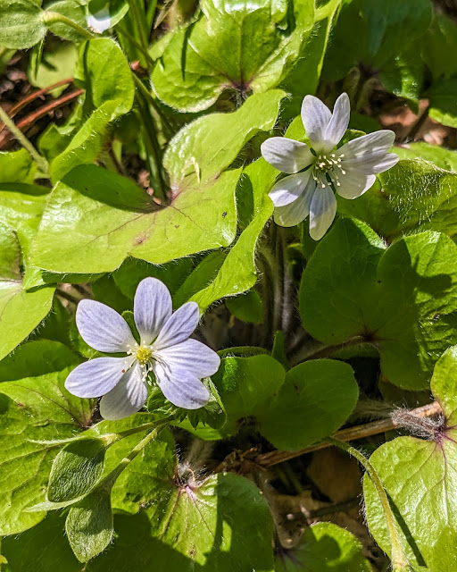
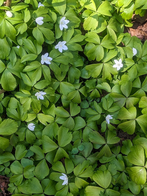
A few more Hepatica for good measure

The Voyageur itself soon pulled in to port from Grand Portage, and gave us a show. It unloaded a surprisingly large group of visitors. Even though the ferry travels around the island, dropping off hikers at various campgrounds, all visitors must confirm their camping permits, fill out an itinerary, and get the required park orientation at Windigo.

From our bench, we could hear the ranger who walked out on the dock to orient the Voyageur's passengers. Every previous visit on the island -- most recently four years ago in 2019 -- the orientation was the same: A ranger randomly handed out some laminated cards with the seven Leave No Trace principles printed on them and then asked each card holder to explain how we would respect that principle, filling in details as needed. It was always a bit odd, especially if you got chosen to explain "Plan Ahead & Prepare" (while already on the island). But it was at least interactive and kept hikers on their toes.

The orientation has changed since then -- dramatically. Because we had arrived so early in the season, we hadn't experienced it ourselves. Thankfully, as it turns out. The ranger would yell out an exaggerated: "Isle Royale is so wild..." to which the less-than-enthusiastic group of orientees were obligated to respond, in a monotone: "How wild is it?" The ranger would then repeat and elaborate: "Isle Royale is so wild that there is no running water in the backcountry!"

The group of Voyageur passengers was clearly not into it. Despite the attempt at interactive call-and-response, the passengers did essentially nothing except murmur "how wild is it?" and listen to the ranger's lecture. On the other hand, we agreed that the information in this new orientation was much better than the old one. The rangers got right to the heart of some highly relevant matters, like the lack of running water or what to do if you meet a moose on the trail. Clearly the National Park Service was responding to what hikers need to know -- and, increasingly, don't know. They could make it less embarrassing for the rangers, though.

After that grand bit of voyeuring at the Voyageur, we walked back to the shelter to eat lunch. Since the beautiful weather (and our handy satellite communicator's weather report) left little question of our flying out on time, we decided to eat our last freeze-dried meal for lunch: Chicken and Dumplings. Then we slowly packed up, said goodbye to Shelter #1, and hoisted our packs.

Shelter #1 at Washington Creek

We made the walk back to Windigo for the last time and dropped off our packs at a small pavilion. There were lots of other people hanging around the dock and pavilion, all with the slightly listless look of backpackers without anything to do but wait.

I always feel a bit melancholy at the end of a long backpacking trip, especially if it involves waiting. After days filled with hard hiking, setting up camp, and tending to life's basic necessities, the last few hours of waiting leave me with too much time to think about all of the fun that's past. The rest of today definitely involved waiting, along with a general feeling somewhere between exhaustion, boredom, and anxiety to get back home.

To fight that feeling, we kept ourselves up and moving. First we dropped off our two fuel canisters in the "free" box outside the old Windigo store. One canister was completely empty, but the second one we'd only used for a day. Some lucky person got a 90% full gas canister for free!

Next, we decided to spend some time hiking the interpreted nature trail that loops around the Windigo area. We picked up a flyer from the visitor center containing various bits of interpretation for each of the numbered posts along the trail. The numbered posts were identical to the posts that mark campsites, which caused a bit of confusion at first.

The nature trail was, well, perfectly nice. It began with some interesting bits of history of the Windigo area, including a trench and rock pile from the Wendigo mine (yes, the spellings are different). After that it quickly became the exact same interpretive trail I've hiked in many parks throughout the midwest, telling the tale of logging, pioneer plants, succession, and different types of forest habitats. One post was completely missing, others were mismatched with the text ("the large fallen tree in front of you"... definitely didn't exist). The main excitement was a distant glimpse of a moose moving through the trees, although this was not mentioned in the flyer.

The trail did save the best for last: the moose exclosure! This was a small fenced area intended to help study the effects moose have on a forest. The most surprising part, for me, was that we could actually open a gate and walk right through the exclosure! The difference was stunning, and illustrated far better than words just how much foliage moose eat.

We finished the loop back to the dock, where even more people were now sitting around listlessly. A group of four guys were doing some remarkably skimpy sunbathing, also listlessly, and somewhat surprisingly given the cool weather. From overheard snippets of conversation, they too were ready to be headed home. We wondered if they were waiting for our same 5:00 plane, which would definitely be full.

Our next step was to return our camping permit. There was a small box outside the visitor center with a sign on it, so I slipped the permit in there. A ranger came out and chatted with us about our itinerary, the local "camp fox", and other general pleasantries.

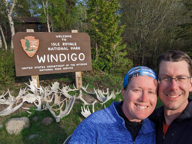
Finally, we took the requisite selfie with the Windigo sign:

Everyone who comes to Windigo takes this photo

Back at the pavilion, we had nothing better to do but read on our Kindles, at least until John from Munising showed up. He had been hiking solo on the island and was clearly ready to interact with other humans again. It turned out that he had recently finished a stint in the military, and was now completing some kind of internship at Pictured Rocks National Lakeshore. He enthusiastically answered our questions about his job, about how Pictured Rocks is legendarily (at least within the world of Yoopers) overrun with tourists, and many other things.

Our flight was set for 5 pm. At 4 pm, as we were happily chatting with John, we heard a seaplane come in and land... followed immediately by a second sea plane. Sarah, John, and I jumped up and grabbed our packs, as did the sunbathers and several others from their party who had been hanging around the dock. The whole motley crew made its way down to the seaplane dock where, sure enough, two seaplanes were just tying up. They were here for all of us. Lesson for the future: Always be super early to your seaplane reservation!

The pilots quickly divvied us up: The sunbathing bros went in one, while John, Sarah, and I once again flew with Pilot Abby, the same pilot Sarah and I had flown with on our trip to the island. 

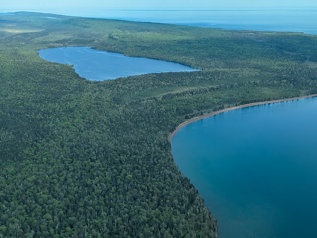
Feldtmann Lake and Rainbow Cove

In virtually no time, we were off the water and into the air. The sky was much clearer than on our inbound trip, and I spent every single moment with my eyes glued out the windows, taking in the beauty of the island, Lake Superior, and eventually the familiar landmarks of the Keweenaw too. Meanwhile, Abby and John had a nonstop discussion about the different birds in northern Michigan vs. Florida, with John absolutely schooling everyone with his knowledge.

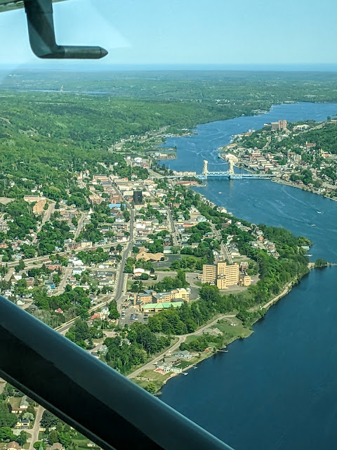
We flew in low over the Portage Lake lift bridge (spectacular!) and pulled up to the dock. Abby hauled our packs out of the pontoons, and... that was it. We were back on the mainland, and our epic trip to the west end of Isle Royale was done.

Coming in over the Lift Bridge

We were also officially at odd ends. Knowing that the seaplane was often delayed, possibly even for a day or two, we hadn't made a hotel reservation for our return. Instead, we drove into Houghton, parked at the nicest hotel we thought we could afford (the Franklin Square Inn), marched our smelly, greasy selves up to the desk, and asked for a room. The well-trained attendant didn't even blink, and soon we were in a lovely room taking showers!! -- Two each, as is traditional.

As I'd vowed all the way back at Siskiwit Bay, dinner was burgers, onion rings, and cherry Cokes on the deck of the Downtowner. It was fabulous. Then we took our giant pile of stinking clothes to the nearest laundromat and cleaned the heck out of them, making a quick run down to the KBC to share a beer on their deck before the clothes dried.

That night, we slept fitfully, confused by the soft mattresses and non-frigid air.

Our trip wasn't over yet, but that's a story for another time -- driving around Calumet to pick up coffee beans, going over to Bayfield Wisconsin where we thoroughly enjoyed an Apostle Island boat cruise (and thoroughly didn't enjoy a local winery), and then a long, long drive all the way back home.

Much-photographed boat at Windigo

A final reflection: Our week-long trip to the island was wonderful. Of course it had its ups and downs -- literally, but also figuratively -- but overall, this was once again a fantastic visit to a fantastic place.

This was our first visit to the west end of the island. The west end definitely has easier hiking than the rockier, ridge-ier east end. The glacially rounded ridges were easier to climb, and the trails were much smoother and less rocky overall. Even the hardest trail we hiked -- 10.3 miles on the Feldtmann Ridge -- really wasn't that bad. The one possible exception is the Minong Ridge trail, which I have never hiked. We chose to hike the Feldtmann loop clockwise, opposite from the most common direction, and I would definitely do that again. Besides giving us slightly easier uphills, in a busier season it would also avoid the rush of people heading to Feldtmann Lake campground right off the boat or plane.

I had promised Sarah that she'd love the island in May. It would be quiet, with relatively few people and no need to rush from campground to campground. That was my experience during my solo trip in May 2019, and it proved just as true this year. We always got a shelter (at the campgrounds that had them), and a campsite to ourselves everywhere else (even though having to camp in the crappiest site at Feldtmann Lake wasn't exactly a highlight).

Let's talk about the season: May is early spring on the island, something that is hard to understand until you've experienced it in person. The early season had a lot of advantages, but it's important to know what you're getting into.

The nights were definitely cold, and Sarah vowed to look into a warmer sleeping bag. Nonetheless, we prefer cold to hot, especially because you can bake on Isle Royale's sunny ridges, regardless of air temperature. Plus, cold weather keeps bugs down. We really did get lucky with the weather -- only the first day had any rain, and otherwise the skies were clear, sunny, spectacular, and almost entirely bug-free. Being spring, we could just as easily have had a wet, soggy, cold mess of a week, or even the opposite: a warm, humid, mosquito-filled swamp.

Speaking of spring, we really did end up in early spring this year. That was just as much a function of a surprisingly long, drawn-out end to winter, as it was the actual dates on the calendar. By the end of our trip, we were starting to see the beginnings of a general wildflower bloom, but for the most part the forests were brown. That's not a bad thing. I love spring wildflowers, and the nearly leafless trees gave us better-than-usual views from the forested ridges. The total lack of underbrush made trails easy to follow. The Feldtmann Ridge trail, in particular, is legendary for being a wall of green brush later in the season. 

Finally, this was our first experience with the seaplane. While it's expensive, and prone to delays, it is definitely the way for us. No seasickness, no long, dull ride across the water, no diesel fumes. We planned for an extra day on the island (even bringing several extra meals), and we'd do that again, but we luckily didn't need them. We'll undoubtedly take the seaplane again.

And as always, we're already daydreaming of our next trip. We'll be back!

Miles hiked: 1.2 (Windigo nature trail) + 1.0 (back and forth to the campground)

Total miles: 49.7

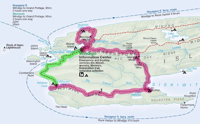
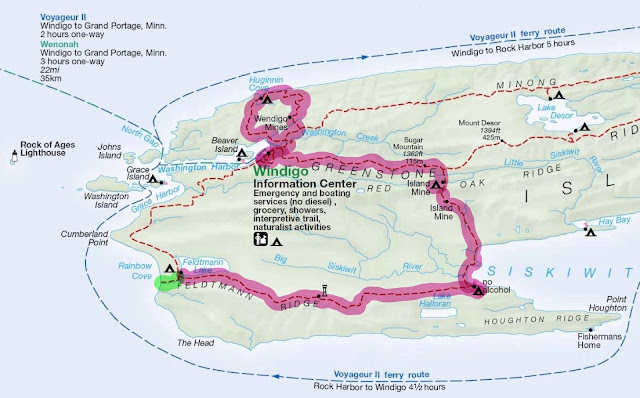
Our full route. Not shown: 10 round trips between Windigo and Washington Creek

Thursday, August 10, 2023

Isle Royale 2023, Day 6: Feldtmann Lake to Windigo

Last time: So many moose! So many bros!

Feldtmann Lake in the morning

Sunday May 28, 2023: The bright morning brought two things: bugs and moose! The bugs weren't exactly bad... it's just that we hadn't had to deal with bugs at all on the trip so far. Luckily, it was mostly non-biting flies, but with the occasional mosquito mixed in just to keep things interesting.

The moose on the other hand, were everywhere: walking along the beach, through the water, and... what's that sound? Oh yeah, moose walking right through our campsite. By the time I got out of my tent, there were hoof prints just feet away from my tent. The moose had judged us harmless, and acted accordingly.

We had tea while sitting on a bench that moose had recently stepped over (they were far off on the other side of the lake now, so it was safe). Then we had a second round of tea to help Sarah with her self-described "hangover" brought on by too much sun and fun on yesterday's Rainbow Cove trip.

Morning also brought a surprising lack of bros. The bros must have gotten up earlier than us and headed out, because we couldn't hear them anywhere. And if they'd been around, we definitely would have heard them.

After our quiet breakfast, we packed up and headed out on the final leg of our week-long trip. Today, we would take the Feldtmann trail back in to Windigo and relax. We were in no rush: Our plane left tomorrow, Monday, at 5 pm. This oddity in our timeline was due to staying our first night in Windigo to avoid rain.

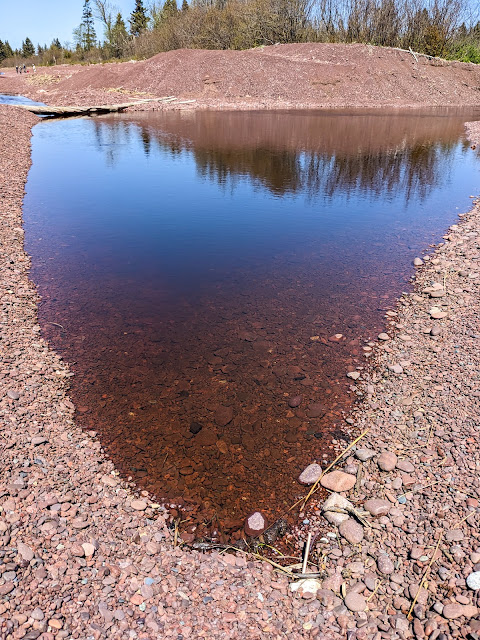
The first few miles of this part of the Feldtmann trail were quite flat. The trail runs just below a bluff that marks an ancient lakeshore, and as a result, we were basically walking on a flat and shallow ancient lakebed. At one point, the trail led through a lovely opening filled with grass and low-growing evergreens. In that grassy field, the trail was made entirely of bare red cobbles, just like the ones at Rainbow Cove. It was a bit tricky to walk on, with ankles threatening to roll. Plus, walking on beach cobbles was very strange in the midst of the grassy field. We were truly walking on the ancient shoreline!

We ended up eating lunch next to a lovely little stream that didn't even appear on any maps. We continued to stop every hour for a short break and snack, a practice that worked so well that we'll likely do it in all future backpacking trips. 

As with most other trails we'd been on, the trail crews were ahead of us. There were many downed trees that had been cut clear and pushed off of the trail. Each time we saw one, we said in a chorus: "Thank you, trail crew!"

We had expected to meet a bunch of people on the trail, since it's quite common for hikers to arrive at Windigo and immediately hike to Feldtmann Lake -- the opposite direction from what we were doing. But we only met a few people on the trail: first one eager solo hiker, followed a little while later by a couple with brand-new gear who looked like they were slightly shell-shocked. We were sympathetic -- that's exactly how we felt on our first trip to the island.

Soon, we started to make the only big climb of the day, up a large ridge near the entrance to Washington Harbor. The day was already getting a little warm, and the climb heated us up. Soon enough we were walking on the exposed ridge top, with the sun beating down on us from a clear blue sky. We were hot! I have always been amazed at how different things can feel at the top versus bottom of Isle Royale's ridges.

6-days-with-no-showers selfie at Grace Creek overlook

The ridge had one big upside: A beautiful overlook of the interior of the island, highlighting Grace Creek and the wetlands it winds through. Better yet, there were also some shady evergreens nearby under which we could drop our packs, have a seat, and cool down.

We spent quite a while resting at the overlook before we packed up again and started the last short leg to Windigo. Along the way, we heard the Voyageur's horn sound in Washington Harbor. A few minutes later, the horn sounded again. This sparked some debate: Was that horn the boat's arrival and departure sound? They sounded too close together unless there were remarkably few passengers. Our only experience with the Voyageur also involved a horn, calling some tardy (actually, just not early enough) backpackers to come running. We also wondered if this meant that the Voyageur had dropped off a crowd of hikers who would be taking up spots in the Washington Creek campground tonight.

The trail quickly came down off of the ridge through deciduous forest. As with everything else on this trip, trees were just starting to leaf out, and we had great views through the bare forest. The trail soon came to run right alongside Washington Harbor, giving us both a nice lake breeze and great views across the harbor. We could look straight across to Beaver Island and see shelters set right on the water, of which we were immediately envious.

Sarah with Marsh Marigolds

We walked through "downtown" Windigo, where Sarah stopped to enjoy the use of running water. I continued the quarter mile to Washington Creek campground, which was largely empty (we later decided that the Voyageur must have been heading back to Minnesota, which had probably removed campers from the campground). I decided to claim shelter #1, at the far end of the line. Like the other shelters, it was set right on the creek, in deep shade, and was nicely private.

While waiting for Sarah, I wandered around exploring the vicinity of the shelter. The campground's path continued beyond the shelter, so I curiously followed it. This led me to a lovely meadow on the point of land where Washington Creek meets Washington Harbor, with a conveniently placed picnic table right at the shore. It was a beautiful sight and a beautiful location, and I spent a good while enjoying it.

Eventually Sarah returned from Windigo, and we set about arranging our air pads and sleeping bags, resting for a while, and getting quite chilly in the shady late afternoon. So, we walked back to Windigo. It was like a magnet, always drawing us in, despite the fact that we'd already hiked almost 9 miles today, and added an extra half mile every time we went back and forth!

At Windigo, our first order of business was to figure out what to do with our gas canisters. Gas can't be brought on the seaplane, so Sarah was eager to figure out what we should do with them. We found a milk crate outside the old store, with a small handwritten sign that said "free". Several gas canisters were in it, all of them empty.

Crossing Grace Creek on a two-lane bridge

Next we walked down to the seaplane dock, where Sarah remembered seeing some gas on the way up. Indeed, a few people had left empty gas canisters on top of a larger housing for airplane fuel. Plus, somebody had put an unopened package of blackout curtains on top of them. Perhaps the seaplane made a drop-off for park employees?

Our third priority was to inspect the "new" store, whose construction had been a topic of discussion for several years on the Isle Royale Forums. Rangers had promised that it should be open in a few days, but still too late for us to enjoy. While the building was finished, it was still being stocked and set up with merchandise. We stared in through the windows and drooled: There were snacks of every imaginable kind, kitchy souvenirs, and best of all: an ice cream case. Not that it was hot out, but every single piece of junk food sounded amazing.

We decided to have our dinner on the big Windigo dock, where the sun was shining brightly to warm us up. We enjoyed freeze-dried Fettucine Alfredo, always a favorite, to the accompaniment of seagulls, an otter, many many mergansers, and a camp fox that fearlessly trotted right through the middle of "town".

Eventually we couldn't keep our eyes open. We took advantage of the running water one last time, then headed back to Washington Creek campground. We slept curled up against the cold and clear night air.

Next time: How wild is it?

Miles hiked: 8.8 (Feldtmann to Windigo) + 1.5 (back and forth to the campground)

Total miles: 47.5


Friday, July 28, 2023

Isle Royale 2023, Day 5: Rest day at Feldtmann Lake

Last time: A magic waterfall on the way to Feldtmann Lake - Links to all of my trip logs

Enjoying the beach at Feldtmann Lake

Saturday May 27, 2023: The night was as warm as promised -- 40 degrees! -- and for the first time all trip I didn't wear a hat and puffy coat to bed. I still wore a thermal base layer and fleece, true, but who's counting?

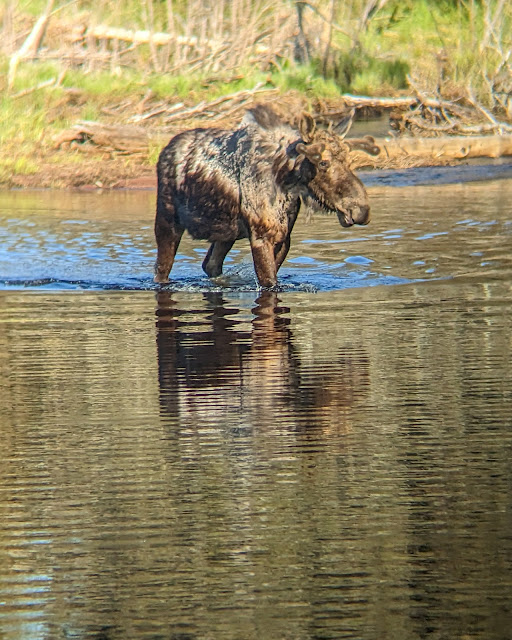
When I woke up in the morning, I heard the same thing that I'd heard while going to sleep the night before: The distinctive thump-splish-splash of moose walking through shallow water. I crawled out of my tent and, sure enough, there were the same two young bulls, clomping back and forth along the beach. I walked along the campground trail (parallel to the beach) to watch them, when suddenly they came up into the campground and walked straight through site #2, whose occupant seemed to be completely asleep and unaware in his tent.

I excitedly told Sarah about this once she woke up. First we spared a thought for the three poor guys we'd met at Siskiwit Bay, who had complained that there were no moose at Feldtmann. They missed an entire moose parade by just one day!

But ever practical, Sarah's main question was: Has anybody packed up and left their site empty? Today was our self-imposed rest day, and any way to avoid spending it in the tiny, exposed site #3 would be good, even if it meant living in a moose highway. We took a look and found that the inhabitants of both sites #1 and #2 were now gone.

Wood Anemone

We decided to move in to site #2, which seemed all around nicer. So it was that our tents levitated down the path, one of us at each end. Ah, the advantages of a modern lightweight tent! The new site was shady, spacious, and right next to the lake -- everything that site #3 was not.

After all of that, we finally enjoyed breakfast while sitting on a driftwood bench near the beach. The lake was again lovely and calm in the morning light. There were now three moose feeding down by the lake's outlet.

The rest of our morning was uneventful: We hung some stinky hiking clothes to air out on a clothesline, lounged around doing some reading, and had a lunch of rice cakes and peanut butter.

After lunch, we packed a daypack and headed down the trail to Rainbow Cove. We were promised that this short (0.8 mile) trail would lead us to the most amazing beach on Isle Royale -- a beautiful place of warm cobbles and amazing sunsets. We were just behind a large group who seemed to have some sort of very specific task that involved wandering off into the brush and measuring things.

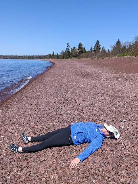
Rainbow Cove's beach, featuring a napping Sarah

The trail headed gradually downhill, generally following Feldtmann Lake's outlet stream (which, as far as I know, has no name). Along the way, we passed through many odd openings in the trees. They reminded me a bit of old homestead clearings, and sure enough, at one point I saw an old cookstove hiding in the trees. It probably wasn't from farmers -- the west exposure would have been horrible in the winter -- but perhaps fishermen once lived here? I don't know for sure.

Soon we came out to Rainbow Cove itself. It was... familiar. Other hikers had set our expectations high, and indeed, it was a lovely place. But if you've ever been to Calumet Waterworks or Agate Beach or Great Sand Bay (in one of its rockier seasons) on the Keweenaw, then you have also seen Rainbow Cove. Even Carnelian Beach, which we'd hiked just two days earlier along Siskiwit Bay, was pretty much the same. It's a beautiful red cobble beach made from the conglomerate that is absolutely ubiquitous in the Copper Country.

So we were perhaps a bit underwhelmed. But the beach was gorgeous, the sky was perfectly clear and blue, and there was the greatest lake in the world -- Superior! -- lapping right at our feet. So who were we to complain?

Our first task was to filter some cold Lake Superior water for future use. This involved both of us wading into the lake as far as we could go, which was about ankle-deep. The water was probably 38 degrees at most, and even in the hot sun, it hurt. While the filter ran, we put on sun block -- a lot of it -- and sat on a piece of driftwood. Then we kept sitting there, basking in the sun and reading. As we did, another Moosewatch group (or the same one? I have no clue) came down the trail, walked down to the stream's outlet, crossed it, and then disappeared into the brush along the lakeshore.

After a while, I got up and walked down the beach myself. The stream's outlet was cold and fast-running, and I waded across to see what I could see. The answer: More beach. I waded back and found that Sarah had burrowed into the rocks down near the water.  The golf-ball-sized pebbles did a great job of conforming to her body. I tried it, and with a little wiggling and shuffling, the pleasantly warm rocks made a shallow form-fitting nest. I quickly had a small backrest set up and settled in to read. It was ideal: Warm sun and rocks, cool water just below our feet, beautiful views, and good books.

Feldtmann Lake's outlet stream at Rainbow Cove

The Rock of Ages lighthouse -- which we'd first seen from the Feldtmann Ridge lookout -- was visible in the far distance. A variety of boats came and went across the shallow cove, never stopping, always on their way to somewhere else. The seaplane crossed the sky in front of us, and we waved. Less than 15 minutes later, the plane returned heading the other way. We waved again.

We spent three or four hours on the beach, finally calling it quits when it started to feel like dinnertime. While we'd started out a bit skeptical, Rainbow Cove had proved to be just as fantastic as promised. But make sure you visit Calumet Waterworks too, just to give yourself a comparison.

Back at camp, we took advantage of a luxury. We had left our "pocket shower" sitting out -- basically a large black water bag that does a nice job of absorbing heat from the sun. It had worked well on this sunny day. We hung it up around a tree and used it to give our hands and faces a scrub.

That was all well and good, but from there things went downhill. For in our absence, the bros had arrived.

"The bros" was our name for a collection of guys -- it's always guys -- who had arrived and set up in several open sites. They may or may not have been hiking together or even knew each other prior to arriving at camp, but somehow (pheromones? secret signs?) they had found each other and were now inseparable. Their key characteristic was to have a loud and expert-level opinion of every possible topic. They were loud enough to be heard across the campground, but that wasn't necessary, because they had packed fishing rods and were walking up and down the beach (and through our campsite) sharing their thoughts along the way. Their opinions were vast and varied. Gear and pack weight were favorite topics, as were lure choices, GPS and navigation apps, the proper kind of water bottle... anything and everything. Each statement used profanity like it was punctuation. "It f-ing slaps!" was used as an exclamation point.

On the upside, at least they weren't fellow Michiganders. I know this because they loudly wondered where they could buy marijuana now that they had arrived in Michigan (where it is legal). The short answer: Not in a national park.

We distracted ourselves by enjoying a dinner of freeze-dried something. My notes say lasagna, but my brain has no record of this. It was calories, not much more.

No, this is not fake. Yes, that is a real moose. Yes, that's the bench we were sitting at.

We enjoyed the not-so-quiet evening by reading while sitting on a driftwood bench between our site and the beach. This also gave the passive-aggressive message to please not walk through our campsite again. But soon both we and the bros had to move, because moose were coming. The two young bulls had decided they wanted to be on the other side of the lake, and got there by walking along the entire beach in front of the campground just as they had done this morning. This brought out the whole campground, cameras and all.

Sarah and I stood in our campsite and watched the young bulls walking not 10 feet away from us. Then they turned around and walked back... and forth... and back again, dunking their heads to find tasty morsels at the bottom of the lake.

I have been close to moose before, and they never fail to impress and terrify at the same time. They're just plain big, and it is much too easy to imagine what would happen if they suddenly decided that you were a problem to be dealt with.

The moose walked past so often that eventually it got a bit boring. Later, when they'd settled into one particular corner of the lake, I learned how to take a photo through a pair of binoculars:

Moose through binoculars

While much less exciting than moose, we also enjoyed a great deal of waterfowl drama that evening. Mergansers dove, the birds that went "meep" went "meep", and then a pair of geese started chasing away some uninvited guests, which involved an enormous amount of flapping and honking that echoed across the entire width of the lake.

Soon enough, our long, hard day of relaxing caught up with us. It was bedtime! We crawled into our tents, but alas, the bros had other ideas. They had set up on the beach in front of the next campsite, fishing and loudly discussing wilderness first aid or Netflix or something. Their penetrating voices and profane punctuation put any thought of sleep out of my mind. I gritted it out until 10 pm, when I finally crawled back out of my tent and walked down the beach. I did my best to kindly but firmly ask them to quiet down because people are trying to sleep and everyone can hear you! and they were so surprised that they actually did it.

Although it was now past 10 pm, the sun was merely low in the sky. As much as I would have loved to see the Milky Way in the perfectly clear night sky, I would have had to stay up until well past midnight. I didn't have it in me. I was out light a lightbulb once I got back into the tent.

Next time: Return of the Windigo - Links to all of my trip logs

Miles hiked: 1.6 (Rainbow Cove and back)

Total miles: 37.2